


11 Zoos in Northern California You Won't Want to Miss
While every zoo in the Golden State is worth visiting, there are a few must-sees that rise above the rest. Here are our favorites in NorCal.
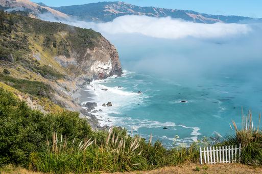
Embark on the best Lake Tahoe hikes and be rewarded with beautiful water vistas, fresh alpine air, and majestic scenery.

8 min read
August 14, 2020
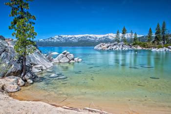
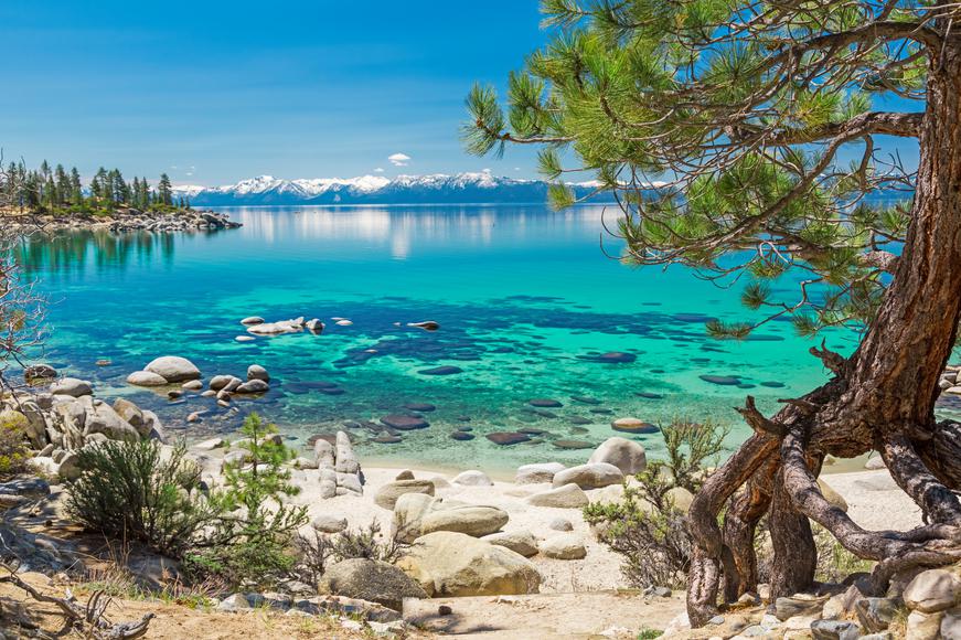
Need to take a short break from reality and nourish your soul and body? There’s no better way to let nature embrace you than by hiking alongside meadows full of wildflowers, roaring waterfalls, steep canyons, and tree-lined paths. Embark on the best Lake Tahoe hikes and be rewarded with beautiful vistas and fresh alpine air. Revitalize yourself while you travel around Northern California's most sought-out area—from visiting South Lake Tahoe to exploring Truckee and everything in between, we’ve got you covered.

Location: Emerald Bay area, South Lake Tahoe
Hours: 8 a.m.–5 p.m.
Parking: There is free parking on Emerald Bay Road, at the far end of Bayview Campground.
Difficulty: Easy
Distance: About 2 miles
Time: About 1 hour
Route: Out and back
Dogs allowed: Yes, but on-leash
Permit: Pick up a free Desolation Wilderness permit at the trailhead.
Although the Cascade Falls Trail is considered to be one of the easiest hikes near Lake Tahoe—which is among California’s best lakes—it’ll still fill your heart with joy. Halfway through the route, as you traipse through the thick forest, you’ll catch glimpses of the turquoise waters of the 200-foot Cascade Falls. Savor the spectacular views of Cascade Lake and the eastern shore of Lake Tahoe. As you return on the same path of hard-packed sand, admire the purple lupine, pink monkeyflowers, and purple-yellow camas lilies along the way.
Location: Heavenly Valley, South Lake Tahoe
Hours: 10 a.m.–5 p.m.
Parking: Park in the City of South Lake Tahoe parking garage for $25 (daily maximum).
Difficulty: Easy
Distance: About 2 miles
Time: About 1 hour
Route: Out and back
Dogs allowed: No
Permit: No permits are needed.
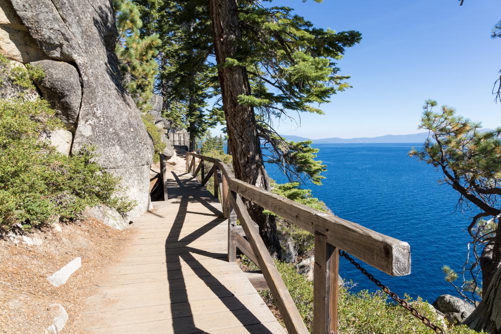
One of the best hikes in Tahoe is the Skyline Trail, situated within the Heavenly Ski Resort. Start your Lake Tahoe experience off right, and take a gondola ride and ski lift from this top California ski resort to reach the Skyline Trailhead. Trek up the tree-lined trail to the Observation Deck, where you’ll enjoy expansive views of Lake Tahoe, Carson Valley, and the Desolation Wilderness. One part of the path crosses state borders, so feel the magic of being in two places at once.

Location: Emerald Bay State Park, South Lake Tahoe
Hours: Sunrise–sunset
Parking: Park in the Emerald Bay State Park lot for $10 (day fee).
Difficulty: Moderate
Distance: About 4.3 miles
Time: About 2-3 hours
Route: Loop (with out-and-back option)
Dogs allowed: Dogs are not allowed on the Vikingsholm premises.
Permit: Pick up a free Desolation Wilderness permit at the trailhead.
This trail through the Emerald Bay area will leave you breathless. Park your car and venture down the steep trail to Emerald Bay’s Vikingsholm—a 38-room mansion constructed in the early 20th century—to take a step back in time. You’ll get to listen to the sound of Lower Eagle Falls long before you reach it. Take a breather, then continue on an upward climb to Upper Eagle Falls. The loop trail ends at the Upper Falls; either return to your car or continue on to the Eagle Falls Trailhead (located across the street), which leads to Eagle Lake. The second part of the hike will take you through a dense forest until the path reaches the glistening Eagle Lake. Take in the mystical surroundings before you head back.
Location: Sugar Bowl Road, Truckee
Hours: Sunrise–sunset
Parking: Park along Donner Pass or Sugar Bowl Road
Difficulty: Moderate
Distance: 5.1 miles
Time: About 2.5 hours
Route: Out and back
Dogs allowed: Yes, but on-leash
Permit: No permits are needed.
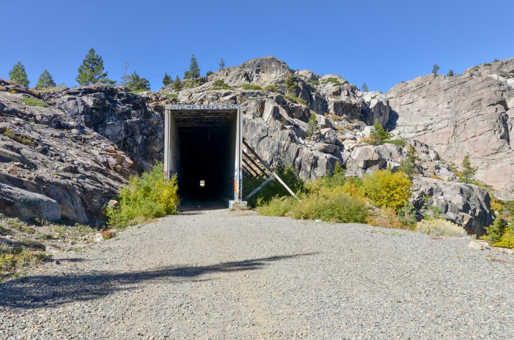
One of the best hikes in North Lake Tahoe leads you through the historical tunnel system of the Donner Pass train tunnels. Before the tunnels’ construction in the late 1860s, crossing this part of the Sierra Nevada was quite difficult. Today, the Donner Pass Tunnels act as a free, open-air art gallery, so don’t forget to bring your flashlight to admire the graffiti on the walls. The breaks between the tunnels allow you to enjoy a few minutes of sunshine before heading into another tunnel. One of the tunnel breaks will leave you speechless as you gaze at the deep blue Donner Lake below.
Location: Echo Lake, South Lake Tahoe
Hours: Sunrise–sunset
Parking: There is free parking near the Lake Aloha Trailhead, Tahoe Rim Trail, or Echo Lakes Trailhead at Echo Lakes.
Difficulty: Easy to moderate
Distance: About 5.5 miles
Time: About 2–3 hours
Route: Out and back
Dogs allowed: Yes, but on-leash
Permit: Pick up a free Desolation Wilderness permit at the trailhead.
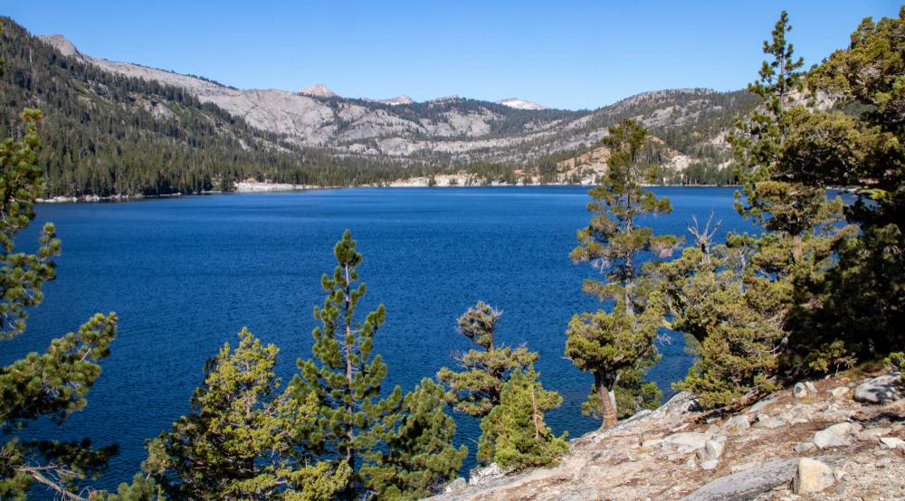
For a relaxing hike, make your way around the shimmering Echo Lakes. Be on the lookout for fantastic photo ops of the alpine terrain, chirping birds, and wildflowers. Embrace nature’s bounty as you walk alongside incredible rock formations and discover mini waterfalls cascading past Lower Echo Lake until the farthest northwest corner of Upper Echo Lake. Take a swim in the fresh alpine waters before you head back. Aside from having a surreal serene scene, Echo Lakes is also one of the best dog-friendly hikes Lake Tahoe has to offer.
Location: Mokelumne Wilderness, South Lake Tahoe
Hours: Sunrise–sunset
Parking: The Carson Pass Information Station has a parking area with a $5 fee (for day use).
Difficulty: Easy
Distance: About 5.5 miles
Time: About 2–3 hours
Route: Loop
Dogs allowed: Yes, but on-leash
Permit: Pick up wilderness permits at the Carson Pass Information Station next to the parking lot.
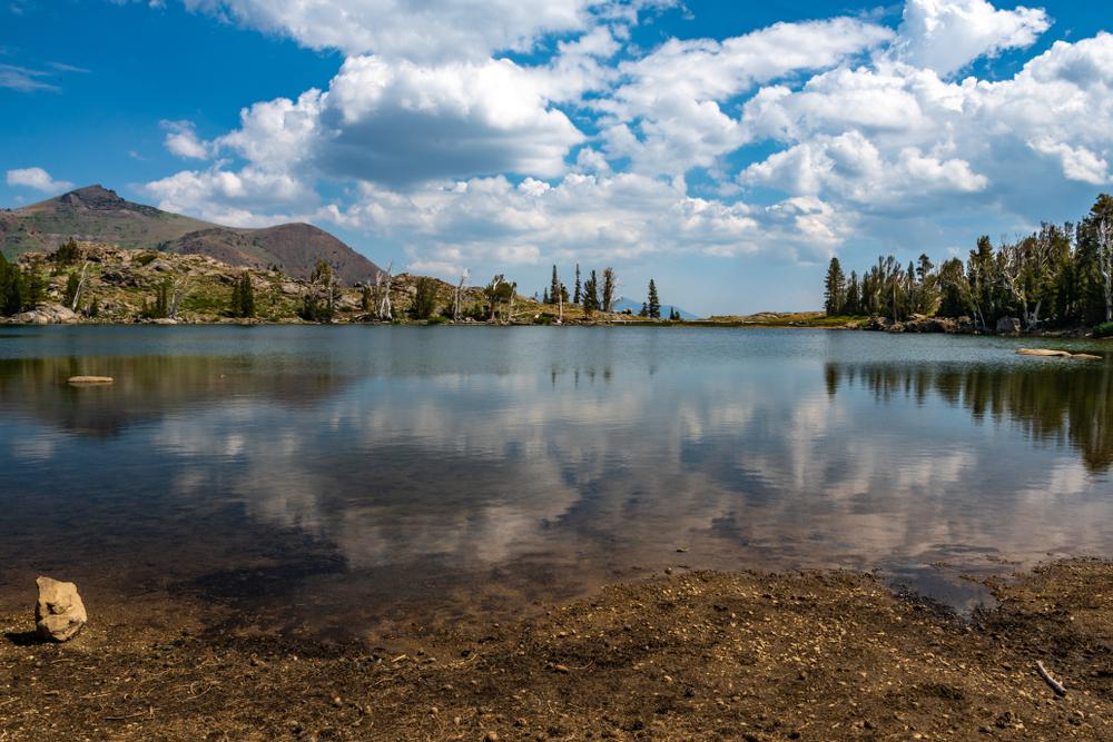
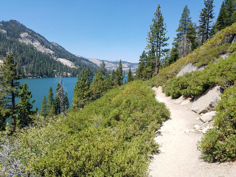
This easy hike near Lake Tahoe takes you through the Mokelumne Wilderness. On your journey along the well-maintained Winnemucca Trail, you’ll pass by enticing alpine lakes inviting you for a swim. Breathe in the fresh air mixed with the sweet scent of summer wildflowers blooming along the path and around the lakes. The red alpine paintbrush, blue flax, and red mountain sorrel paint a pretty picture, making the hike seem shorter than it is. On your way to Winnemucca Lake, you’ll pass by Frog Lake before reaching the massive pile of volcanic rock known as Elephants Back. Once you reach Winnemucca Lake, either continue onward to the Fourth of July Lake or loop around to Woods Lake and back to the parking area.
Location: Squaw Valley, near Olympic Valley
Hours: Sunrise–sunset
Parking: There is free parking on the side of Squaw Peak Road.
Difficulty: Difficult
Distance: 5.6 miles
Time: About 3.5 hours
Route: Out and back
Dogs allowed: Yes, but on-leash
Permit: No permits are needed.
Prepare for rushing waterfalls, clear pools, large granite boulders, blooming wildflowers, and breathtaking views on the hike along the Shirley Canyon Trail. Disconnect from your everyday worries as you trek to Shirley Lake. Be prepared for a strenuous hike; once you pass huge granite boulders, you’ll be rewarded with a rejuvenating swim in the lake. The lush greenery will make you want to stay forever, so keep your camera ready to capture these timeless moments.
Location: Mount Tallac, South Lake Tahoe
Hours: Sunrise–sunset
Parking: There is free, easily accessible parking close to the trailhead.
Difficulty: Difficult
Distance: 9.5 miles
Time: About 6-7 hours
Route: Out and back
Dogs allowed: Yes, but it’s not advised to bring them.
Permit: Pick up a free Desolation Wilderness permit at the trailhead.
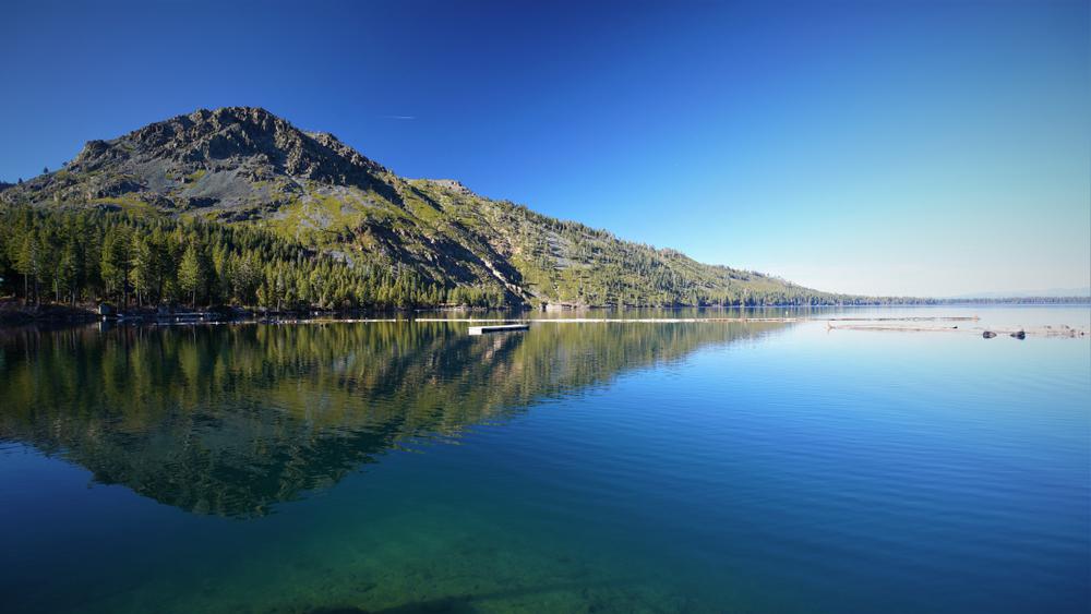
The arduous hike to Mount Tallac is well worth the trouble. When traipsing through South Lake Tahoe’s evergreen forest, the glimmering waters of Fallen Leaf Lake will catch your eye. As you continue on, you’ll feel the increase in elevation. The anticipation of the breathtaking vistas that await you will motivate you to quickly reach Mount Tallac’s summit. Upon reaching the peak, enjoy an unobstructed 360-degree view of Emerald Bay, Cascade Lake, Fallen Leaf Lake, Desolation Wilderness, and Lake Tahoe’s south shore. The stunning views will leave you speechless. (Make sure to bring a jacket; late summer snowfalls or sleet storms occasionally occur.)
Location: D.L. Bliss State Park, South Lake Tahoe
Hours: 7 a.m.–8 p.m.
Parking: There are parking areas in D.L. Bliss State Park for $10 (day fee).
Difficulty: Moderate
Distance: About 13.5 miles
Time: About 7–8 hours
Route: Out and back
Dogs allowed: Dogs are not allowed on the Vikingsholm premises.
Permits: Permits are not needed.
The Rubicon Trail will lead you right along Lake Tahoe’s shore. Begin the hike from the Rubicon Point Lighthouse; savor the scenic vista before starting your journey. Although the path doesn’t have direct access to the lake, small swimmable coves will appear along the way to Emerald Bay. May the birds’ songs and aromatic scents of wildflowers accompany you to Vikingsholm and Eagle Point. Revel in the breeze while you stand at the edge of the Eagle Point viewing platform and enjoy the scenery of the forested terrain.
Location: Fairway Drive, Tahoe City
Hours: Sunrise–sunset
Parking: There is a parking area by the Tahoe City Public Utility District Office.
Difficulty: Moderate
Distance: 20.2 miles
Time: About 10 hours
Route: Point to point
Dogs allowed: Yes, but on-leash
Permit: No permits are needed for this part of the Tahoe Rim Trail.
Set out on the adventure of a lifetime—explore part of the renowned 165-mile Tahoe Rim Trail, which wraps around Lake Tahoe—and take in the panoramic views. The Tahoe Rim Trail is known for its vast valleys, unspoiled nature, wildlife, and stunning vistas of Lake Tahoe. Take a dip in Watson Lake during your hike through a mixed forest of fir, cedar, and aspen. Hike highlights include lava-formed cliffs, cinder cones, and views of the Truckee River Canyon. The landscape’s unparalleled beauty will remain with you for many years, just as it did for Mark Twain.
To continue your exploration of the Golden State’s natural beauty, check out our guide to California’s national forests.

While every zoo in the Golden State is worth visiting, there are a few must-sees that rise above the rest. Here are our favorites in NorCal.

Enjoy the weekend by taking one of these marvelous day trips from San Diego, perfect for a quick getaway from home.

Bolster your collection or discover some new tunes, California record stores are legendary and influential throughout the industry.
Explore the top California wildlife sanctuaries, home to diverse ecosystems & incredible species, perfect for nature enthusiasts.

