


Fun and Free Things to Do in San Francisco
If you're looking for something fun to do, there are plenty of fun and free things to do in San Francisco, use our guide to help make plans.
Dreaming of discovering Lake Tahoe's stunning waterfalls? Read on to find out where Lake Tahoe's most gorgeous waterfalls are found.
8 min read
July 02, 2021
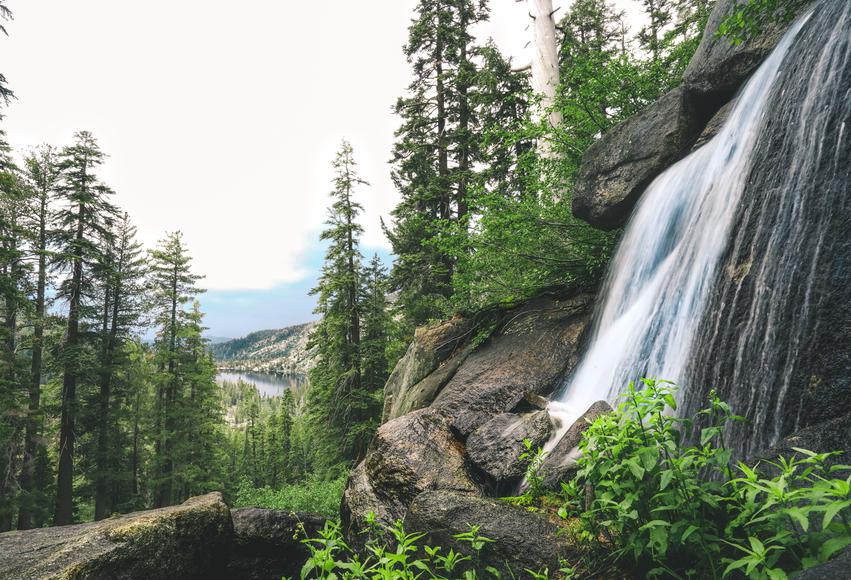
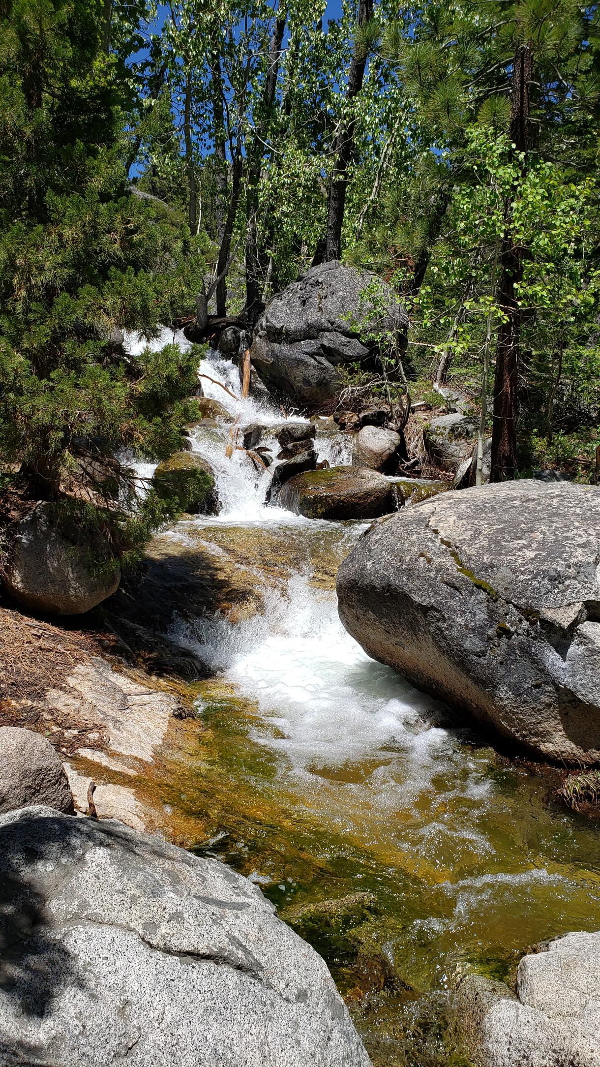
People are naturally attracted to waterfalls. It’s not just the visual beauty and invigorating sound; we are drawn to the air and the ambiance of crashing water. According to Jason Lee, The Travel Author, humans are happier around waterfalls. Thanks to our bodies’ ability to soak up the waterfall’s release of negative ions, the ions enter our bloodstream as positive energy. Once they enter our bloodstream, our production of serotonin is increased. So basically, spend as much time around waterfalls as you can.
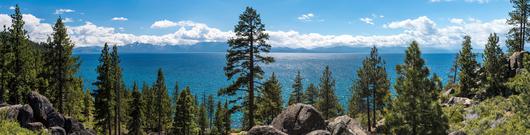
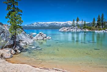
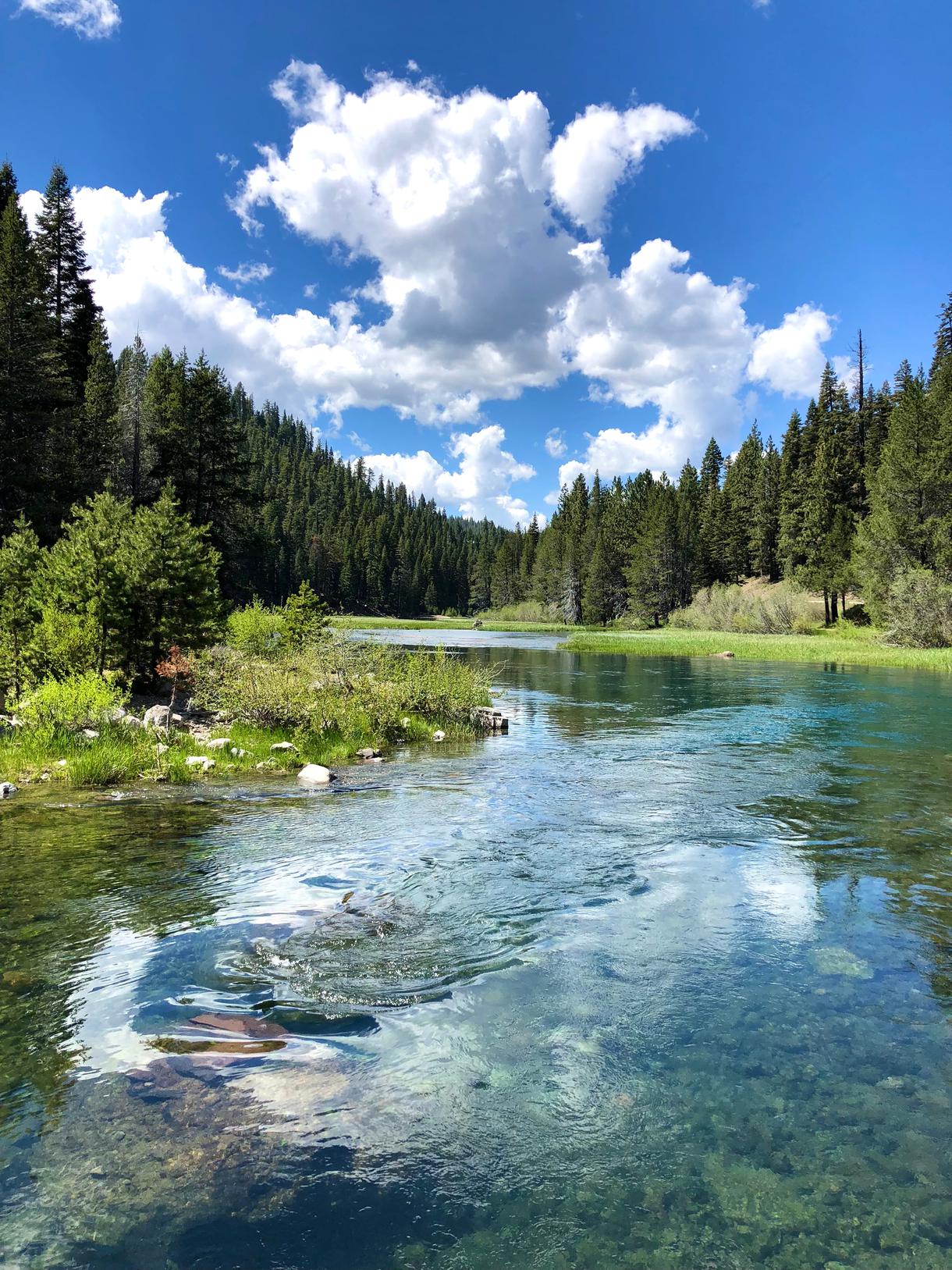
The Lake Tahoe area boasts plenty of natural wonders for hikers to enjoy, but not that many people know about Tahoe’s waterfalls. Due to significant winter snowfalls, we enjoy clear, glorious snow melt, especially after big snow years. If you know where to go, you can find majestic waters tumbling down the mountain sides in the late spring and early summer months. The charged waterfall offers a refreshing contrast to Tahoe’s generally dry, high-altitude air.
Before you pack your bags, please study our local conditions and heed the advice of this long-time local hiker. Here are a few hiking tips to keep you safe and happy at Lake Tahoe:
Parking: Bring small denominations of cash, as some trailheads have pay kiosks that don’t accept cards. If you’re visiting in July or August, during weekends, or on the holidays, expect the parking lots to fill up quickly. To ensure you find a parking spot, leave early. Don’t leave valuables in your car, as items in unattended vehicles are occasionally a target for theft.
Also, don’t leave food or anything that smells sweet, like scented sunscreen, in your car. While generally uninterested in people, our local bears are notorious for smelling goodies and making their way into vehicles. These same bears are not known for leaving the cars they enter in good condition.
The Elements: Tahoe starts at an elevation of 6,250 above sea level, and our peaks top out at over 10,000 feet. Altitude can make ordinary stresses on the body more intense. The air is dry, contains less oxygen than sea level air, and the sun’s rays are significantly more intense. To avoid exhaustion, plan a trip that seems relatively easy for your fitness level, apply sunscreen, wear sunglasses and a shade hat, and drink plenty of water along the way.
Trail Difficulty: Lake Tahoe has no easy waterfall hikes. All trails will require steady footing, and some are steep and extremely technical. The waterfalls themselves and the surrounding rock can be deceivingly slippery. Be sure to wear footwear with good tread. Trail running shoes are the local favorite. Some people prefer heavier hiking boots, for additional ankle support, but they can make your feet quite hot.
Avoid regular running shoes and street sneakers, since it’s easy to lose your footing on steep slippery dirt trails. Avoid cliff areas and smooth rocks near the water. Some people get so moved by the intoxicating beauty of the falls, that they forget that nature’s playgrounds require prudent judgement.
Balance: Keep your backpack light. Waist packs lower the load closer to your center of mass and lessen the likelihood of losing your balance. If you aren’t naturally surefooted, consider picking up a hiking stick. Just a light tap of the stick on the ground will send additional messages through your hand to your brain, significantly improving your proprioception. Without even thinking about it, you’ll have a better understanding of where your feet are relative to the uneven ground.
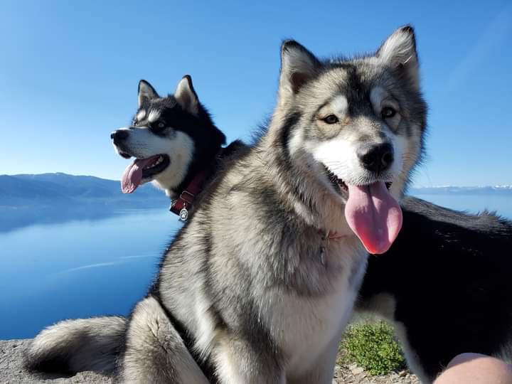
Dogs: No doubt our furry friends enjoy waterfalls at least as much as their human pals. Unfortunately for our four-footed friends, there are a number of challenges on our local Tahoe waterfall hikes, including but not limited to leash requirements on crowded trails, wildlife that can be distracting and/or dangerous to dogs that don’t have excellent recall, pad-searing temperatures on rocks that are exposed to the sun, and of course cliffs and slippery rocks near the falls. On a pawsitive note, these hikes do have water for our thirsty friends to lap up.
Pics, Picnics, and Dry Duds: Wear quick-dry clothing, bring a camera, and pack a picnic lunch. Many of these Tahoe waterfall hikes include seasonal swimming holes which can be a treat for hot feet, and invigorating for those who want to go for a full dunk. If you are into capturing beauty and memories, don’t forget to snap a few pics. A picnic lunch will give you an excuse to relax and linger by the glorious waterfall.
So where are these fabulous Lake Tahoe waterfalls that every hiker should know for your bucket list? Here are the local favorites:
Horsetail Falls: Twin Bridges Trailhead
4 miles, 1340 feet elevation gain
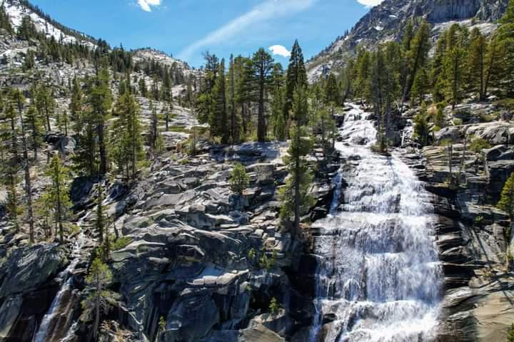
This may be the most dramatic waterfall in California outside of Yosemite. It falls in six stages, for nearly 800 feet. This forested hike is extremely technical and challenging; but, there’s many swimming holes to reward the rugged hiker. You’ll pass juniper trees, boulder fields, and creeks. The trail is a bit difficult to discern, but since it’s fairly well-travelled there’s a good chance of scrambling your way up in the right direction. Look for the diamond-shaped brown hiker signs. Located west of Desolation Wilderness, the trail starts near the town of Strawberry. Since people have spotted rattlesnakes, long pants are recommended.
Emerald Falls and Eagle Falls: Emerald Bay lot and Eagle Falls Trailhead
1.9 miles, 460 feet elevation gain
If you have seen a spectacular photo of a waterfall with a bay and an island in the background, there’s a good chance you were looking at Eagle Falls, which is accessible right just below the Emerald Bay parking lot. If you’re game for a short, steep uphill hike, take the trail on the uphill side of the road towards Eagle Lake, and you’ll be rewarded with another waterfall treat. To get to Eagle Lakes, take a right at the junction. The trip back down will give you iconic views of Emerald Bay and Lake Tahoe.
Cascade Falls: Bayview Campground Trailhead
1.4 miles, 250 feet elevation gain
Cascade Falls is also in the Desolation Wilderness area and is accessed through the back of the Bayview Campground. The parking lot is small, and fills up early. This short hike is mostly level and forested at the beginning, but then gets steeper and more challenging, with big boulders as you approach the falls. The trail leads to the top of an impressive cascade of water that tumbles down a 200-foot cliff. In addition to Mother Nature’s water attraction in the foreground, the views of Cascade Lake and Lake Tahoe in the background also steal hikers’ attention.
McCloud Falls: Ward Canyon Pacific Crest Trailhead
6.4 miles, elevation gain unknown
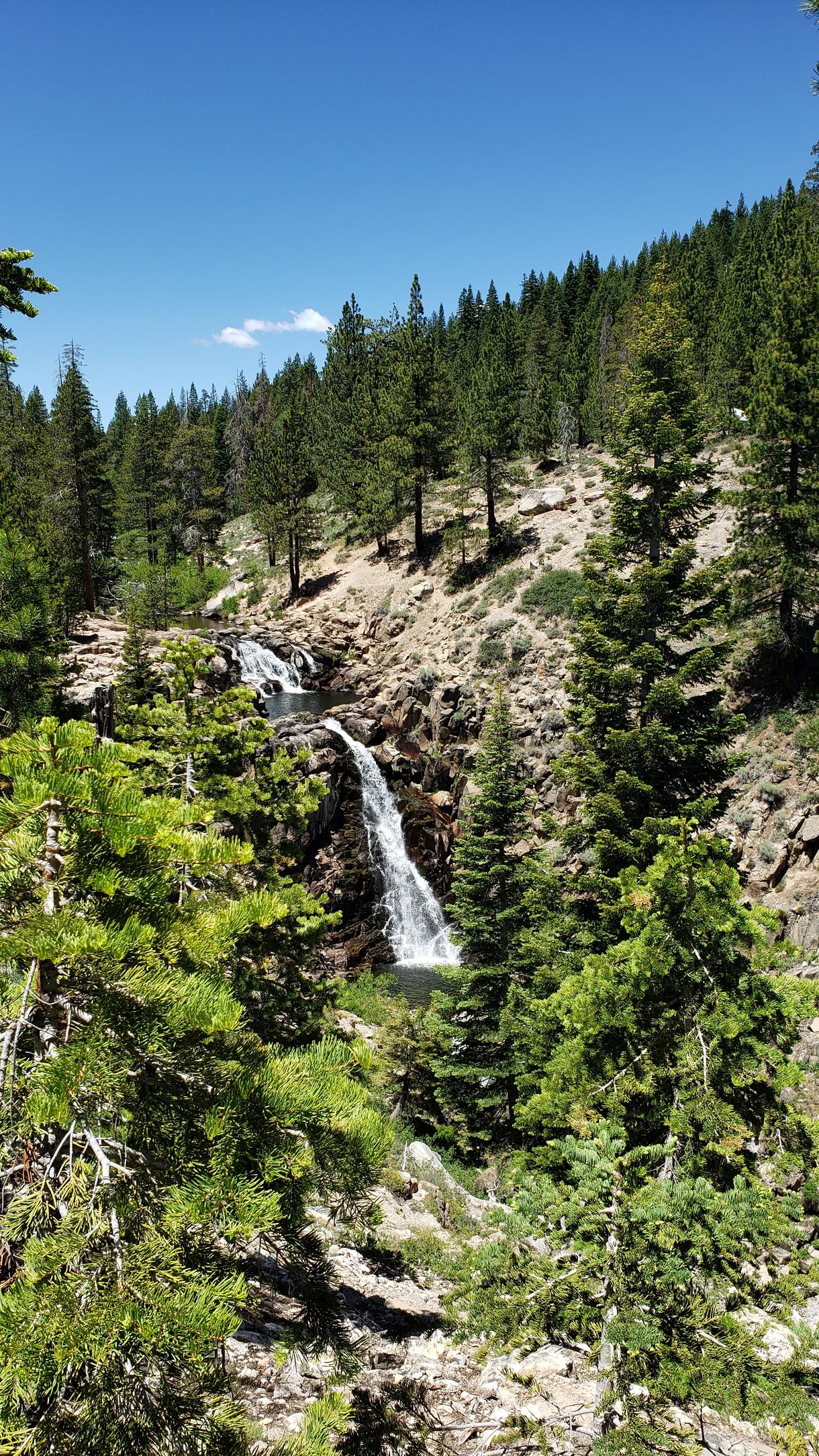
If old growth forests, lush vegetation, and seasonal wildflowers float your boat, jump on this hike! The canyon's base is a mosaic of shrubbery, featuring currant, bitterbrush, and manzanita, adorned with an array of vibrant seasonal wildflowers such as corn lilies, larkspur, snow flowers, tiger lilies, Indian paintbrush, cow parsnips, and lupine.
The mountains of the grand Pacific Crest and Grouse Rock loom to the west. This path narrows into a single-track trail guiding you towards the Ward Creek Bridge. Beyond this crossing, the journey evolves into a gentle ascent, navigating rocky steps amidst the cool shade provided by aspen trees and towering pines of ancient lineage. The waterfall will be on your right side. You will hear them before you see them. The falls themselves are diminutive, plunging about 30 feet.
Shirley Canyon: Squaw Valley Ski Area Parking Lot, NW Corner (Free)
1.5 - 5.6 miles, 310-1,860s feet elevation gain
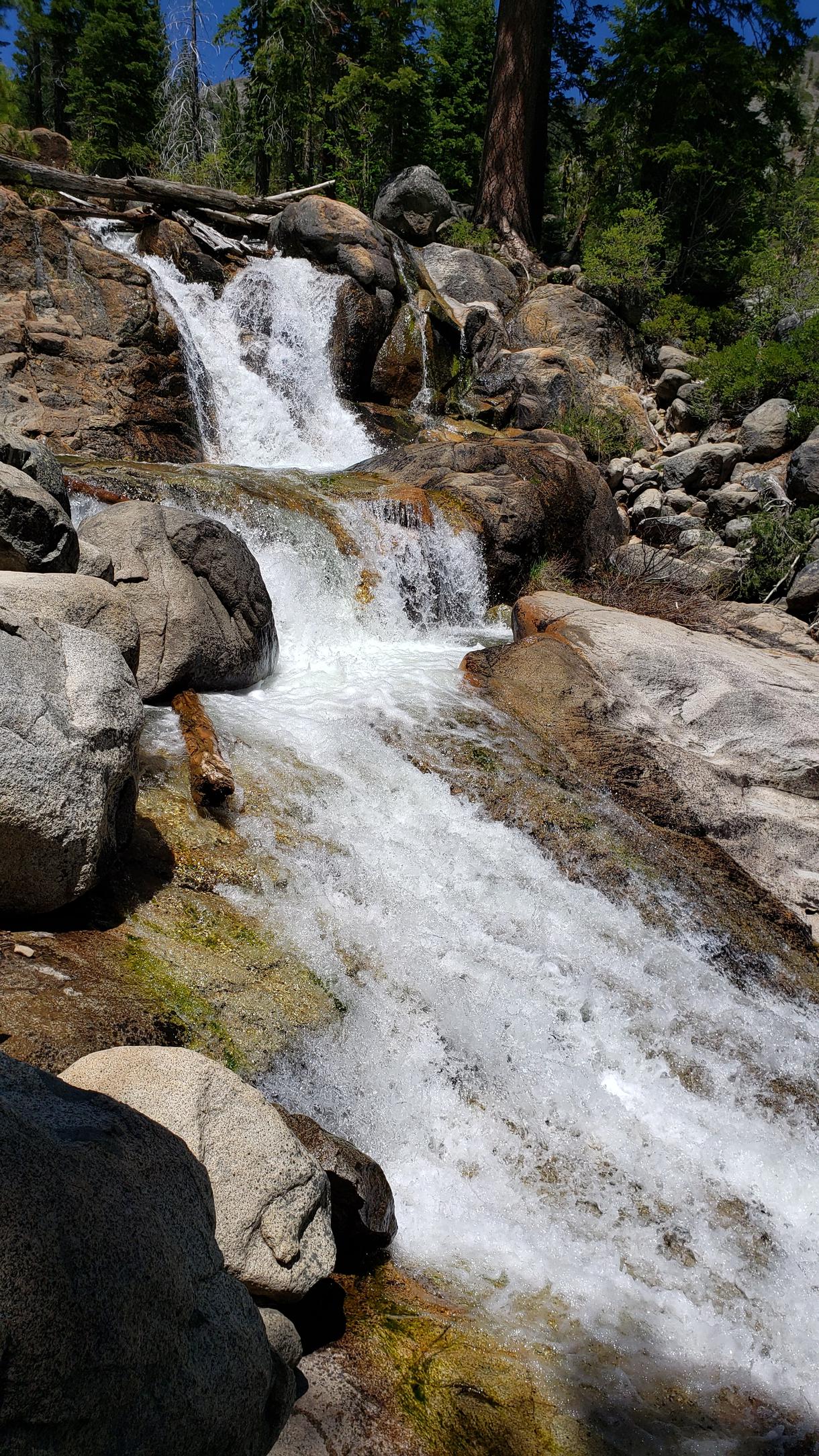
Parking is free at the northwest corner of the Squaw Valley ski area lot. Don’t park blocking the firelane at the trailhead, because chances are high to get tickets. Hiking up Shirley Canyon is nothing short of divine. The creek pools, cascades, boulders, alders, pines and fir trees start within a few hundred feet of the trailhead, so you don’t need to go all the way up to find breath-takingly beautiful scenery.
The falls themselves have multiple cascades, which many hikers, intent on getting up to Shirley Lake and the tram Highcamp Station, blaze by without realizing what they are missing. The trail weaves in and out of the path of the creek, and many hikers are too focused on stepping over tree roots and rocks to notice the natural wonders to the climber’s right of the trail. As you get higher up on the trail and the granite steppes obscure the path; look for the sprayed blue markers to point you in the right direction.
Many hikers choose to continue past the falls, as beautiful wildflowers often dot the slopes above Shirley Lake. At Highcamp there’s a swimming pool and a bar. If the tram is running, take the free ride down. The jaw-dropping views, unusual granite formations, sheer cliffs, and views of Lake Tahoe treat tram riders to a very unique ride.
Galena Falls: Mount Rose Summit Pacific Crest Trailhead
4.7 - 5.2 miles depending on which trail you take, 490 foot elevation gain
Located above Incline Village, Nevada, this moderate portion of the Tahoe Rim Trail suits athletic children, dogs, and less-surefooted hikers. The first portion of the hike is open and sunny with wildflowers and views of Mount Rose Meadows. After a half mile ascent, you’ll arrive at a stunning Lake Tahoe viewpoint; the views of Lake Tahoe shimmering below will forever stay etched in your memory.
After resting for a moment, take the stone stairs which pass through a forest lodgepole and white pines. The trail levels out as you approach the falls. Take a left at the sign for the Tahoe Rim Trail, and continue for a couple hundred more feet to the falls. At about 70 feet in height, the falls themselves are modest, but they still effuse that delightful waterfall air.
Van Sickle Falls: Van Sickle Bi-State Park Trailhead
2.5 miles, unknown elevation gain
Van Sickle Bi-State Park straddles the California-Nevada state line near the Heavenly Valley ski area village and casinos of South Lake Tahoe. Bikes are allowed on this trail, which is an off-shoot of the Tahoe Rim Trail. Dogs are not allowed in the park, so please leave Fido at home. Orange confidence markers tell hikers where to go. Soon after you start the hike, go left at the junction. (Do not go towards Saddle Road.) After another quarter mile, you’ll start to get spectacular views of the lake; make sure to stop at one of the fantastic rock outcroppings. Just below the falls, a newly constructed bridge crosses the stream.

If you're looking for something fun to do, there are plenty of fun and free things to do in San Francisco, use our guide to help make plans.

Finding a wall isn't the problem. The problem is figuring out which gym fits your lifestyle the best.

All waterfall hikes in L.A. have one thing in common—unbeatable views of terrific cascades. Here are the ones to try next.

From undulating mountains, to coastal expanses, to verdant forests, here are some of the top spots for backpacking in California.

