


Fun and Free Things to Do in San Francisco
If you're looking for something fun to do, there are plenty of fun and free things to do in San Francisco, use our guide to help make plans.
Whether you want to trek through the woods or along a scenic river, these are the best Central Valley hikes you don't want to miss.

5 min read
August 25, 2020
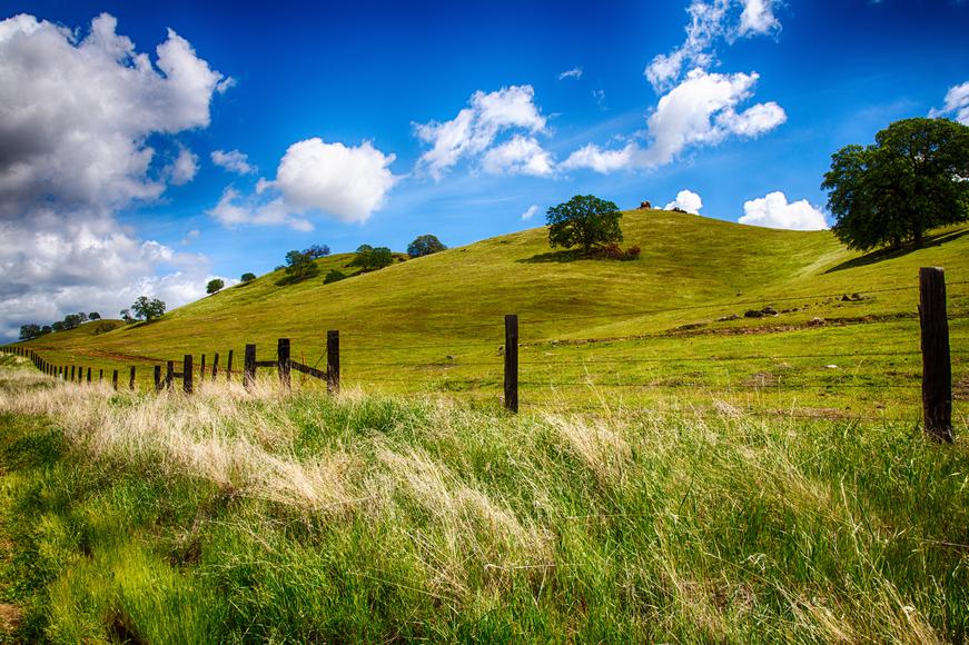
With its magnificently diverse landscape, California is a hiker’s paradise. There's nothing more healing than getting in a good workout as you roam nature’s wonderland. Whether you want to trek through the woods or stroll along a rushing river, California is a sanctuary for all and offers no shortage of amazing day hikes.
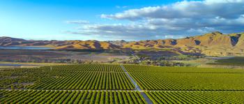
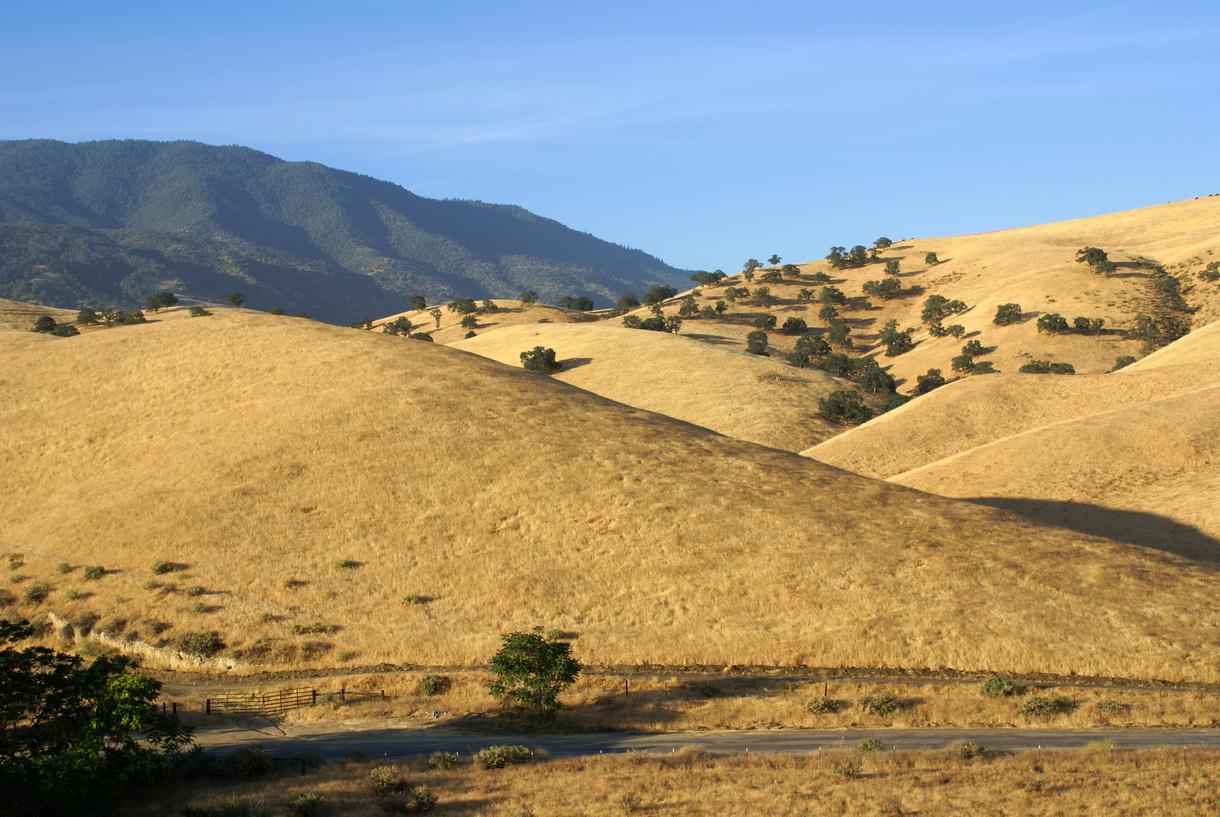
Though it often gets overlooked, the Central Valley—with its expansive pastoral landscapes dotted with U-pick farms, lush parks and regional preserves, and seasonal wildflowers—is a particularly beautiful area for outdoor adventures. You might be surprised by what the Central Valley offers; not only is this region one of the most affordable places to live in California, but it also boasts an endless list of trails. These are the Central Valley hikes you don't want to miss.
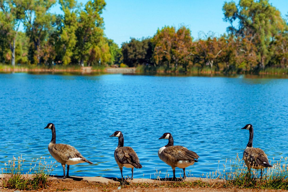
Location: Lodi Lake Wilderness Area
Hours: 9 a.m.–5 p.m.
Parking: Parking is available in the main lot.
Difficulty: Easy
Distance: 3.2 miles
Time: Approximately 1 hour
Route: Loop
Dogs Allowed: No
With a relatively low elevation gain, Lodi Lake Wilderness Trail features great views and is a popular Central California hike for all skill levels. The trail is most popular from May through July and is a great place to run, fish, and canoe. The easygoing path loops around the lake, offering breathtaking vistas as you hike along the ridge. The trail is shaded with plenty of trees, so you can escape the heat while also feeling like you're truly in the wilderness.
Location: Coarsegold
Hours: Sunrise–sunset
Parking: There is street parking at the north end of Blue Heron Way.
Difficulty: Moderate
Distance: 3.4 miles
Time: Approximately 1 hour
Route: Out and back
Dogs allowed: Yes, on-leash
Revis Mountain Ridge Trail is perfect for hiking and nature journeys. While the trail starts off steep and difficult, after the first 90 yards or so, it continues swiftly downhill through the fields, offering a spectacular view of Yosemite Lakes Park. The trail will also carry you through oak meadows, making it one of the best hikes in Central California. Towards the end of the path, you'll come across the Revis Mountain Fire Road Trail, where you can change course for an interesting adventure.
Location: Coarsegold
Hours: Sunrise–sunset
Parking: Street parking is available on North Dome Drive.
Difficulty: Challenging
Distance: 2.7 miles
Time: Approximately 45 minutes
Route: Out and back
Dogs allowed: Yes, but on-leash
Located at the southern end of the Ridge Trail, this journey begins west of Revis Lane East. The Revis Mountain Fire Road Trail is a 1.3-mile stretch extending from North Dome Drive to Quail Court. The path provides splendidly scenic views with an array of spring wildflowers and an abundance of birds year-round. While hiking along the trail, you may even come across deer, coyotes, quail, and wild turkeys.
Location: Tehachapi
Hours: Sunrise–sunset
Difficulty: Intermediate
Distance: 1.4 miles
Time: Approximately 25 minutes
Route: Loop
Dogs allowed: Yes, on-leash
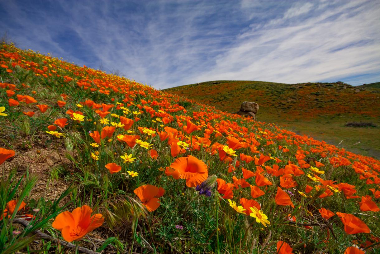
Jane’s Loop provides hikers with wonderful views from the east-facing slopes facing the Lehigh quarry and expansive meadows. Admire wildflowers (in full bloom during springtime) along your way and absorb the wisdom of oak trees. Due to the hillside's manmade bench cut, more sunlight streams onto the trail—take advantage and soak up the Vitamin D. The trail is accessible year-round and is great for running, cycling, and bird watching.
Location: Tehachapi
Hours: Sunrise–sunset
Difficulty: Easy
Distance: 1.2 miles
Time: Approximately 20 minutes
Route: Loop
Dogs allowed: Yes, but on-leash
Aimee’s Loop is another Tehachapi favorite among beginners and advanced hikers. This fun and easy hiking path also connects to the Mifflin Loop and Jane’s Loop, making it possible to continue your outdoor adventure. This family-friendly trail is ideal for kids, too, and allows them to appreciate and explore nature's bounty.
Location: Tehachapi
Hours: Sunrise–sunset
Parking: Parking is available in the lot at Tehachapi Mountain Park.
Difficulty: Moderate
Distance: 4.8 miles
Time: Approximately 1.5 hours
Route: Out and back
Dogs allowed: Yes, but on-leash
Start your hike at the campground located in Tehachapi Mountain Park. The path is fully covered with dirt and gravel, so gear up accordingly and get ready to get dirty. With an elevation of nearly 7,700 feet, the Tehachapi Mountain Trail features several steep and challenging slopes. But the journey is filled with gorgeous wildflowers and is a hot spot for bird watching, so the effort is worth it.

Location: Auberry
Hours: Sunrise–sunset
Parking: Park in the San Joaquin River Gorge for $5, or access the trail near Temperance Flat from Wellbarn Road.
Difficulty: Moderate
Distance: 17.2 miles
Time: 3 to 4 hours
Route: Out and back
Dogs allowed: Yes
The singletrack San Joaquin River Trail runs from the San Joaquin River Gorge parking area to Finegold Bay. When hiking in spring, breathe in the aromatic scent of the wildflowers; during the summer, pack plenty of water because it's quite hot.
Take a detour along the way and trek the connected trails such as the Wuh-ki’o Trail or the Pa’san Ridge Trail. The Wuh-ki’o Trail is an eight-mile out-and-back trail showcasing lovely views of the San Joaquin River; the moderate trail is accessible year-round to hikers, horses, and mountain bikers. The Pa’san Ridge Trail is a seven-mile hike, is rated moderate, and is dog-friendly.
Location: Friant
Hours: Sunrise–sunset
Parking: Parking is available along Auberry Road.
Difficulty: Moderate
Distance: 3.2 miles
Time: Approximately 1 hour
Route: Out and back
Upon starting your adventure from the Discovery Trailhead, you'll come across a dirt road heading north, leading you to oak-filled forests. Along the path, you'll reach a T-intersection with an inoperative San Joaquin and Eastern Railroad bed. As you trek uphill, the singletrack trail becomes steeper and more challenging, but you'll be rewarded with sweeping views of San Joaquin Lake and Millerton Lake.
Location: Coarsegold
Hours: Sunrise–sunset
Parking: Street parking is available on Club House Drive.
Difficulty: Easy
Distance: 1.5 miles
Time: Approximately 25 minutes
Route: Loop
Dogs allowed: Yes, but on-leash
Located in Yosemite Lakes Park, the Blue Heron Lake Trail is a one-mile walk through smooth, fairly flat terrain. This lovely lakeside route is perfect for all skill levels and is mainly sought out for running, bird watching, fishing, mountain biking, and kayaking.
Location: Tehachapi
Hours: Sunrise–sunset
Difficulty: Challenging
Distance: 2.4 miles
Time: Approximately 45 minutes
Route: Loop
Dogs allowed: Yes, but on-leash.
Possibly one of the more challenging trails on our list, the Mifflin Loop Trail is popular among hikers, cyclists, and runners. With a few bridges, narrow rocks, and tree gaps to navigate through, the trail is fitting for those seeking a good workout. Make sure to pack a picnic to enjoy at the top of the canyon whilst soaking in the picturesque views. Keep left towards the bottom of the canyon to trek through rocky terrain, or stay to the right for a smooth walk down.

If you're looking for something fun to do, there are plenty of fun and free things to do in San Francisco, use our guide to help make plans.

All waterfall hikes in L.A. have one thing in common—unbeatable views of terrific cascades. Here are the ones to try next.

From undulating mountains, to coastal expanses, to verdant forests, here are some of the top spots for backpacking in California.
Settled off the California coast, the Channel Islands offer endless adventures. Here are the best things to do and how to get there.

