

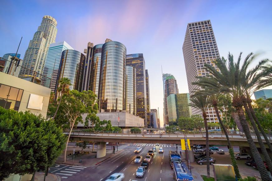


11 Must-Try Waterfall Hikes in Los Angeles
All waterfall hikes in L.A. have one thing in common—unbeatable views of terrific cascades. Here are the ones to try next.
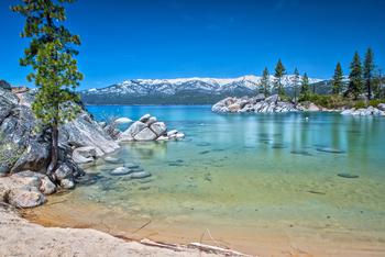
Take a break from your busy schedule, and hike to one of the best waterfalls in Northern California for a magical adventure.

7 min read
August 17, 2020
Green forests, snow-capped mountain peaks, and the sweet smell of summer dreams—the only thing missing is a roaring waterfall plummeting down from the heavens. California waterfalls are among nature’s most magical creations, and luckily, you can get an up-close look at many of them by hiking along scenic paths. So, take a break from your busy schedule to visit one of the best waterfalls in Northern California, and let the might of Mother Nature remind you of the important things in life.
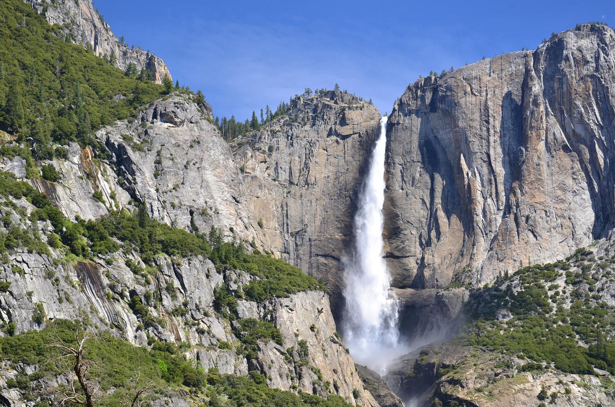
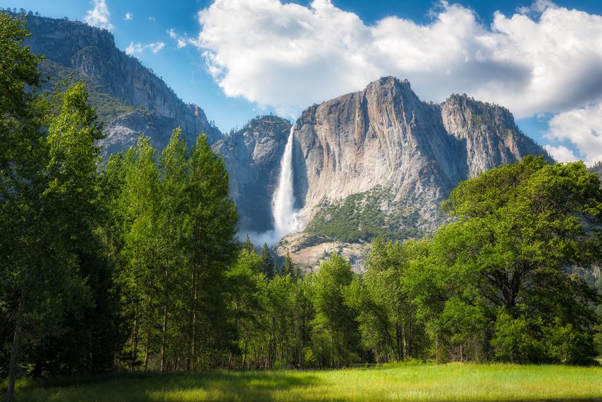
Location: Yosemite National Park
Parking: There is a parking area near the Yosemite Falls Trailhead on Northside Drive.
Difficulty: Challenging
Distance: 7.2 miles
Time: About 6 hours
Route: Out and back
Dogs allowed: No
Permits: Visitors must pay a $35 entrance fee. Make sure to check the park regulations and reservations policy to enjoy a seamless experience.
With a 2,425-foot drop, Yosemite Falls is North America’s tallest waterfall. One of the top sights in Yosemite National Park, this majestic waterfall is actually comprised of three separate falls: Upper Yosemite Fall (1,430 feet), the middle cascades (675 feet), and Lower Yosemite Fall (320 feet). The steep trail to the top will challenge you physically, but the effort will be worth it once you lay eyes on the Yosemite Valley, Half Dome, Sentinel Rock, Yosemite Creek, Merced River, and massive falls. Take in the beauty presented to you, and let the thundering waters wash away your woes.
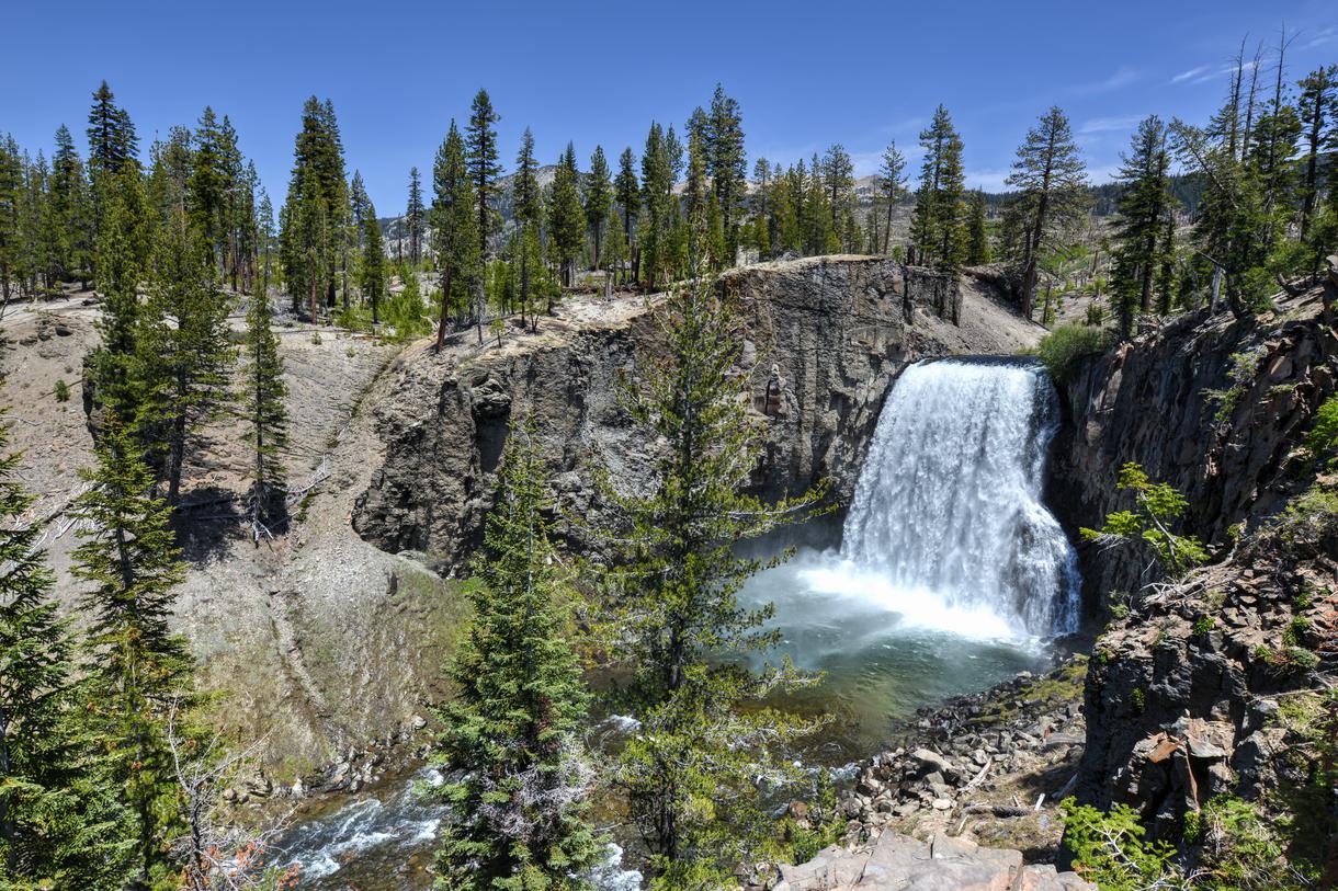
Location: Devils Postpile National Monument, Mammoth Lakes
Parking: Park at the Devils Postpile Parking Lot on Devils Postpile Road. Or, go to the parking areas at Reds Meadow Resort and Devils Postpile to take the shuttle bus to the trailhead.
Difficulty: Easy
Distance: 6 miles
Time: About 2–3 hours
Route: Out and back
Dogs allowed: Yes, but on–leash
Permits: There is a road access fee of $10. Make sure to check the park regulations and shuttle schedules in advance.
Travel to the striking Rainbow Falls in Reds Meadow and marvel at the natural phenomena. As you follow the easygoing Rainbow Falls Trail, you’ll pass by the jaw-dropping Devils Postpile—basalt columns formed by lava flows about 100,000 years ago. Once you reach the beautiful falls, you'll understand its name: When the sun sparkles on the cascading waters, a rainbow forms in the mist, making it a stellar sight to behold.
Location: Hetch Hetchy Valley, Yosemite National Park
Parking: There are parking lots near the Rancheria Falls Trailhead and at O'Shaughnessy Dam.
Difficulty: Moderate
Distance: 5.5 miles
Time: About 3–4 hours
Route: Out and back
Dogs allowed: No
Permits: Visitors must pay a $35 entrance fee, but check the park regulations and reservations policy in advance.
This moderate hike along the northern edge of the Hetch Hetchy Reservoir makes for a unique Yosemite experience. As you cross the dam, walk alongside granite rocks, and pass bridges on the Wapuma Falls Trail, the scenery will leave you inspired. Though the falls were originally 1,800 feet tall (the rising reservoir levels caused the landmark to lose some its height), you'll still be impressed by its beauty and power. Linger for as long you can before heading back to your car and returning to reality.
Location: Eldorado National Forest, Placerville
Parking: Park in the lot near the Twin Bridges trailhead on Highway 50 (day fee is $8).
Difficulty: Moderate
Distance: 3.9 miles
Time: About 2–3 hours
Route: Out and back
Dogs allowed: Yes
Permits: A Desolation Wilderness permit is required to enter.
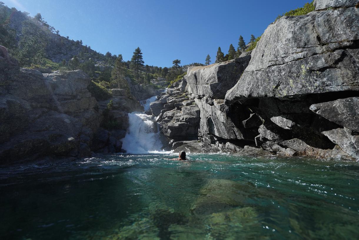
Start your adventure along the tree-lined trail, and hike through the granite landscape of the Desolation Wilderness until you reach the breathtaking, 500-foot-tall Horsetail Falls. Located in the Eldorado National Forest, just outside of South Lake Tahoe, this waterfall is the perfect place to contemplate life—the sound of the water hitting the rocks makes it nearly impossible to listen to anything else. If you're feeling adventurous, take the path towards Wilderness Boundary from the junction so you can visit the base of the waterfall.
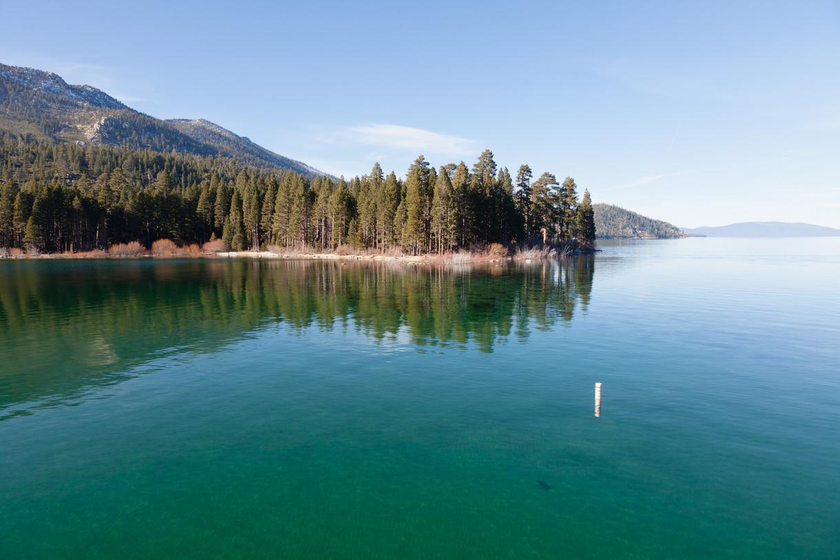
Location: Emerald Bay area, South Lake Tahoe
Parking: There is free parking on Emerald Bay Road, at the far end of Bayview Campground.
Difficulty: Easy
Distance: About 2 miles
Time: About 1-2 hours
Route: Out and back
Dogs allowed: Yes, but on–leash.
Permit: Pick up a free Desolation Wilderness permit at the trailhead.
One of the best hikes in Lake Tahoe, the Cascade Falls Trail is brimming with aromatic wildflowers and spectacular views. As you trek through the thick forest, be on the lookout for the turquoise waters of Cascade Falls; prepare for your heart to skip a beat once you reach the marvelous, 200-foot waterfall. Soak up the scenery—and soak in the water—before making your way back on the trail.

Location: Tahoe National Forest, Sierra City
Parking: There is parking near the Pacific Crest Trailhead on Highway 49, right after entering Sierra City.
Difficulty: Easy
Distance: 2.1 miles
Time: About 1 hour
Route: Out and back
Dogs allowed: Yes
Permits: No permits are needed.
This easy hike allows you to admire the Tahoe National Forest's wilderness while also feeling proud of hiking a portion of the Pacific Crest Trail. The Loves Falls Trail traverses alongside three waterfalls that feed into the North Yuba River. The Upper Falls of the Loves Falls trio creates a heart shape, which is how the falls got its name. Go under the suspended bridge for the perfect photo op, and dip your feet in the cold river before heading home.
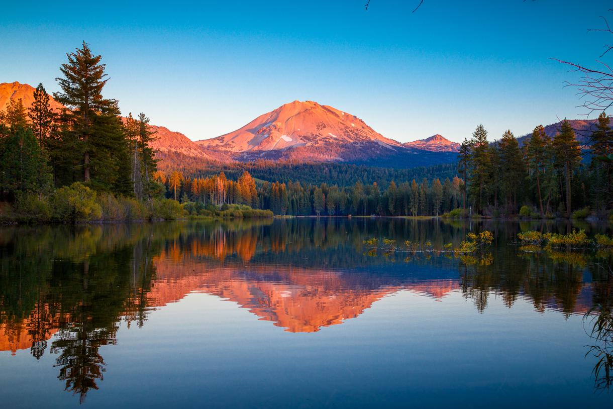
Location: Lassen Volcanic National Park
Parking: There is a parking area at the Mill Creek Falls Trailhead.
Difficulty: Moderate
Distance: 3.8 miles
Time: About 2-3 hours
Route: Out and back
Dogs allowed: No
Permits: A $10 day pass is required to enter, but be sure to check the park regulations before visiting.
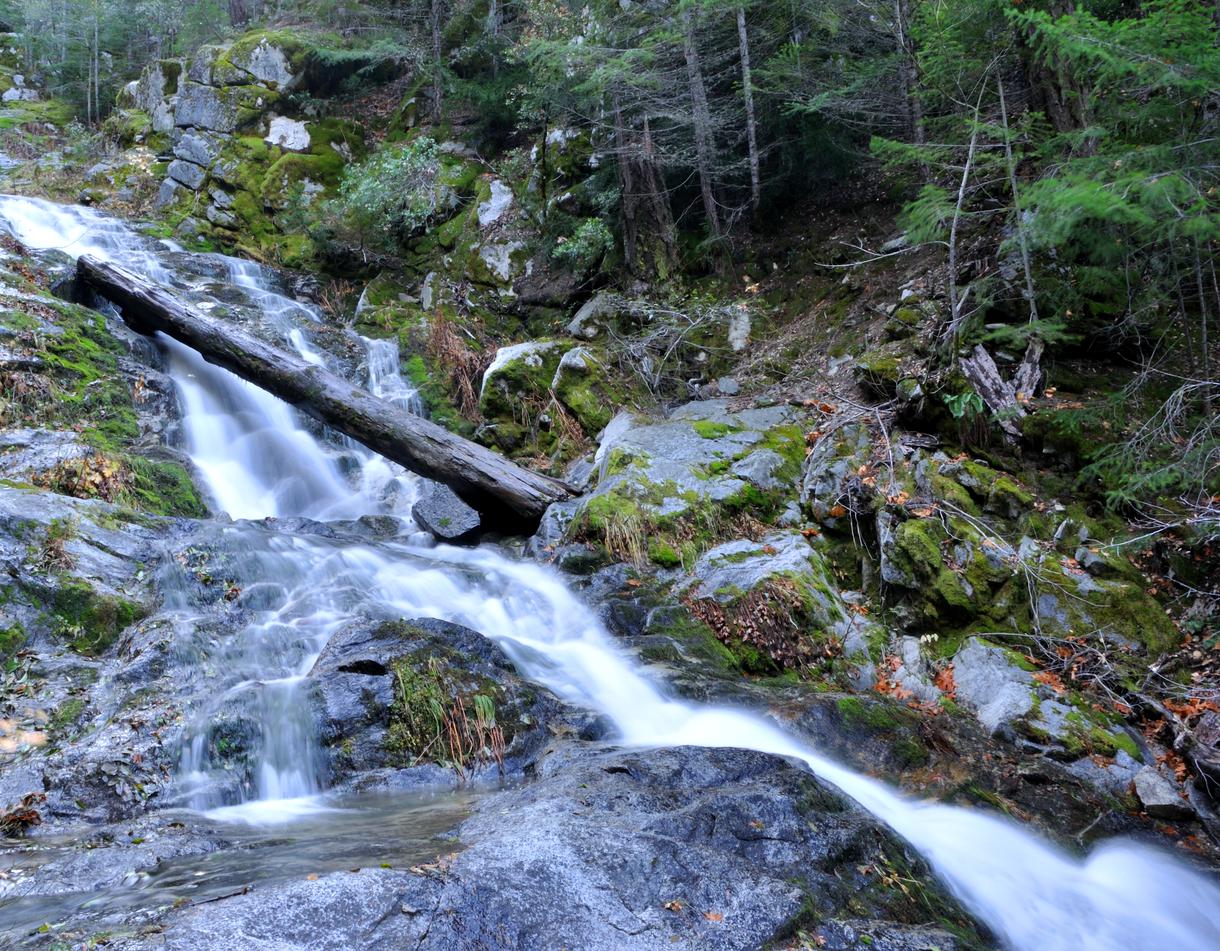
Keep your eyes open for deer and birds while on this waterfall hike in the Shasta-Cascade. The footbridges just above the 75-foot Mill Creek Falls and the lush green forest around you give off a vibe of tranquility and solitude—a much-needed feeling in today's highly bustling world. Extend your relaxation-inducing adventures in the Shasta-Cascade by pitching a tent at a top campsite and exploring other trails in the region.
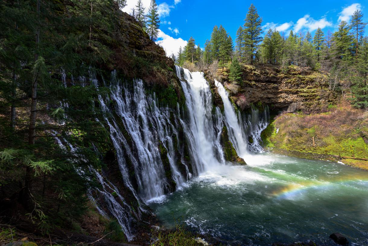
Location: McArthur–Burney Falls Memorial State Park, Burney
Parking: There is parking at McArthur Burney Falls Memorial State Park (day-use fee is $10).
Difficulty: Easy
Distance: 1 mile
Route: Loop
Time: About 1 hour
Dogs allowed: No
Permit: A day pass is required to enter the park, but check the park regulations before you visit.
Visit Burney Falls in Northern California and see what the hype is all about. The Burney Falls Loop is considered one of the most popular waterfall hikes near Redding—and there's a reason why it draws crowds. Multiple springs come together in a mist-filled basin, creating the illusion of a 250-foot-wide water wall. At its highest point, the water rushes down at an impressive 129 feet. It would be a shame to not dip your feet into the freezing water, and just in case you're feeling daring, pack your bathing suit.
Location: Whiskeytown National Recreation Area, Whiskeytown
Parking: There is limited parking near the James K. Carr Trailhead.
Difficulty: Challenging
Distance: 3.4 miles
Time: About 2 hours
Route: Out and back
Dogs allowed: Yes
Permits: Passes are required and cost $25 per vehicle (valid for 7 days), but make sure to check for any park closures before visiting.
Rediscovered in 2004 through aerial photographs by park natural resource manager Russ Weatherbee, the three-part Whiskeytown Falls still remains a mystical mystery. The three-part waterfall is 220 feet tall, making it the tallest one in the park. Follow the steep and strenuous James K. Carr Trail through the forest to reach the falls. Enjoy the serene scenery along the well-shaded path before the sound of the rumbling falls encompasses you. Take the time to explore your surroundings before climbing up the cement stairs to the upper section of the falls. Savor the views from the vista point before returning to the trailhead.
Location: Shasta-Trinity National Forest
Parking: Yes
Difficulty: Easy
Distance: About 4 miles
Time: About 1-2 hours
Route: Out and back
Dogs allowed: Yes, but on–leash.
Permits: No permits are needed.
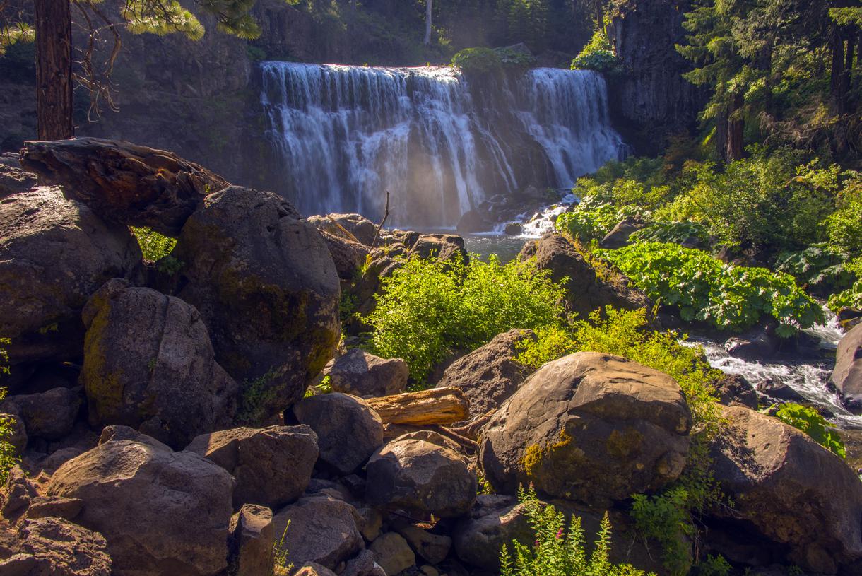
Follow this forested pathway along the McCloud River to visit all three falls. The McCloud River Falls Trail hosts thousands of visitors each year; it's very likely that this is the most popular waterfall hike in the Shasta-Trinity Forest. You'll come across the Lower Falls first when trekking along the trail. But the most mesmerizing section is the 50-foot-high and 80-foot-wide Middle Falls, which tumbles down into a swimming hole—the perfect way to cool down from the summer heat. After drying off, move on to discover the Upper Falls, which flows through basalt rocks. Linger for as long as you can to enjoy the majestic views from the lookout area, then make your way back down.

All waterfall hikes in L.A. have one thing in common—unbeatable views of terrific cascades. Here are the ones to try next.
Discover how to track and prepare for meteor showers in California for a spectacular celestial viewing experience.
Ditch the busy Spring Break crowds and check out these fantastic, underrated spring travel destinations in California.
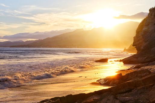
Gaze into California's amazing sunsets with our exploration of the top sunrise spots in California.

