


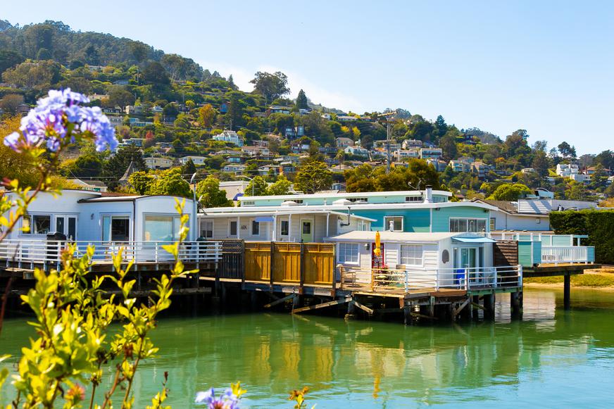


Fun and Free Things to Do in San Francisco
If you're looking for something fun to do, there are plenty of fun and free things to do in San Francisco, use our guide to help make plans.

Put on your hiking boots and blast your workout playlist—you’re about to discover the exhilarating world of mountain hikes in California.
6 min read
April 17, 2021
One of the best parts of living in California is that you’re never too far away from a beautiful hiking trail. From the snow-capped Sierra Nevada mountains to the lush and green San Jacinto, mountain hikes in California are bucket list-worthy experiences worth crossing off. Put on your hiking boots and blast your workout playlist—you’re about to discover the exhilarating world of mountain hikes in California.
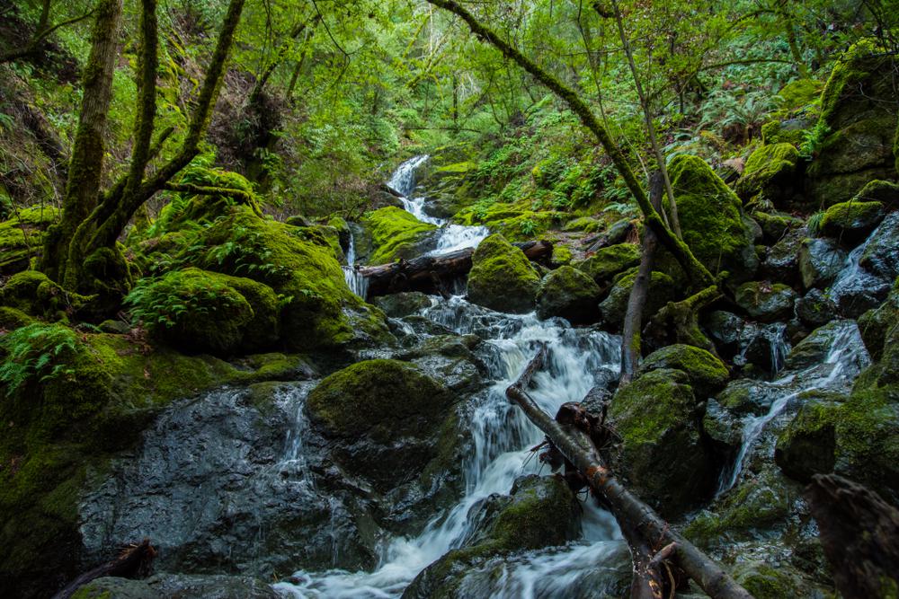
Location: Mount Tamalpais Watershed, Fairfax
Level of difficulty: Moderate
Distance: 4.8 miles
Route: Out and back
Dogs allowed: On leash
Cataract Falls is a stunning Northern California waterfall you can hike to. One of the most famous trails in Marin County, this mountain hike features scattered waterfalls along the entirety of the path. Hike this trail after rainfall to see the waters cascading in full force.
While this is a short hike, it has a decent amount of elevation—it’s a good outdoor workout. For magical views, stop at the junction of the Cataract and Helen Market Trails to take in the beauty of the hidden pool and its surrounding greenery.
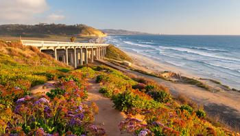
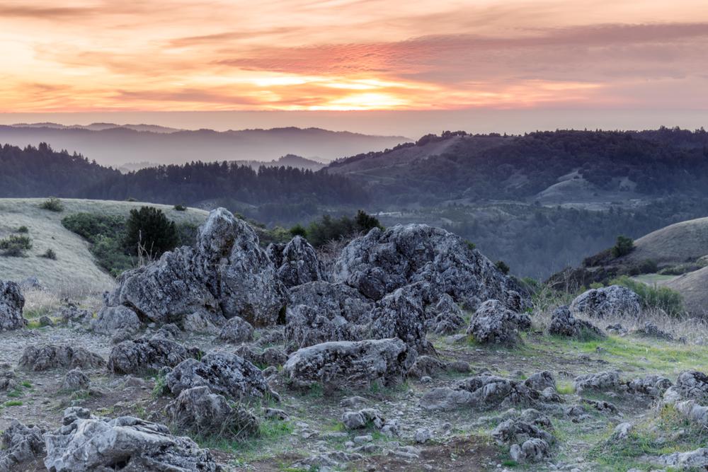
Location: Sonoma Coast State Park, Occidental
Level of difficulty: Moderate
Distance: 6.2 miles
Route: Loop
Dogs allowed: No
If you like to be alone on your mountain hikes in California, this little-known trail is perfect for you. You’ll face a variety of ups and downs on your hike and have the beautiful ocean as your companion throughout. Make sure you wear your hiking shoes while trekking this trail—certain areas can get pretty muddy.
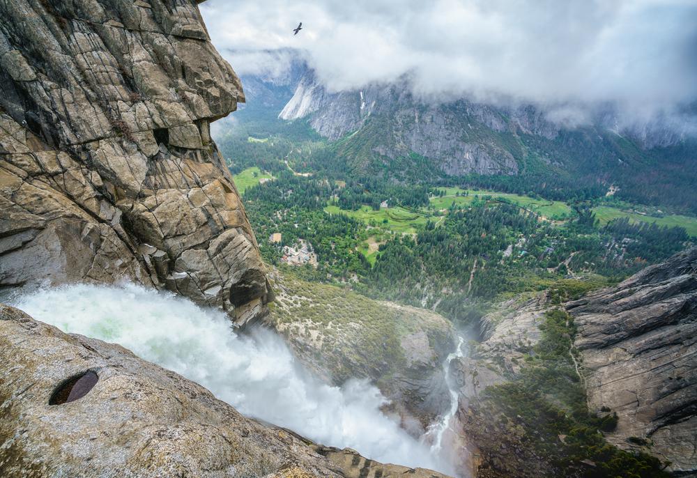
Location: Yosemite National Park, Yosemite Valley
Level of difficulty: Hard
Distance: 7.6 miles
Route: Out and back
Dogs allowed: No
This heavily trafficked trail is a must-do hike for nature lovers. Don’t take the “hard” label lightly on this mountain hike in California. If you’re not an experienced adventurer, you might want to steer clear of this strenuous trail. But if you are confident that you’re ready to tackle this mountain hike, you’re in for a treat. It generally takes six to eight hours to complete this trail—the overlook at the end boasts unbeatable views of the waterfall.
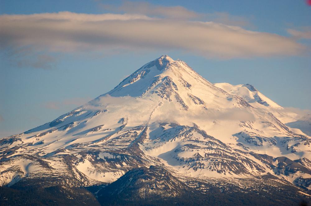
Location: Mount Shasta, Siskiyou County
Level of difficulty: Moderate
Distance: 2.6 miles
Route: Loop
Dogs allowed: On leash
Trekking the Spring Hill Trail is Mount Shasta hiking at its best. Nestled in a great forest setting, this trail is ideal for nature trips, bird watching, and a picnic at the end. You’ll have the majestic Mount Shasta watching over you throughout your hike and enjoy one of the best mountain vacations near S.F. Your four-legged friend will also love exploring this trail on a leash, so feel free to let them accompany you.
Location: Shasta-Trinity National Forest, Weed
Level of difficulty: Moderate
Distance: 8.6 miles
Route: Out and back
Dogs allowed: Yes
What could be better than a hiking trail featuring a mountain? A trail featuring two mountains, of course. Mount Eddy makes an appearance on this Mount Shasta hiking trail. While it’s quite long, you don’t need to complete this mountain hike in one go. There are several camping spots near the lakes where you can spend the night and continue hiking the next day. All in all, the views, wildflowers, and challenge make this Northern California hike a must-do.
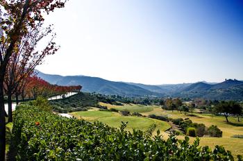
Location: Ranch San Antonio County Park, Los Altos
Level of difficulty: Moderate
Distance: 9.2 miles
Route: Out and back
Dogs allowed: No
The Black Mountain Trail in Los Altos features beautiful wildflowers and panoramic views of Silicon Valley. The first part of the hike is a decent warm-up, with heightened elevation gains once you reach the last couple of miles. However, the middle portion (which is the majority) is fairly monotonous, allowing you to catch your breath. One thing to keep in mind if you’re planning on tackling this trail is time—make sure to go early enough to finish before sundown.
Location: Yosemite National Park, Yosemite Valley
Level of difficulty: Hard
Distance: 203.1 miles
Route: Point to point
Dogs allowed: No
If you’re looking for an adventure of a lifetime, this trail is for you. Every other hike you’ve done up to this point has been preparing you to tackle the John Muir Trail. Taking around 15 days to a month to fully complete, this mountain hike in California is no joke. But, almost anyone who has attempted this strenuous adventure has rated it five stars—that has to count for something. While attempting to complete it in its entirety is best for experienced travelers, hiking a portion of this trail is also possible.
Location: Angeles National Forest, Mount Baldy
Level of difficulty: Hard
Distance: 11.5 miles
Route: Loop
Dogs allowed: Yes
The sheer length of this strenuous Mount Baldy hike makes it the coolest backpacking trip to take in California. This mountain hike begins at the Manker Flats Trailhead and takes the winding road up Baldy Notch towards the Devil's Backbone and to the summit. Similar to many other Mount Baldy trails, this mountain hike in California requires a fair amount of experience to tackle. Sounds like a trip you’d enjoy? Get your national park adventure pass and get going.
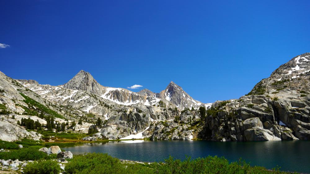
Location: John Muir Wilderness, Mammoth Lakes
Level of difficulty: Moderate
Distance: 9.5 miles
Route: Out and back
Dogs allowed: Yes
As one of the best hikes near Mammoth Lakes, this mountain trail is unbelievably scenic for the entire way. The Duck Pass and Pika Lake Trail tends to get fairly crowded, so if you’d like to have more solitude, go early on a weekday. While completing this trail is possible in one day, you can also divide it up and camp by the lake for a two-day adventure.

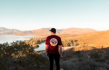
Location: Poway, San Diego County
Level of difficulty: Moderate
Distance: 7.3 miles
Route: Out and back
Dogs allowed: On leash
As its name suggests, this mountain hike in California is rather unique. As one of the best hikes in San Diego, the popular trail gives you awesome photo ops and panoramic views. While the hike is uphill and quite challenging, the views are definitely worth the trouble. Along this San Diego mountain hike, you’ll see Lake Poway, the Pacific Ocean, and even downtown San Diego.
Location: Tehachapi Mountain Park, Tehachapi
Level of difficulty: Moderate
Distance: 4.8 miles
Route: Out and back
Dogs allowed: On leash
This trail is among SoCal’s scenic Tehachapi Mountains. The Tehachapi hiking trail is mostly shaded but definitely a trek uphill—the last mile is a butt-kicker. If hiking among trees and lush greenery is good enough for you, make this mountain trail in California your hike of choice.

Location: Palomar Mountain State Park, Pala
Level of difficulty: Easy
Distance: 1.9 miles
Route: Loop
Dogs allowed: No
On the west side of Palomar Mountain lies a hidden gem of a state park. An easy and short way to explore the mountain of this secluded park is by hiking the Boucher Hill Loop. With panoramic views of both the desert and ocean, this Palomar Mountain hiking trail climbs steadily until reaching the historic Boucher Fire Tower Lookout. Make sure to drop in for awesome views.
Location: Palomar Mountain State Park, Warner Springs
Level of difficulty: Hard
Distance: 13 miles
Route: Out and back
Dogs allowed: On leash
A more popular Palomar Mountain hiking trail is the Oak Grove Trail to High Point. Considerably more strenuous than the previous trail, this mountain hike in California is for skillful trekkers. Once you make it past the first two miles—which are the steepest—you’ll be glad to have embarked on the hike. There’s a high chance you’re alone for most of the hike, but beautiful mountain views keep you company along the way.

If you're looking for something fun to do, there are plenty of fun and free things to do in San Francisco, use our guide to help make plans.

Finding a wall isn't the problem. The problem is figuring out which gym fits your lifestyle the best.
What are you waiting for? Pack up your camping essentials and head over to the best campgrounds California has to offer.

The leagues, the stadiums, how to watch, how to get tickets. Consider this your starting point.

