

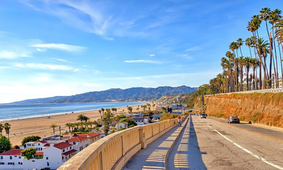


Fun and Free Things to Do in San Francisco
If you're looking for something fun to do, there are plenty of fun and free things to do in San Francisco, use our guide to help make plans.
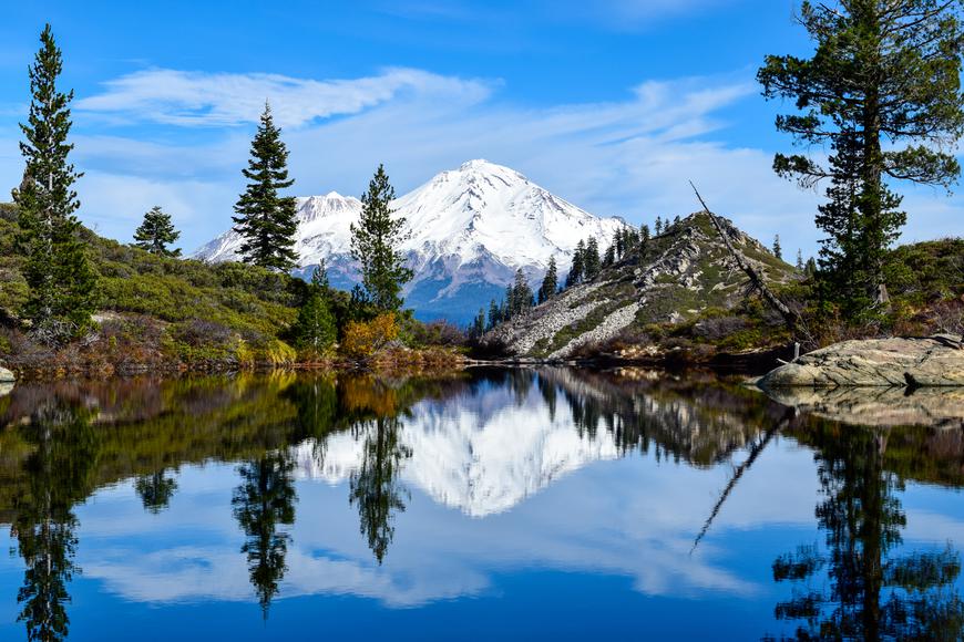
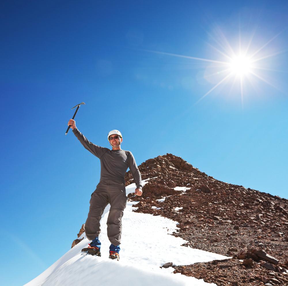
Climbing atop this 14,179-foot giant is an indescribable feeling, and the payoff atop can’t be replicated by anything.
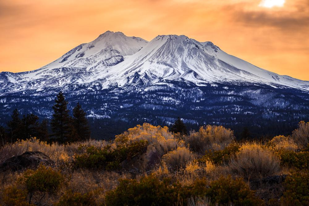
Wish to go hiking on Mount Shasta? We don’t blame you—climbing atop this 14,179-foot giant through world-class treks is an indescribable feeling, and the payoff atop can’t be replicated by anything. Scrape the turquoise-blue skies north of Redding, where unspoiled vistas await. And while most Golden State mountains climb gradually, this one rises from the surrounding flatlands with such snow-capped majesty that the whole thing almost seems unreal.
Most people attempt the Avalanche Gulch route on Mount Shasta somewhere between mid-May and mid-July. With optimal weather conditions and snowpack coverage, this is believed to be the best time to attempt this route. If you wait until it’s too late in the summer, the snow will melt and there might be a lot of loose scree, which naturally makes the hike more challenging. Even if you’re an expert hiker, this time of year can be more dangerous since there’s a higher chance of rockfall in the Gulch.
Despite the mild weather forecast, you should always be prepared for rapid weather changes. Come prepared with rain gears and pack a few extra layers while you’re at it. Mount Shasta has a tendency to jump from optimal to stormy real fast, sometimes even in a span of a few hours. Also, the higher you ascend, the stronger the winds, so don’t forget your windbreaker; better safe than freezing.
Yes, two of them, in fact—you need a Wilderness Permit and a Summit Pass before climbing Mount Shasta. Anyone attempting to reach the summit of Mount Shasta needs to fill out their own free wilderness permit. A summit pass, however, is a little different. If you climb above 10,000 feet, then this pass is required; otherwise, you’re climbing illegally.
Obtaining a permit is a must for accessing the Mount Shasta Wilderness Area at any time of the year, but the good news is, there's no quota system or need for advance booking in place. This allows for the flexibility of picking up your permits either on the day you plan to climb Mt. Shasta or the day prior. Be aware, though, that specific rules do apply under certain circumstances.
Your Mount Shasta climbing permit is available at the Mt. Shasta Ranger District Office or the Shasta McCloud Management Unit during business hours. For those arriving outside these hours, there's a convenient option to self-issue a permit right outside the main entrances of these offices. Additionally, self-issuing a permit directly at the Mt. Shasta trailheads is another alternative for climbers.
The cost for a Mount Shasta Summit Pass stands at $25 for each climber. When opting for self-issue, carrying the precise cash amount or a personal check can streamline the process, ensuring a quicker and smoother start to your adventure, leaving you more time to enjoy the hike.
For those residing nearby and anticipating multiple ascents of Mount Shasta, an Annual Summit Pass is available for $30 at any Ranger Station. This pass remains valid through December 31st of the purchase year, offering a convenient and cost-effective option for frequent climbers.
Considering a backpacking adventure up Mt. Shasta with your buddies? It's important to note that group sizes are capped at 10 individuals, so it might be wise to stick to the main crew this trip. Also, there's a limit on camping durations, allowing for a maximum of seven nights within any 30-day period.
Mt. Shasta, similar to the well-visited Mount Whitney, sees a significant number of climbers and hikers each year. To maintain its breathtaking natural beauty, the Mt. Shasta Wilderness management, along with climbers, have implemented a responsible Waste Disposal System akin to the compulsory W.A.G.-Bag system used at Mt. Whitney. This means everyone is encouraged to conscientiously manage their waste by utilizing 'pack out' bags, available at ranger stations or the Bunny Flat Trailhead, ensuring that Mt. Shasta remains as splendid as ever for future visitors.
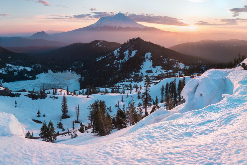
The stunning views that greet hikers on Mount Shasta are truly unparalleled. As you traverse any path on the mountain, you're treated to vast, sweeping landscapes. A significant reason for these breathtaking sights is the expansive area above the timberline. To fully appreciate the beauty of Mount Shasta's trails, they must be experienced firsthand.
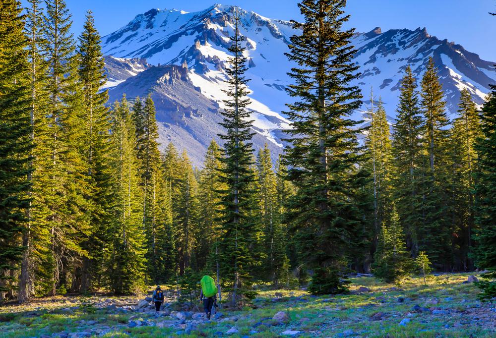
The trailhead at Mt. Shasta guides you through an expansive forest of ancient conifers, offering scenic views of the Sacramento River Canyon – a popular spot for a wide range of water-based activities. Dedicated to the memory of ranger John S. Everett, this path weaves past numerous vantage points where you're likely to capture breathtaking images of Lassen Peak, the Trinity Alps, and the majestic China Mountain.
For those new to hiking and in search of an easy-to-navigate trail map for Mt. Shasta, the Sisson Meadow hike is an excellent choice. This trail is managed by the Siskiyou Land Trust and spans 7.5 acres of conserved and rehabilitated wetland area. The well-maintained path offers panoramic views of the mountain and its neighboring summits, providing picturesque sights of Mt. Eddy, Black Butte, and the Castle Crags Wilderness. This route is perfect for those seeking a rewarding experience with minimal effort.
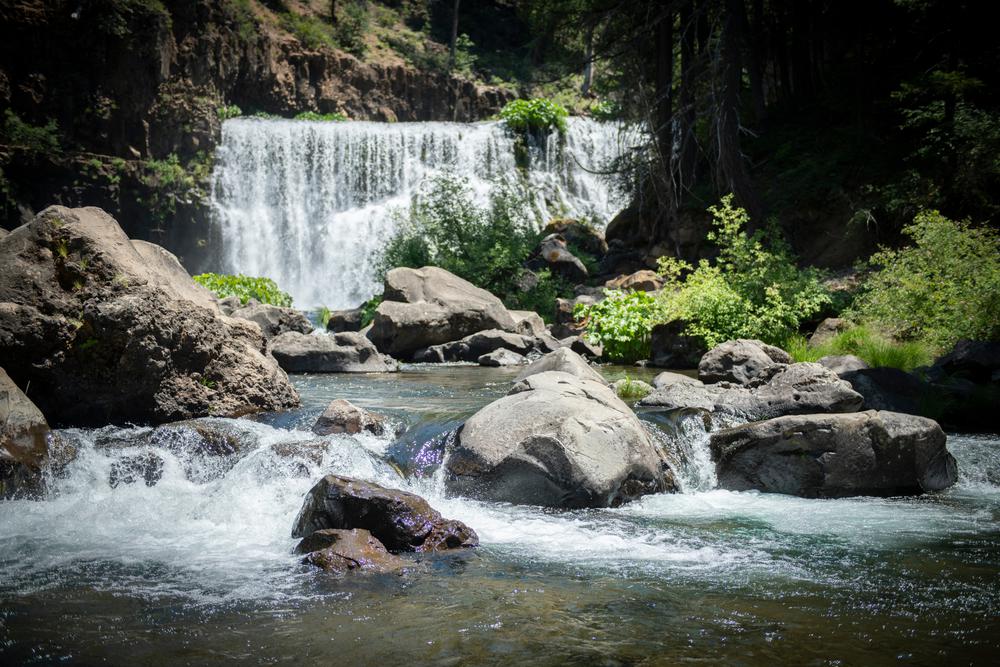
Winding through a canyon of basalt and lava rock, the McCloud Waterfalls trail is the most fun you’ll have when backpacking in Mt. Shasta. This well-maintained trail boasts summer swimming opportunities, unmatched fall foliage, and an early spring thaw—safe to say it’s a year-round treat. You’ll come across the Lower Falls first when trekking along the trail. But the most mesmerizing section is the 50-foot-high and 80-foot wide Middle Falls, which tumbles down into a swimming hole; the perfect way to cool down from the scorching summer heat.
Echoing the appeal of the Sisson trail, the Panther Meadow route offers an abundance of stunning vistas over a short distance. This trail provides exceptional views of the mountain, with the Trinity Divide also visible from various points. The path meanders through a quaint, fragile alpine meadow, revealing a creek that, though seasonal, is remarkably picturesque. It's worth mentioning that Panther Meadow is often regarded as a sacred space, and it's not uncommon to encounter individuals engaged in meditation or spiritual practices within this serene setting.

If you're looking for something fun to do, there are plenty of fun and free things to do in San Francisco, use our guide to help make plans.

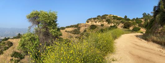
All waterfall hikes in L.A. have one thing in common—unbeatable views of terrific cascades. Here are the ones to try next.

From undulating mountains, to coastal expanses, to verdant forests, here are some of the top spots for backpacking in California.
Settled off the California coast, the Channel Islands offer endless adventures. Here are the best things to do and how to get there.

