


Fun and Free Things to Do in San Francisco
If you're looking for something fun to do, there are plenty of fun and free things to do in San Francisco, use our guide to help make plans.

From leisurely strolls with scenic vistas to Mount Shasta backpacking trails spanning several miles, there’s much to discover in Shasta.
5 min read
April 25, 2024
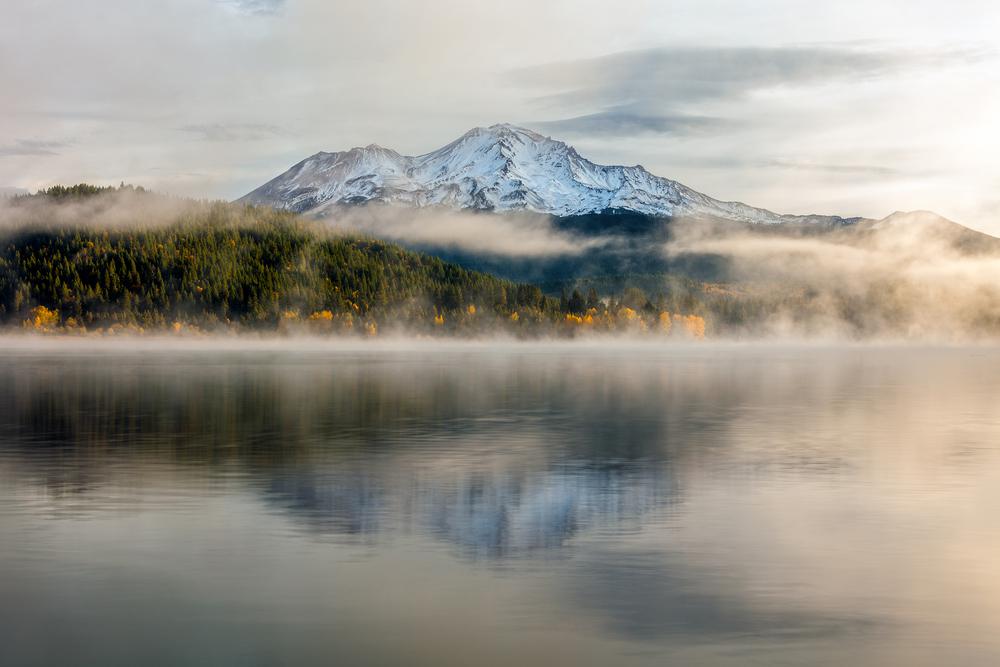
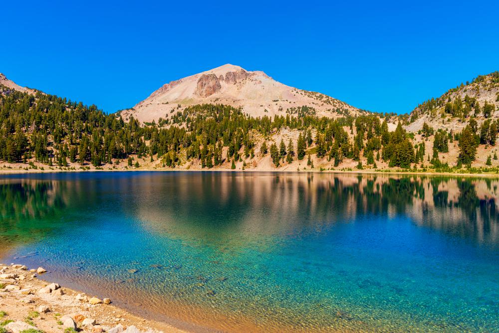
Mount Shasta is one of Northern California’s most noticeable landmarks. While it’s virtually impossible to drive past the 14,000-foot mountain without being enamored by its larger-than-life beauty, there’s still more to the region than what meets the eye. Lakes, rivers, falls, and forests—Shasta is heaven for nature lovers, best discovered on foot.
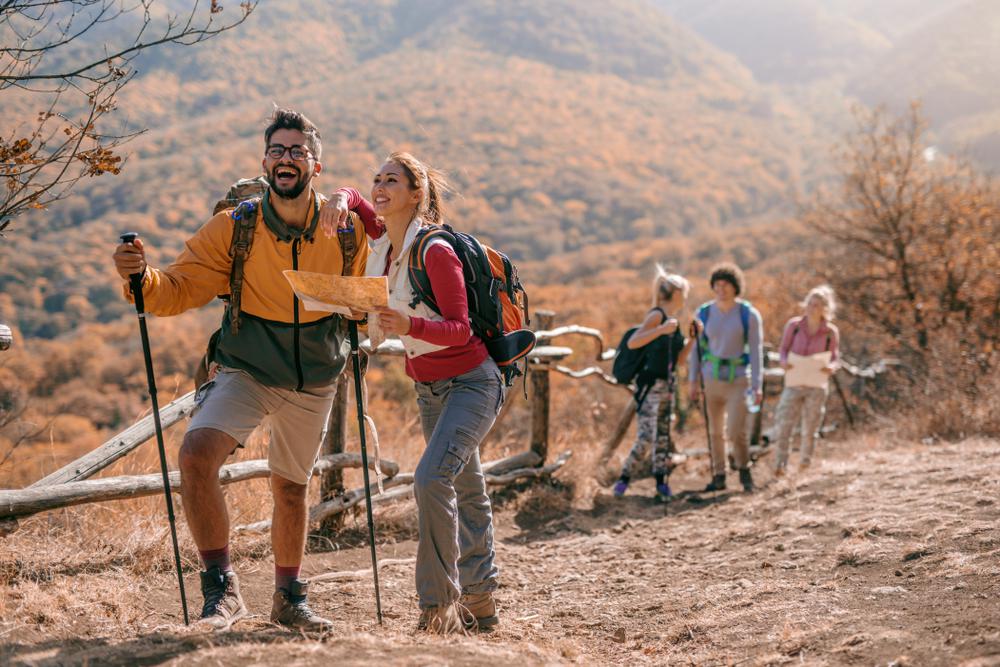
Hiking in Shasta is an adventure soaked in beauty and serenity. From leisurely strolls with scenic vistas to Mount Shasta backpacking trails spanning several miles, there’s much to discover in and around the Shasta mountains, and we’ve compiled the best of all.
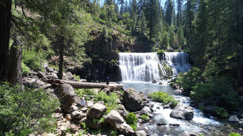
Location: Shasta-Trinity National Forest, McCloud
Level of difficulty: Easy
Distance: 3.5 miles
Route: Out and back
While hiking is the most popular activity at McCloud Falls, many people also head out here to cliff dive, kayak, and go off-roading. The good thing is that this hike is super easy—even the city dweller of your friend group will enjoy it. Spend a hot summer’s day at this fan-favorite spot in the Shasta-Trinity National Forest and you’ll come back having enjoyed every summer activity in the book.
Location: Mount Shasta Wilderness, Mount Shasta
Level of difficulty: Easy
Distance: 7 miles
Route: Out and back
The Bunny Flat Trail is a scenic and easy hike near Mount Shasta with the perfect balance of flats and climbs. Best visited from June through October, this trail is a favorite among hikers, runners, campers, and bird watchers. If you’d like to bring along your pup, you’re in luck—this trail is dog-friendly; just make sure to hang on to your leash.
Location: Whiskeytown National Recreation Area, Shasta Lake
Level of difficulty: Moderate
Distance: 2.6 miles
Route: Loop
If you like the idea of trekking a moderately challenging hiking trail with lakeside views, you’re going to love the Bailey Cove Loop Trail. This Lake Shasta hike is beautiful, peaceful, and physically demanding enough to keep you going without making you forget you’re on a hike. Side note—we heard that dogs also love this trail.
Location: Siskiyou County Flood Control District, Mount Shasta
Level of difficulty: Easy
Distance: 7.3 miles
Route: Loop
Another beautiful lakeside hiking route, the Lake Siskiyou Trail is a popular recreation spot for people looking for a leisurely stroll near the Shasta Cascade. The trail circles the perimeter of Lake Siskiyou and features peeking views of the Shasta mountains from behind the tall green trees. And yes, this is yet another dog-friendly trail in Shasta.
Location: Shasta-Trinity National Forest, Mount Shasta
Level of difficulty: Easy
Distance: 1.3 miles
Route: Out and back
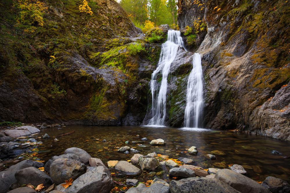
The Shasta-Trinity National Forest is a treasure trove of hiking trails fit for every level. If you’re short on time and energy but still want to go on a quick hiking trip, this is the trail you need to hike in Shasta. Not only is the entirety of the route just over a mile in length, but trekking it is also super easy. You even get waterfall views in the end without breaking a sweat, which definitely makes it feel like you’re cheating the system.
Location: Mount Shasta Wilderness, Montague
Level of difficulty: Easy
Distance: 0.7 miles
Route: Out and back
You’re probably going to hike by a waterfall, over the meadow, and along the lake—why not also cover a cave? Somewhat of a hidden gem among Northern California hikes, this easy and short trail is a fun discovery trip in the Mount Shasta Wilderness. Don’t forget to bring a headlamp if you’re looking to go into the cave—it can get very dark on this hike in Shasta.

Location: Whiskeytown National Recreation Area, Mount Shasta
Level of difficulty: Moderate
Distance: 7.8 miles
Route: Out and back
The Seven Lakes Basin hiking route is a part of the Pacific Crest Trail, leading you around the Cliffs, Mumbo, and Seven Lakes Basins. However, lakes aren’t the only natural beauties you see along this Shasta hike—Mount Shasta, Mount Eddy, and the Trinity Alps are also visible throughout the journey. Look out for birds and other animals in the wildflower fields as you’re trekking. If you prefer to continue your hike the next day, you’ll find several places to set camp along the way.
Location: Mount Shasta
Level of difficulty: Moderate
Distance: 2.6 miles
Route: Loop
Hiking at Mount Shasta is best done via the Spring Hill Trail if you want a view-heavy but exercise-light trail. Nestled in a scenic forest setting, this mountain trail is ideal for nature trips, bird watching, and a picnic at the end. You’ll have the majestic Mount Shasta watching over you throughout your hike and see the neighboring mountain ranges and cities. Your four-legged friend will also love exploring this Shasta trail on a leash, so feel free to let them accompany you.
Location: Shasta-Trinity National Forest, McCloud
Level of difficulty: Hard
Distance: 6.5 miles
Route: Out and back
Crossing over to the difficult trails to trek, hiking Shasta is significantly more intense than the rest on this list. Situated in a lush forest setting near McCloud, the Helen Lake Trail is better reserved for the experienced hikers as it requires a bit of stamina. This trail can be accessed year-round, but looks like a completely different place depending on when you visit. A frozen wonderland in the winter and a green fairytale in the summer, this Shasta hike is a treat. Besides hiking, visitors enjoy camping, snowshoeing, and backpacking on this trail.
Location: Mount Shasta Wilderness, Mount Shasta
Level of difficulty: Hard
Distance: 10.3 miles
Route: Out and back
If you read about every trail on the list so far and still feel like you could complete them with your eyes closed, this one’s for you. The Avalanche Gulch Route has every quality needed to be a perfect Mount Shasta backpacking trail. An epic two-day journey with an ascent over a 14,000-foot California volcano, this Shasta hiking trail is reserved for the pros.
The Avalanche Gulch Route takes the standard trail up from Bunny Flats—you can plan an overnight stay at one of the campsites near Lake Helen. After spending the night, continue your ascent up the face and then head through Red Banks to Misery Hill. While you definitely can complete this trail in less than two days, spreading it out is ideal to get used to the altitude.

If you're looking for something fun to do, there are plenty of fun and free things to do in San Francisco, use our guide to help make plans.

Finding a wall isn't the problem. The problem is figuring out which gym fits your lifestyle the best.

The leagues, the stadiums, how to watch, how to get tickets. Consider this your starting point.
What are you waiting for? Pack up your camping essentials and head over to the best campgrounds California has to offer.

