


Fun and Free Things to Do in San Francisco
If you're looking for something fun to do, there are plenty of fun and free things to do in San Francisco, use our guide to help make plans.
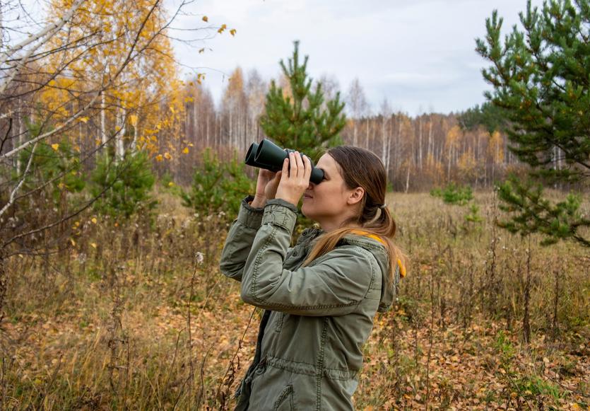
The Lost Coast is a wild, remote region near the northern tip of California. Here's how to backpack through this pristine stretch of land.
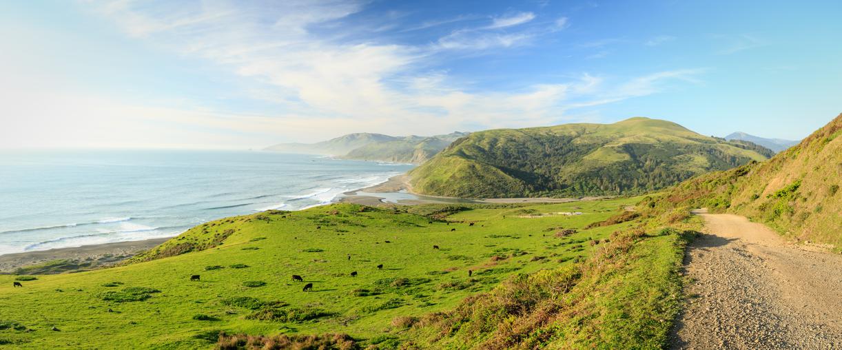
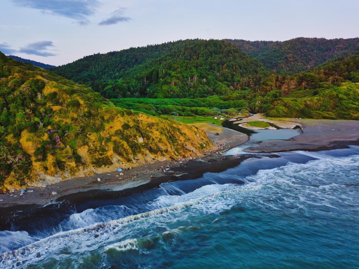
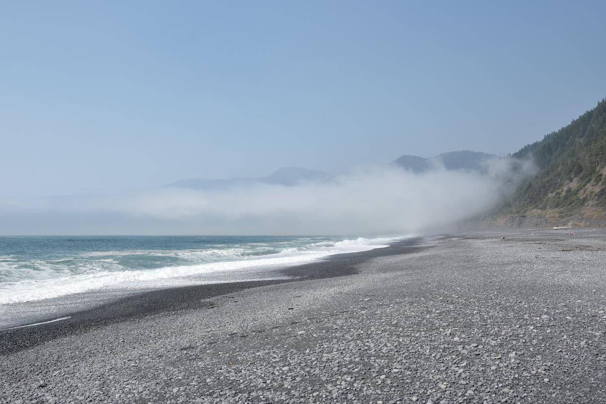
Waves crash along the shore, preventing travelers from passing at high tide as the rugged coastline rises from the sands covered with chartreuse-colored foliage. The fresh air almost feels foreign — as if it were possible to breathe in the refreshing moment you jump into a swimming pool on a hot summer day — while the fog rolls in and out, imitating the tide. These miles of coastal lands are largely untouched by human hands, and those who have the honor of traipsing through them respect the motto: leave no trace. While this ode to pre-industrial times carries the essence of a faraway place, the mysterious trail belongs to the Lost Coast, a pristine stretch of natural land near the northern tip of California.

The Lost Coast of California is a rugged, remote region where the state meets the Pacific Ocean in Humboldt and Mendocino Counties. Designated the nation’s first National Conservation Area in 1970, this strip of untamed coast was largely preserved due to its daunting nature. Since the rigid land was too tough and costly to develop in the 1930s, the Lost Coast is now the only section of California’s coastline that remains untouched by the Pacific Coast Highway (commonly referred to as Highway 1), which veers inland for 20 miles throughout this section.
While the northern portion of the famed Lost Coast Trail extends for nearly 25 miles, the less popular section of the trail stretches south for an additional 9 miles. Even with these sought-after pathways, the King Range Wilderness remains wild. The area averages 100-plus inches of rain every year — most of which occurs between October and April — making it one of the wettest regions in the United States. Due to these harsh conditions, the best time to go backpacking on the Lost Coast Trail is between May and September, during the drier season, though weather conditions are always unpredictable in this area.

In an effort to protect the wild nature of the Lost Coast, overnight visits require permits year-round. Permits are issued on a first-come, first-served basis, with no lottery or on-site purchases available, so it’s crucial to plan ahead.
Each block of permits for the next calendar year is released on October 1; visitors can have a maximum of three active permits at a time. To ensure the Lost Coast Trail remains in pristine condition, permits are limited to five people, and a maximum of 15 people can travel in a single group. Since permits are scheduled ahead of time and are based solely on the start day, no early or late access to the trail is allowed. Along with a permit, campers will need to provide a tentative itinerary that shows the number of days they plan to spend in the King Range Wilderness, which trailheads they expect to enter and exit, and where they intend to camp along the way.
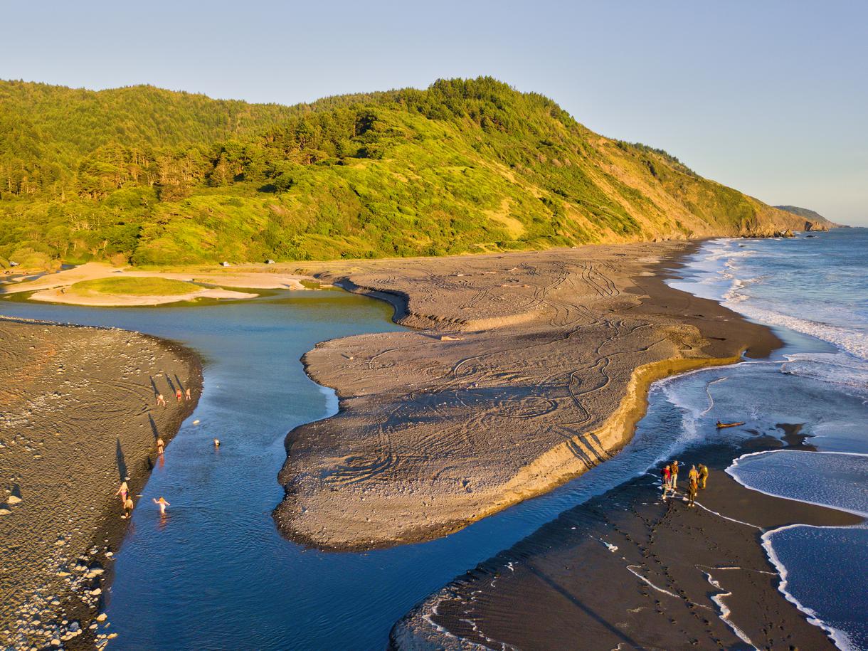
After passing through San Francisco, make a quick stop in Garberville to fill up the tank. And if you’ve reserved a shuttle through Lost Coast Adventure Tours, call the company to confirm your estimated time of arrival before cell reception cuts out. From Garberville, it should take approximately 45 minutes to travel along the 22 miles of twists and turns that eventually drop you off at the parking area of Black Sands Beach, one of the most charming secluded beaches in California. Here, the shuttle will pick you up and drive you for two more hours to Mattole Campground, where the real journey begins.
The Lost Coast Trail begins with a mixture of solid ground and sandy pathways, but this first section will be the shortest one on the route. This portion of the hike will take you from Mattole Beach to the Punta Gorda Lighthouse before continuing on to Sea Lion Gulch – about 5.4 miles from where the trek began. At first, the adventure is filled with loose sand and ice plants, so the going is slow. Trudging through the soft surfaces is easiest with shorter strides, but once the sand gives way to pebbled shores, less effort is needed.
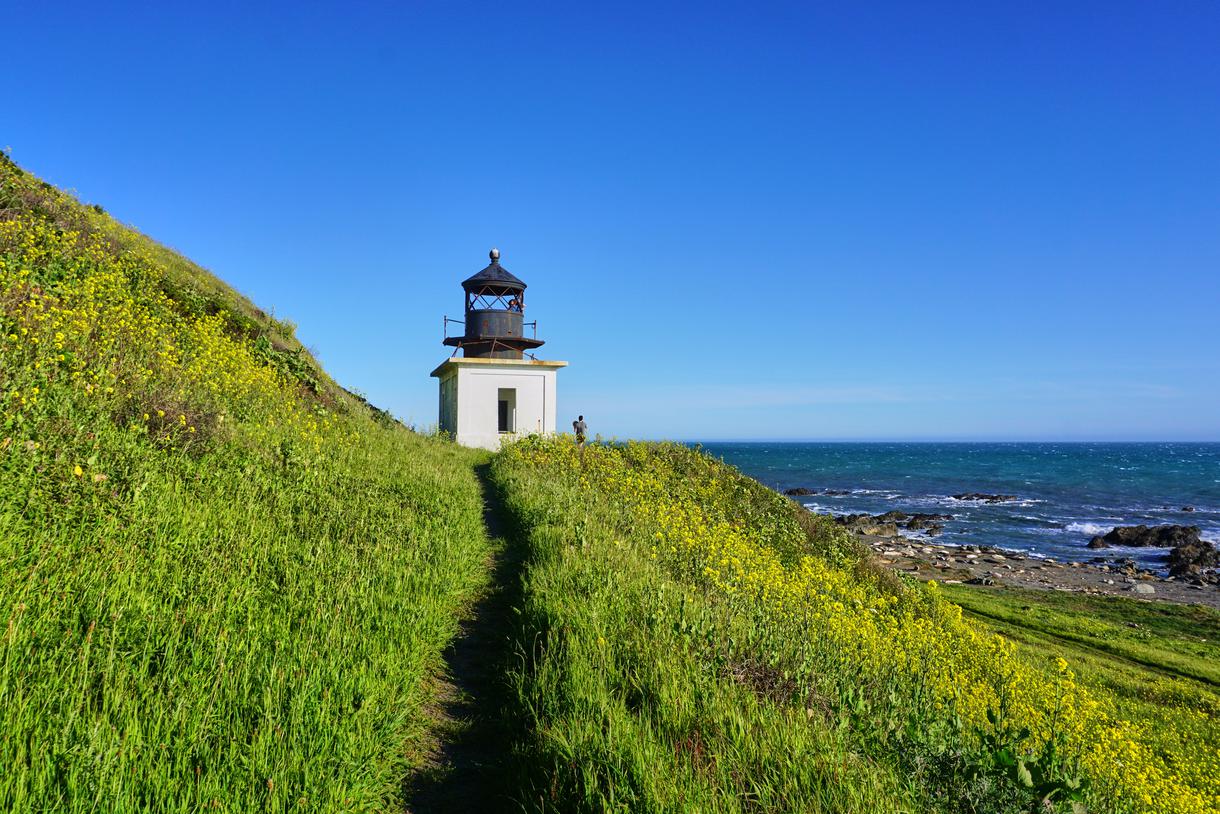
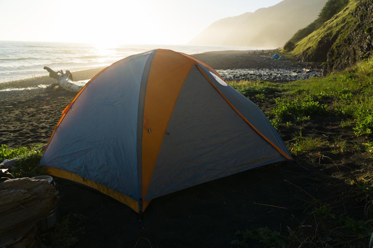
Continue on through short stretches of solid ground interspersed with lengthy portions of pebbled surfaces for 2.5 miles before reaching Punta Gorda — the first region where high tides make the trail impassable. But if you’ve used the tidal chart and planned accordingly, this section should not prove too large an obstacle; just be cautious when passing through. About 1.25 miles farther down the trail, one of the coolest California lighthouses, Punta Gorda Lighthouse, emerges from the bluffs and provides the perfect place for a quick rest before finishing the final leg of the day’s journey. The last mile rewards you with beautiful ocean views as you trek along the bluffs and eventually arrive at Sea Lion Gulch, where you can set up camp at one of California’s best beach camping destinations.
Though the idea of hiking the Lost Coast may evoke images of well-laid pathways, the day’s excursion proves that it is actually much more complicated; there is no one right way to explore the untamed wilderness of this region. Sometimes, the best path lies along the edge of the bluffs, while at other points, it’s better to walk on the densely packed sand along the shore. In this lesson lies the true meaning behind hiking the Lost Coast Trail: discovery. Discovery of the wilderness largely unseen in urban areas; discovery of the coastline in our backyard; discovery of the various ways to accomplish a common goal; and most of all, the discovery of one’s self.
The Northern California morning fog will greet you once you exit your tent and commence your second day of adventures. It’s best to begin the Lost Coast hike today at Sea Lion Gulch. The trail between Sea Lion Gulch and Randall Creek is impassable at high tide, so you’ll want to start here in order to avoid becoming trapped along the four miles of sand where the ocean tides are in control. While you wait for the tides to retract, don your sandals or river shoes so the trek is more bearable.
In addition to being one of the most difficult portions of the trail to plan around due to the tides, the sands here are dotted with bowling ball-sized rocks, making the going slow. Luckily, this tough terrain only lasts for half a mile and eventually leads to more solid footing — though the jutting rocks force the excursion away from the sea, as they make this portion of the path impassable even at low tide. These rocky formations indicate an inland trek, and while there are also signs atop the bluffs directing hikers to head away from the shore, they are easy to miss, so keep an eye out for them.

Once you’ve made it through and breathed a quick sigh of relief, you’ll find yourself on the downhill portion of the inland path, where you’ll arrive at a crossroads and have to determine which way leads to the Cooskie Creek Spur trail and which one leads to the Lost Coast Trail. Take a minute to find your bearings and ensure you’re on your planned route; you’ll know you’re on the correct path when you encounter an old, dilapidated shack and return to the sandy, pebbly beach. While the going is slow back on the sands, at mile five you’ll reach Randall Creek. Rejoice in knowing that the most strenuous portion of the day’s work is done; walk merely two miles more and you will find yourself south of Spanish Creek, a great place to stop for the night.

Upon waking up on the third day, take comfort in knowing that this is the only day of the grand adventure that does not involve any impassable sections. While this means the going is somewhat easier, the deep, sandy terrain can make the 7.5-mile trek feel more strenuous.
After a mile of hiking on solid ground, a shady canopy of trees greets you, warning of the Kinsey Creek crossing one mile farther down the road. Continue on to mile three, where the rocky beach welcomes you with open arms. The gorgeous views here provide some relief from the fatigue that sets in as you walk along the stones that pound out the beat.
Just over half a mile later, Big Creek Campground comes into view. In another mile, you’ll arrive at an incline leading to the 100-foot-tall Big Flat — the highest point on the trail. Pause here to take in the sweeping vistas that reward you for your efforts before meandering through the dense pine forest. From here, the trail winds down into a grassy field that, though beautiful, poses potential threats such as ticks and rattlesnakes, so stay alert.
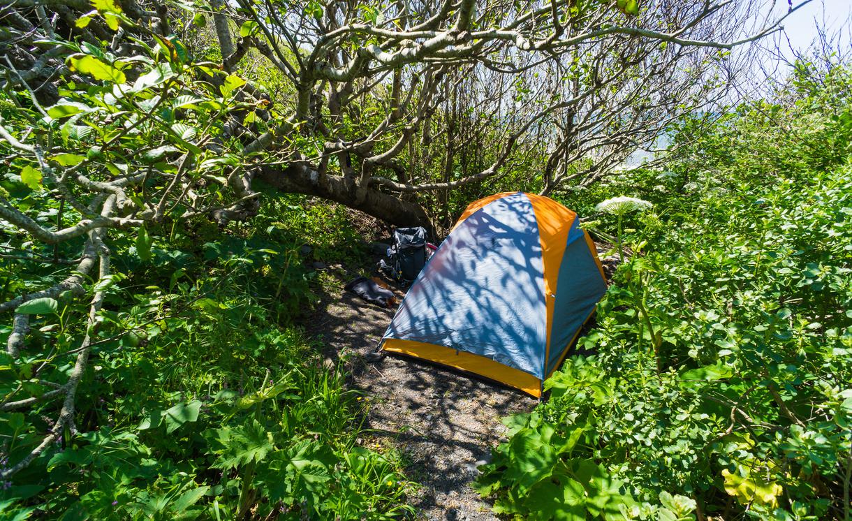
Around mile six, the pathway widens and reveals a makeshift air strip, a welcome change of scenery that implies some sort of civilization not seen throughout the rest of the trail. Keep your eyes on the pathway as you marvel at the nature around you, as the trail quickly makes a 90-degree turn toward the water before meandering along the bluffs and leading to Big Flat Creek. The creek provides some of the best camping destinations in California, making it a popular Lost Coast Trail stop.
The last day of an adventure is always bittersweet, as the memories solidify and the reality of returning to everyday life sets in. Set aside any qualms during this last leg so it doesn’t become watered down with sadness, and instead focus on the tasks ahead. The pathway stays solid for about a mile before leading back toward the undulating sands of the beach.
Between Miller Flat and Gitchell Creek lies the final questionable portion of this coastal hiking trail in California. Get to this section early in the day so your group can cross the next 4.5 miles of beach before the tide comes back in. If you arrive at Miller Flat during high tide, the silver lining is that you will be treated to an unusual sight as the waves meet the forest. So wait here, looking out into the seeming impossibility of the tide wafting back into the open ocean and your path defining itself before your eyes. As you continue your trek, the popular campsites of Buck Creek and Shipman Creek pass by, inviting the opportunity to meet fellow hikers.
A few miles later, you’ll see two large boulders that mark the sandy path, congratulating you for conquering nearly 23 miles of the Lost Coast Trail, California, and encouraging you to keep going. The widened pathway provides a spectacular view of the Northern California coastline before veering away from the beach. Climb up to the bluffs between Telegraph and Humboldt Creeks, head to the northern edge of Humboldt Creek, and see the final sign where the Black Sands Beach trailhead transforms into a walkway – leading you to the parking lot where the shuttle picked you up and the adventure began.
Before you embark on this beautiful journey of exploration, make sure to check the ultimate guide to California’s Lost Coast for tips and tricks that will make your route a lot easier. Once you’ve learned all the insider tricks, you’ll come to realize that your life on the trail will be much easier to appreciate when prepared. Enjoy!

If you're looking for something fun to do, there are plenty of fun and free things to do in San Francisco, use our guide to help make plans.

Finding a wall isn't the problem. The problem is figuring out which gym fits your lifestyle the best.

All waterfall hikes in L.A. have one thing in common—unbeatable views of terrific cascades. Here are the ones to try next.

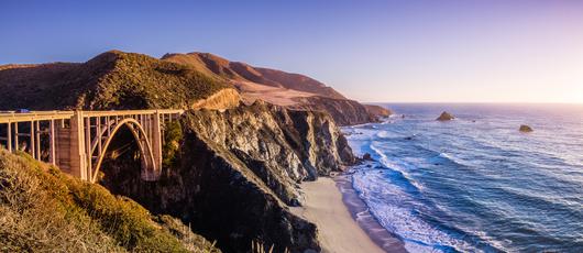
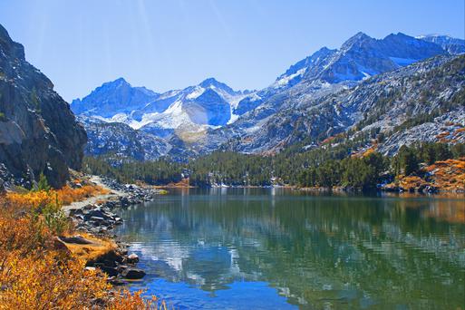
From undulating mountains, to coastal expanses, to verdant forests, here are some of the top spots for backpacking in California.

