


Fun and Free Things to Do in San Francisco
If you're looking for something fun to do, there are plenty of fun and free things to do in San Francisco, use our guide to help make plans.
Experience some of the best scenery in the state while exploring these top California coastal hiking trails.

6 min read
July 14, 2020
Many people fall in love with California because of the state’s stunning and unique coastline. The gorgeous topography of rolling hills, lush forests, and endless stretches of white, sandy beaches is unlike anywhere else in the U.S. Thanks to the endless number of coastal activities in California, your boredom will always be kept at bay here.
The diverse ecosystems and wildlife make for a fantastic hiking experience, so whether you’re looking to explore sunny SoCal or get lost amongst the looming redwoods in NorCal, hit these top California coastal hiking trails to experience some of the best scenery in the state.
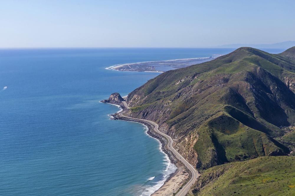
Location: Right off of Highway 101, just north of Orick
Hours: Dawn to dusk
Parking: Free, easily accessible parking close to the trailhead.
Difficulty: Moderate
Distance: 7.6 miles
Time: About 3–4 hours
Route: Out and back
Dogs allowed: No
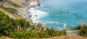
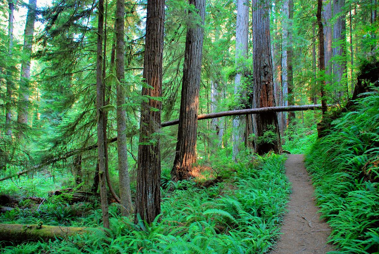
Layer up, because you're headed for a wild adventure on the secluded Skunk Cabbage Trail, located in the magnificent Redwood National Park, about an hour north of beautiful Eureka.
Don’t let the name deter you; this forested pathway in Humboldt County doesn’t smell like skunk and cabbage. Instead, you’ll enjoy marvelous scenery (and perhaps a quick dip in the ocean, if you feel like braving the cool waters). From the lush woods near Elk Meadow to a wild beach situated on Davison Road (just past Gold Bluffs Beach, one of the best beach camping spots in California), you'll be in seventh heaven as you enter and exit entirely different ecosystems within one hike.
Even though you’re deep in the woods, you’ll still hear the crash of the ocean waves as you traipse through Sitka spruce trees, bright green ferns, and seasonal wildflowers blooming on the grassy hillsides. Feeling spontaneous? Add a couple of miles to your trip once you reach the beach and simply walk along the shoreline, admiring the beauty of the California coast.
Location: Palomarin Trailhead, Bolinas
Hours: 6 a.m.–midnight
Parking: Park at the Palomarin Trailhead parking lot along Mesa Road. If you’re hiking on a weekend, arrive as early as possible because the parking lot fills up quite easily. Visitors may be turned away if the trail is overcrowded.
Difficulty: Moderate
Distance: 13.8 miles
Time: 4–5 hours
Route: Out and back
Dogs allowed: No
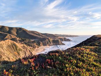
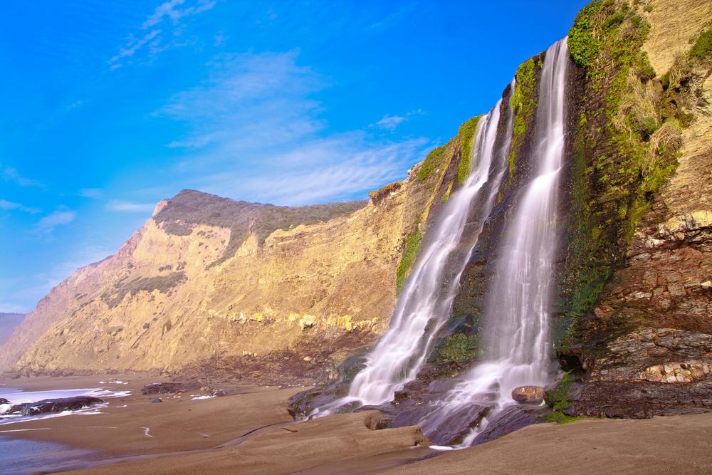
One of the most stunning spots situated within the Point Reyes National Seashore, Alamere Falls is definitely worth the trek to get there. The 40-foot-tall waterfall rushes down towering ocean bluffs—one of the few falls in the world to do so—making it a unique sight. The descent to reach it can be a bit difficult if you’re not prepared, so be sure to wear appropriate shoes, bring a jacket, and pack plenty of water. Though the hike is long, it is well worth the effort; you’ll take in spectacular scenery as you walk past seasonal wildflowers and verdant grasses along the coastal pathway.(If you want to continue your explorations, hit up the other sections of the Coast Trail, which pass through Point Reyes.)
Starting from the Palomarin Trailhead in the town of Bolinas, follow the signs through the Wildcat Campground and continue along the marked trail. (There are unofficial routes that are dangerous, so ensure you stick to the official trail to stay safe.) You’ll hike through some scenic spots on your way to Alamere Falls; expect to pass by shimmering lakes, seasonal wildflowers, verdant grasses, and ocean views. When you reach Alamere Falls, you’ll be totally mesmerized as you watch it cascade over the coastal cliffs. If you feel like spending a night under the stars, retrace your steps to the Wildcat Campground for a lovely camping experience.
Location: Half Moon Bay
Hours: 8 a.m.–sunset
Parking: Free parking is available at the Gray Whale Cove Trail Parking Lot, located near Highway 1. However, arrive as soon as possible because the parking lot fills up quickly.
Difficulty: Easy
Distance: 2 miles
Time: 1 hour
Route: Loop
Dogs allowed: Dogs are allowed on-leash while on the trail loop. However, dogs are not welcome on the beach.
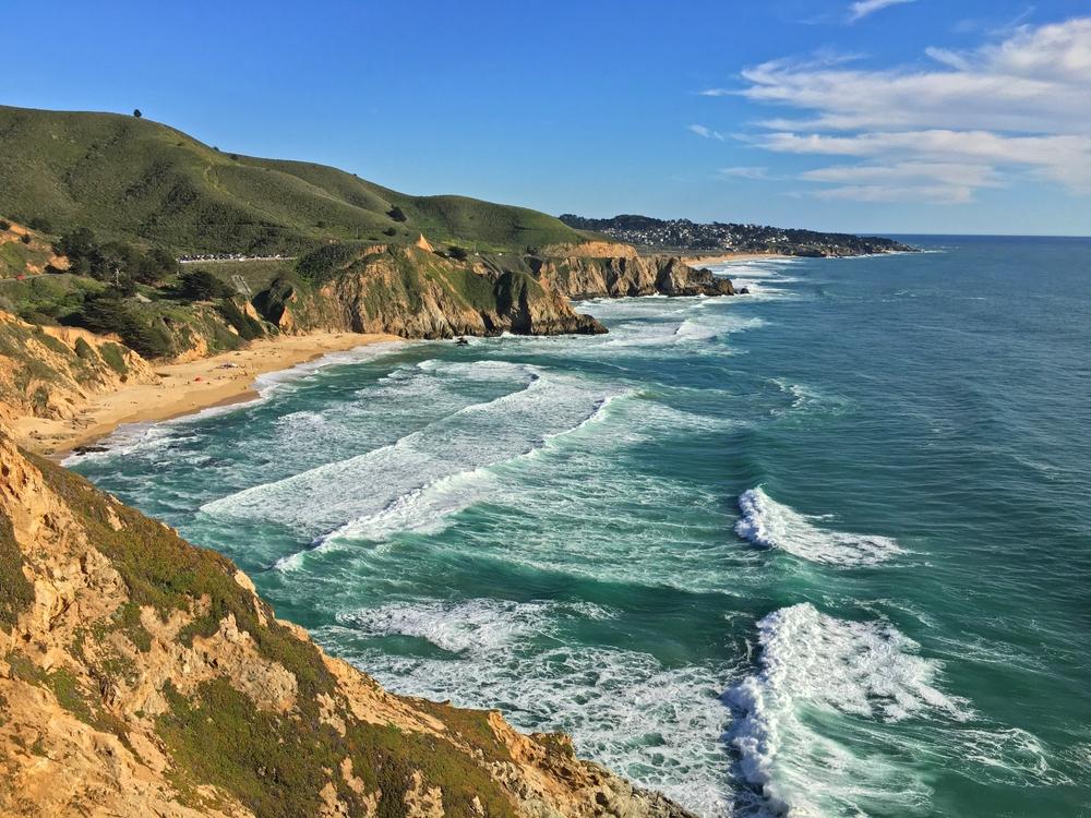
The Bay Area is home to some of the most picturesque vistas in California. What better way to experience and enjoy the beauty of the region than by exploring the easy-going coastal trails?
For a short yet unforgettable coastal hike near San Francisco, drive along the iconic Highway 1 to the Gray Whale Cove Trail Parking Lot in incredible Half Moon Bay, and then trek south on the Gray Whale Cove Trail. At the south end of the trail, make a right turn towards the Montara Mountain trailhead, and then turn right again to complete the loop. On your return, you’ll have a gorgeous view of Gray Whale Cove Beach. If you do the hike early in the day, you’ll be rewarded with a less-crowded trail, cool weather, and peaceful ocean panoramas.
Location: Los Osos
Hours: 6 a.m.–10 p.m.
Parking: Pecho Valley Road parking lot
Difficulty: Moderate
Distance: 6 miles
Time: 2–3 hours
Route: Out and back
Dogs allowed: No
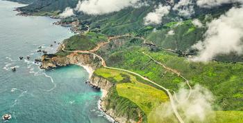
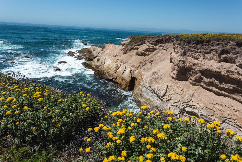
Known for spectacular hikes and lovely weather, the Central Coast is the place to be if you’re seeking a nice workout amid the area’s natural wonders. Hazard Peak Trail—no, it isn’t hazardous, it’s just named after the previous landowner, Alexander Hazard—is one of the best hiking trails in California. Located within Montaña de Oro State Park, near San Luis Obispo, this 950-foot climb leads to the highest summit within a 15-mile radius, so you can witness 360-degree views of the surrounding landscape and ocean.
Hazard Peak is a great trail to explore in the morning and early evening hours, when the weather is a bit cooler and the park is a little less crowded. To begin your hike, leave your car at the Pecho Valley Road parking lot, cross the road, and head south-east. You’ll pass by Morro Rock and Islay Creek Canyon, among other photo-worthy spots. Within a couple of hours or so, you’ll reach the peak. Enjoy the vistas while relaxing at one of the picnic tables or benches, before you begin your descent. Hazard Peak Trail is also a popular bike path, so regardless if you hike or bike, you can definitely make your way to the top.
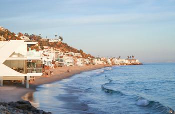
Location: Malibu
Hours: 8 a.m.–sunset
Parking: Parking is free at the Solstice Canyon Hiking Trail lot. It’s best to get here in the morning to avoid traffic and lack of parking spaces.
Difficulty: Easy
Distance: About 3 miles
Time: About 1.5 hours
Route: Out and back
Dogs allowed: Yes, but they must be kept on a leash that is not longer than six feet.
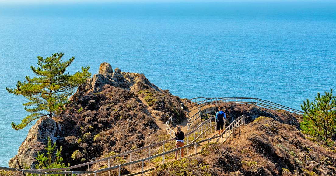
If you’re looking to make the most of your time in the Los Angeles area or seeking something to do during a weekend in Malibu, check out the Solstice Canyon Trail. This is a wonderful L.A. hike with gorgeous views, plus shelter from the sun. Even though the Solstice Canyon loop is about three miles long, you can always cut it shorter by taking the mile-long TRW Loop Trail.
Park your car at the lot, and start your hike up the Rising Sun Trail. As you traverse onward, the journey will become much quieter. Eventually, the Rising Sun Trail will take you to Robert’s Road. Here, you’ll discover the ruins of Roberts Ranch House, which was destroyed in 1982 by a fall wildfire. The house was commissioned in 1952 by Fred Roberts, who founded Roberts Public Market in Santa Monica. Though he insisted that an elaborate fire protection system be built within his residential tropical landscape, it couldn’t withstand the intensity of California wildfires.
As you near the small Solstice waterfall and admire the sweeping views, it’s understandable why Roberts desired a dream home amidst such a fiery landscape. After taking a breather and enjoying the panoramas of the Pacific stretching below you, head south to begin your descent. Just beware of snakes and reptiles, especially on a hot summer day.
Looking for more top hikes in California? Check out the Best Summer Hiking Trails in California and the 9 Off-the-Beaten-Path California Hiking Trails.

If you're looking for something fun to do, there are plenty of fun and free things to do in San Francisco, use our guide to help make plans.

Finding a wall isn't the problem. The problem is figuring out which gym fits your lifestyle the best.

All waterfall hikes in L.A. have one thing in common—unbeatable views of terrific cascades. Here are the ones to try next.

From undulating mountains, to coastal expanses, to verdant forests, here are some of the top spots for backpacking in California.

