5 Things to Do in Little Tokyo, California
Never been before? We’ll be your trustee Little Tokyo guide with a day’s worth of fun things to do in Little Tokyo.
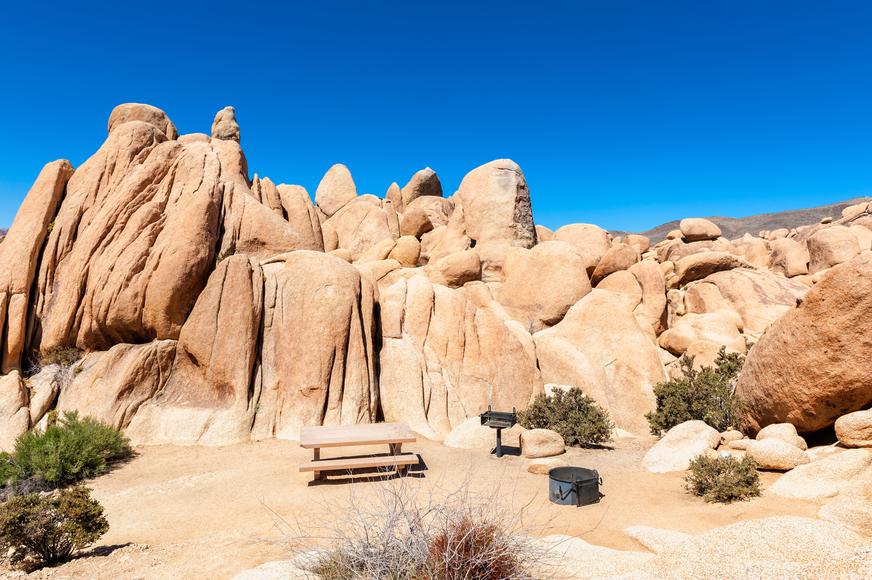
Whether you’re trekking in the woods, by the coast, or in the mountains, California offers the best national park hikes in the country. A day spent among the state’s natural wonders can revitalize your mind and refresh your soul. Take a break from the bustling city and surround yourself with diverse landscapes. Reconnect with nature as you discover the many national park hikes in the Golden State.
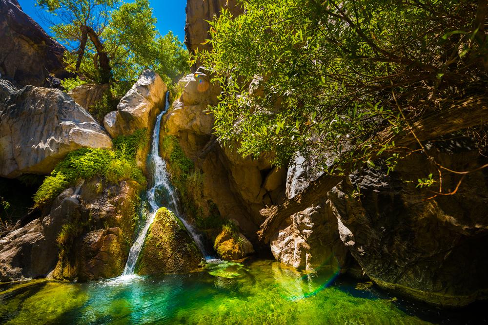
Location: Death Valley National Park, Darwin
Level of difficulty: Easy
Distance: 1.9 miles
Time: 55 minutes
Route: Out and back
Dogs allowed: No
Located in one of the driest and hottest national parks in the nation, the 25-foot Darwin Falls cascading down to this oasis is a breathtaking sight. The short national park hike takes you across little wooden bridges and lush greenery that abruptly thickens along the way. Though the waterfall is relatively small, the view is undoubtedly worth the trip.

Does your business rank among the best in California?
nominate a businessLearn more about our selection criteria and vetting process.
Location: Death Valley National Park, Death Valley
Level of difficulty: Moderate
Distance: 7.8 miles
Time: 4 hours
Route: Out and back
Dogs allowed: No
For a more challenging hike, trek the Wildrose Peak Trail. This national park hike starts from well-preserved charcoal kilns and rewards you with spectacular views of the valley at the end. Once you reach the top, you’ll find a box and a notebook, so make sure to leave your trace. There’s little to no shade along the way—don’t forget sunblock.
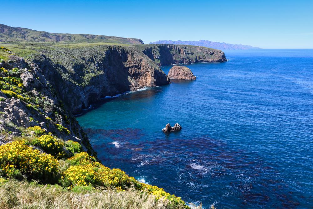
Location: Channel Islands National Park, Santa Barbara
Level of difficulty: Moderate
Distance: 4.2 miles
Time: 2 hours
Route: Loop
Dogs allowed: No
An exciting ferry ride takes you to Channel Islands National Park, where the Pelican Bay Trail awaits exploration. While the hike is rated moderate, make sure to wear sturdy shoes and bring lots of water. The trail has a fair bit of uphill and downhill but isn’t strenuous at all. With plenty of shady spots to take an occasional break, the ocean breeze cools you off on this national park hike.
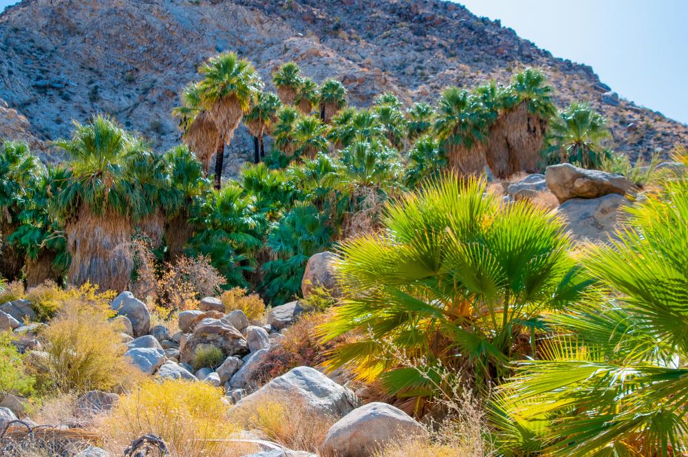
Location: Joshua Tree National Park, Twentynine Palms
Level of difficulty: Moderate
Distance: 3.1 miles
Time: 1 hour and 15 minutes
Route: Out and back
Dogs allowed: No
One of the best hikes in Joshua Tree is the Fortynine Palms Oasis Trail. Best visited from October until June, the desert park gets rather heated during the rest of the summer. The path to this palm-studded oasis is set through Joshua trees and cholla cacti, making it a unique destination.
Location: Joshua Tree National Park, Twentynine Palms
Level of difficulty: Easy
Distance: 1 mile
Time: 30 minutes
Route: Loop
Dogs allowed: No
This is the Joshua Tree hike that everyone can do—you get to see a little bit of everything the desert park has to offer. This easy and kid-friendly trail features kaleidoscopic wildflowers that elevate your journey. Have fun climbing up and down the wonderful rock formations. Take advantage of all the birdwatching spots you come across along the way.
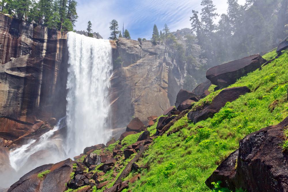
Location: Yosemite National Park, Yosemite Valley
Level of difficulty: Difficult
Distance: 8.8 miles
Time: 5 hours
Route: Loop
Dogs allowed: No
The Mist Trail takes you to two breathtaking waterfalls—a must-do whenever you’re in Yosemite National Park. This incredible Yosemite hike meanders through forests and past vibrant wildflowers. Since the path is quite rocky, make sure to have proper shoes on when climbing the steep initial ascent. Soak in the panoramic views while enjoying a quick break at the top of the falls.
Location: Yosemite National Park, Yosemite Valley
Level of difficulty: Hard
Distance: 15 miles
Time: 9 hours
Route: Out and back
Dogs allowed: No
Hiking the Half Dome Trail in Yosemite is not for the faint of heart. But if you have the guts, it’s one of the best hikes in Yosemite. While the trail is well-marked, it’s up to you to decide whether the panoramic vistas at the top are worth the spine-chilling cable ascend. The spectacular Half Dome Trail offers a mind-bending experience to nature lovers who seek a challenge.
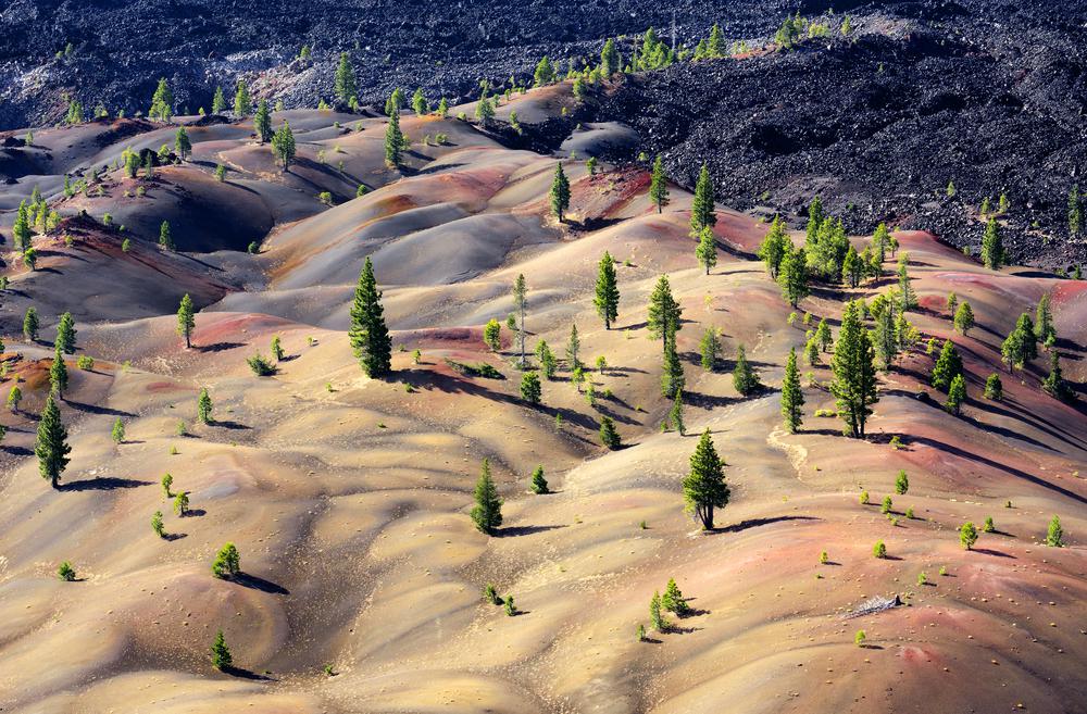
Location: Lassen Volcanic National Park, Old Station
Level of difficulty: Hard
Distance: 4 miles
Time: 2 hours and 40 minutes
Route: Loop
Dogs allowed: No
This picturesque Lassen Volcanic National Park hike is best visited from May till October—it’s less crowded throughout that period. The Cinder Cone Nature Trail is a prime destination to revel in Lassen’s volcanic landscape from above. Although the elevation gains of this trail are small, the hike itself is quite strenuous. Once you reach the top, you’ll see the reds and yellows of volcanic cones merge into compositional patterns.
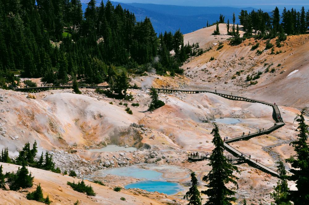
Location: Lassen Volcanic National Park, Mineral
Level of difficulty: Easy
Distance: 2.7 miles
Time: 1 hour
Route: Out and back
Dogs allowed: No
One of the best hikes in Lassen Volcanic National Park is the Bumpass Hell Trail—a gas-covered valley with geothermal lakes and puddles in all shades of blue. Whenever you plan a getaway to Lassen National Park, make room in your itinerary to explore the ins and outs of this hike.
The trail is named after Kendall Bumpass, a visitor who severely burnt his leg in a boiling pool when the soil broke under his feet. There’s a very low chance that the hike will be renamed in your honor, so it’s best not to step off the designated trails.
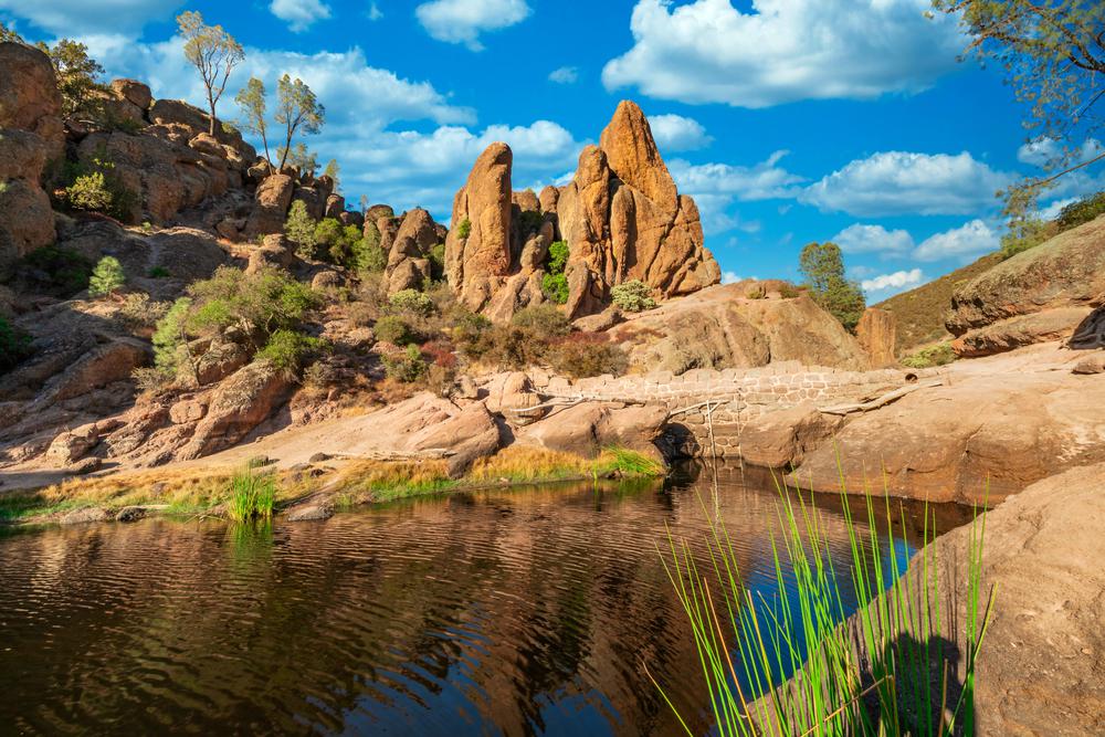
Location: Pinnacles National Park, Paicines
Level of difficulty: Moderate
Distance: 1.2 miles
Time: 30 minutes
Route: Out and back
Dogs allowed: No
This short hike through magical tree tunnels takes you downhill to the Bear Gulch Cave and a beautiful water reservoir. Wildflowers and panoramic views make your hike a lot more scenic. If you find yourself in Pinnacles National Park with your family, get everyone to hike this easy trail.
Location: Pinnacles National Park, Soledad
Level of difficulty: Hard
Distance: 5.4 miles
Time: 3 hours 15 minutes
Route: Loop
Dogs allowed: No
This trail is best hiked counterclockwise. You start with sweeping views of the Gulch and a delightful stroll through ferns and wildflowers. But, the hike gets gradually harder, so be prepared. Although the rock formations and expansive views are the highlights of this hike, viewing wildlife is just as exciting. Bring your binoculars to catch a glimpse of the rare California condors soaring in the sky.


Never been before? We’ll be your trustee Little Tokyo guide with a day’s worth of fun things to do in Little Tokyo.

People go on Memorial Day weekend getaways as an indirect celebration of life. How do you plan on celebrating the long weekend?
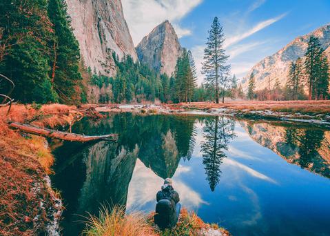
From undulating mountains, to coastal expanses, to verdant forests, here are some of the top spots for backpacking in California.
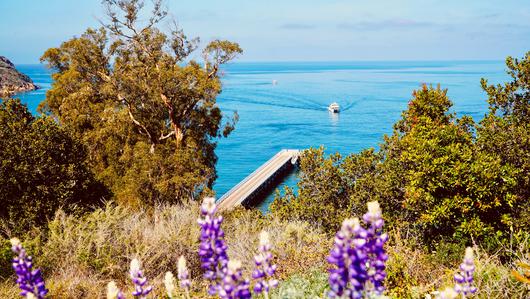
Settled off the California coast, the Channel Islands offer endless adventures. Here are the best things to do and how to get there.

