


Fun and Free Things to Do in San Francisco
If you're looking for something fun to do, there are plenty of fun and free things to do in San Francisco, use our guide to help make plans.

When you need to escape the fast-paced city and get out in nature, these are the best scenic hiking trails in L.A. to visit.

8 min read
June 26, 2020
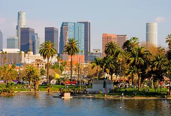
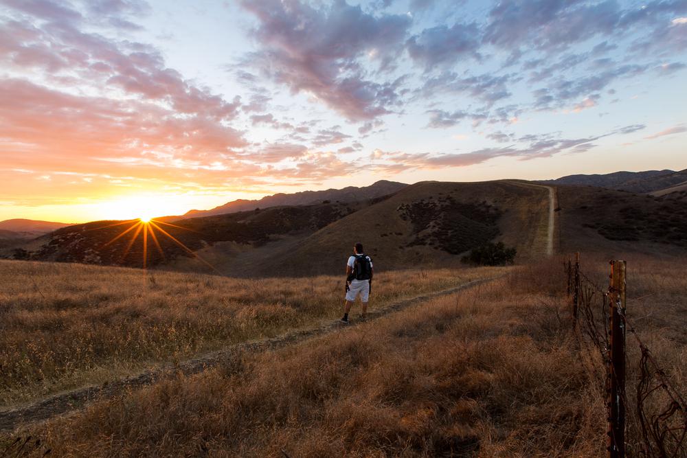
The City of Angels is home to numerous hiking trails with breathtaking views. The stunning hills and mountains will beckon you to nature and out of the city. Just glancing at the undulating peaks from your window is all it takes before you’re dreaming of the fresh air, the sound of birds chirping, and the feeling of the earth beneath your feet. Is there anything else in the world you would rather do than hit the trails on a beautiful day? If not, here are the best hikes in Los Angeles to add to your to-do list.

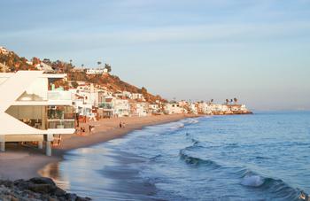
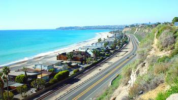
Location: 25623 Pacific Coast Highway, Malibu
Hours: 6 a.m. to 8 p.m.
Parking: There are plenty of free spots along the Pacific Coast Highway (PCH). Pay $5 (cash or check) in the trailhead parking lot.
Difficulty: Easy
Approximate distance: 2.5 miles
Estimated time: 75 minutes
Route: Loop
Dogs allowed: Yes
Located along the scenic PCH, Corral Canyon Park is an absolutely gorgeous place for a weekend hike in Malibu. The 100-acre expanse is the only Los Angeles County canyon that has remained undeveloped within the Santa Monica Mountains. As you make your way up into the Malibu Hills, you’ll discover coastal sage shrubs, oak trees, and wildflowers. On your way back down the trail, enjoy the extraordinary view of the ocean and beautiful L.A. beaches. Take your time hiking through this spectacular terrain and experience the beauty of nature before finding your way back to the city.
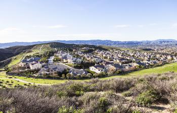
Location: East Loma Alta Drive (at Lake Avenue), Altadena
Hours: Dawn to dusk
Parking: There’s free street parking by the entrance of the trail.
Difficulty: Challenging
Approximate distance: 5.4 miles
Estimated time: 3 hours
Route: Out and back
Dogs allowed: Yes, but they must be on a leash.
Rated one of the “10 Great North American Hikes” by USA Today, this trail provides a great outdoor workout and phenomenal views of downtown L.A., Pasadena, and the San Gabriel Valley. You’ll start the hike by scaling a canyon wall, and 15 minutes later, you’ll find yourself climbing a mountain face. Once you reach the top of Echo Mountain, you’ll discover the ruins of an old alpine resort and a train station, which was originally built in 1894 to connect the mountaintop to Pasadena.
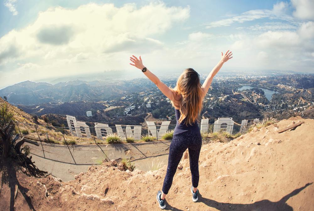
Location: 2840 West Observatory Avenue, Griffith Park
Hours: 5:00 a.m.–10:30 p.m. Hiking trails close at sunset.
Parking: There’s a parking lot next to the Griffith Observatory. It costs $8–$10 per hour to park. If it’s packed, look for street parking along Observatory Avenue.
Difficulty: Easy
Approximate distance: 3 miles
Estimated time: 2 hours
Route: Loop
Dogs allowed: Yes
Less than three miles long, this easy Hollywood hike will lead you to the Mount Hollywood summit—the highest peak in Griffith Park, which spans 4,000-plus acres and is one of the largest urban parks in North America. On a smog-free day, you’ll enjoy a 360-degree view of the Pacific Ocean, the Verdugo Mountains, the L.A. skyline, and everything in between.
About 15 minutes into the hike, the Hollywood Sign will appear on your left. If you're feeling touristy, pose for some cute Instagram pics before continuing your journey. Forty minutes later, you’ll reach the summit. Enjoy the breathtaking views of the L.A. basin, the edge of the San Fernando Valley, and the Griffith Observatory. If you are into photography, this priceless glamour shot is for you.
Location: 27200 Winding Way, Malibu
Hours: Dawn to dusk
Parking: Parking is available in the lot on Winding Way East.
Difficulty: Moderate
Approximate distance: 3.8 miles
Estimated time: 2 hours
Route: Out and back
Dogs allowed: Yes
One of the best hikes in Malibu, this trail leads to Escondido Falls, a two-tiered, 150-foot cascade. Pouring down moss-covered limestone rocks, this picturesque waterfall is the perfect way to cool down on a hot summer day. You can wade into the pool or stand behind the waterfall and feel the cool drops of water on your skin as it refreshes and rejuvenates you.
Start your hike on Winding Way East; as you make your way uphill, you’ll pass beautiful ocean-view estates. Approximately 0.5 miles into your hike, you’ll come across the clearly marked Escondido Canyon Trail. Be prepared to get wet and rock hop as you jump across streams along the way.
Since the waterfall is two-tiered, you’ll reach the 50-foot Lower Escondido Falls first. This is a great place to relax, drink some water, and do a bit of stretching before continuing on. If you’ve had enough hiking for the day, you can always head back from here. But if you’re feeling ambitious, continue following the official route—just note that it’s a steep climb to Upper Escondido Falls. The rocks are slippery, too, but there’s a guide rope in place for your safety. You’ll traipse over boulders and go under part of the lower falls until you reach the magnificent tiered upper falls.
Location: 20828 Entrada Road, Topanga
Hours: 8 a.m. to sunset
Parking: All-day parking is available in the Topanga State Park lot for $10.
Difficulty: Moderate
Approximate distance: 6.9 miles
Estimated time: 3–3.5 hours
Route: Out and back
Dogs allowed: No
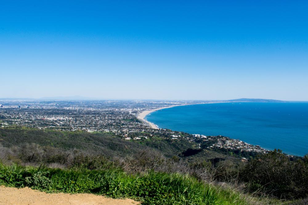
The gorgeous Topanga State Park in Southern California is where this trek begins. Proceed on the unpaved path and continue past a field on your left. Hike on for a breathtaking vista of magnificent highland residences. At that point, you'll see magnificent green mountains and neighborhoods to your left, and a red stone ridge to your right. Trek upward until you get to a split in the trail—take a right to go to the Parker Mesa Overlook. With two benches and a great view of the beach, downtown Los Angeles, and the San Gabriel Mountains, it's a single-track. On a clear day, Catalina Island will also be visible. To go back to the trail's starting point, follow the same route back.
Location: 510 Los Liones Drive, Pacific Palisades
Hours: 8 a.m.–8 p.m.
Parking: A parking lot is located at the trailhead. There are also several small parking lots nearby as well as street parking (park legally to avoid a ticket).
Difficulty: Moderate
Approximate distance: 7 miles
Estimated time: 2–3 hours
Route: Out and back
Dogs allowed: No
Hop off the PCH at Sunset Boulevard, then turn left onto Los Liones Drive. Here, you’ll find multiple trailheads to the east, but you’ll want to take the Los Leones Day Use Trail to the East Topanga Fire Road. You’ll enjoy dazzling views of the Pacific Ocean and weave through lush vegetation as you continue to hike uphill. Once you’ve reached the clearing that overlooks the Pacific Palisades and Santa Monica, you’ve come to the end of the trail. When you’re ready, retrace your steps back to the parking lot.

Location: 2315 Kuehner Drive, Simi Valley
Hours: Dawn to dusk
Parking: Parking is available in the dirt lot on the northern side of the 118, on top of the on- and off-ramp. On the opposite side of the freeway, overflow parking is also available.
Difficulty: Moderate
Approximate distance: 4.75 miles
Estimated time: 2–3 hours
Route: Out and back
Dogs allowed: Yes, but they must be kept on a leash.
This hike begins on a desolate, boulder-lined path, rising above a small parking lot north of the 118. The scenery is minimal, but don’t be discouraged. Once you reach the peak, the mesmerizing view of the surrounding Santa Susana Mountains, San Fernando Valley, and the distant Santa Monica Mountains will definitely be worth the wait.
Location: 3110 Beaudry Terrace, Glendale
Hours: Dawn to dusk
Parking: Park for free on the side of the road.
Difficulty: Moderate
Approximate distance: 6.15 miles
Estimated time: 3 hours
Route: Out and back
Dogs allowed: Yes, but they must be on a leash.
Starting off at the intersection of Beaudry Drive and Beaudry Terrace in Glendale, you’ll pass a yellow gate before reaching a dirt road. Hike up this road and take a left when you reach Beaudry South Motorway. The San Gabriel Mountains and the downtown L.A. skyline will soon appear on your left. As you continue uphill, you’ll be able to see the entire San Fernando Valley and occasionally spot lizards, hawks, and dragonflies. You can either go back down the way you came or take the paved road.
Location: 9000 West Pacific Coast Highway, Malibu
Hours: 8 a.m.–10 p.m.
Parking: Buy a day pass for $8 at the electric meter. Display the pass on your dashboard.
Difficulty: Moderate
Approximate distance: 7.1 miles
Estimated time: 3.5 hours
Route: Out and back
Dogs allowed: No
Start your Point Mugu hike at the Ray Miller Trailhead parking lot. Follow the single-track trail to the end of the lot. You’ll then climb past a top California campground (perfect for an extended trip) and up into the Santa Monica Mountains. Switchbacks will take you high up into the mountains, with occasional views of the rolling waves. On your journey, you’ll encounter skittering lizards, succulents, cacti, and a lot of that invigorating California sun.
The trail eventually reaches a ridge, where you’ll connect with a road and take a left. You’ll then see a gateway leading to the wild, rugged backcountry terrain (the 3.65-mile mark), so turn around and head back to the parking lot. Only the bold and the brazen will continue on into the uncharted territory.
Location: Westridge Road and West Mandeville Fire Road, Los Angeles
Hours: Dawn to dusk
Parking: There’s parking available at the trailhead and along the road outside of the park.
Difficulty: Moderate
Approximate distance: 7 miles
Estimated time: 3.5 hours
Route: Out and back
Dog allowed: Yes
Excitement is in the air as you trek to the magnificent San Vicente Mountain from the stunning twin valleys. You'll pass the famous Getty Center and the stunning multi-million dollar houses on Westridge Road en route to the trailhead. When you get to a parking lot, pull over, park, and go up Mandeville Road, which weaves its way up above the Mandeville and Sullivan Canyons. You will view the beach and the Santa Monica Mountains along the route. There are other, more difficult pathways that wind across the hills in a crisscross pattern.
The walk comes to a finish at the historic Nike Station, a former military radar station that now offers breathtaking views over the valley ridge and the city. On a clear day, you may even be able to view Catalina Island, the San Gabriel Mountains, and the San Fernando Valley if you are fortunate enough to go hiking.

If you're looking for something fun to do, there are plenty of fun and free things to do in San Francisco, use our guide to help make plans.

Finding a wall isn't the problem. The problem is figuring out which gym fits your lifestyle the best.

The leagues, the stadiums, how to watch, how to get tickets. Consider this your starting point.
What are you waiting for? Pack up your camping essentials and head over to the best campgrounds California has to offer.

