


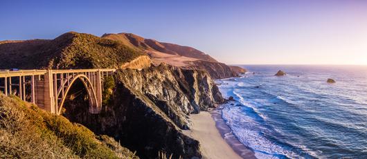

11 Must-Try Waterfall Hikes in Los Angeles
All waterfall hikes in L.A. have one thing in common—unbeatable views of terrific cascades. Here are the ones to try next.
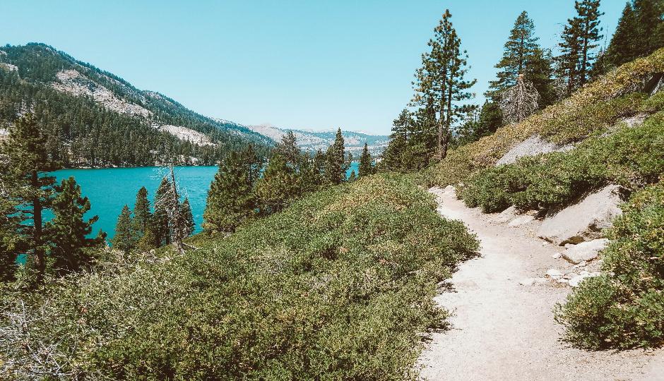
Here's your guide to hiking the scenic and challenging Tahoe Rim Trail, from Kingsbury South Connector to Brockway Summit.
Continued from Traversing Trails: Preparing for the Tahoe Rim Trail
Now that you’ve planned your trip along the Tahoe Rim Trail, it’s time to get hiking. While you can go in either direction, most thru-hikers choose to travel clockwise, so that is the route we will outline.
The journey will begin at Kingsbury South Connector and end at Brockway Summit, right before the trail leaves California, so make sure to set up transportation at both ends of the trail. Before beginning this long excursion, check out a few of the other South Lake Tahoe trails, have a meal at one of the local eateries, and enjoy the comforts of a hotel to reward yourself for taking the leap into the unknown.

Length: 22.6 miles
Rated: Difficult
Best hiked: May–October
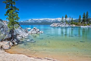
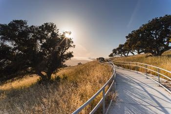
Nestled against the stateline, Kingsbury South Connector is where the trek begins. The winding trail borders the Carson Range, revealing everything from open grasslands to densely packed forests of rare red-fir and white pine trees (which have evaded the logging industry, thanks to their remote location). You’ll walk along open ridgelines and rocky passes as you make your way up the incline, but your efforts will be rewarded with incredible views of the Carson Valley.
After taking in the sights, hike on to see one of the most spectacular hidden bodies of water: Star Lake. Lined with hemlock trees and situated amongst three of the highest peaks in the Lake Tahoe Basin—the tallest being Freel Peak at 10,880-plus feet, with Jobs Peak and Jobs Sister coming in close behind—Star Lake serves as the perfect location for camping and trout fishing.
Once you arrive at Star Lake, you’ll have reached the halfway point along this trail. When you continue on, be prepared for a rugged hiking experience, as granite passes and ancient junipers cross your path and open up to sweeping vistas of Lake Tahoe. You’ll know this difficult section is almost over when the trail starts going downhill. Much like the beginning of the hike, the scenery turns into a hodgepodge of flower-dotted meadows and dense pine forests. The end is near when you see the trail marker for Grass Lake—an alternate path that shortens the journey by about half a mile—which is located just two miles from Big Meadow.
Reliable water sources: Cold Creek and Grass Lake Creek are great sources year-round.
Seasonal water sources: In the spring, streams border Freel Meadows and the area just past Freel Peak.
Water detours: Willow Creek requires a two-mile detour at Armstrong Pass, and Saxon Creek requires a one-mile detour from Saxon Creek Trail to Tucker Flat.
*Note: The eight-mile section north of Star Lake does not have any available water sources, and the water of East Peak Lake is non-consumable.

Length: 18.3 miles
Rated: Moderate
Best hiked: May–November
The next portion of the Tahoe Rim Trail (TRT) passes through meadows and forests, meanders around lakes and streams, and meets up with the Pacific Crest Trail (PCT).
The excursion continues south from the Big Meadow trailhead, crosses Big Meadow Creek, and presents a rolling landscape of grasslands and conifers. About three miles into the hike, Round Lake provides a pleasant escape from the sun’s rays; the lake is tucked beneath cliffs that provide plenty of shade. Carry on and you will find that the TRT merges with the PCT about two miles past Round Lake, when the path begins to loop back to the northwest. Here, the trail runs alongside the Upper Truckee River, providing cooler temperatures as you admire the seasonal wildflowers along Meiss Meadows.
About two miles farther, the trail passes Showers Lake and its granite-covered shores before leading to a rocky crater, where seasonal creeks weave themselves between the open pastures and rugged cliffs. Beyond this point, the terrain is much drier and rougher. But the difficult miles are interspersed with stunning views of the valley below, and the trail eventually takes a long, steep decline over a granite ridge and smooths out. Once you’ve made it this far, the end is near. All you have to do is hike by a small stream surrounded by ferns and other greenery before conquering the final incline to Echo Summit Trailhead.
Reliable water sources: Big Meadow Creek (located half a mile south of the Big Meadow trailhead), Round Lake, Upper Truckee River in Meiss Meadows, Showers Lake, and Echo Lake all offer drinking water year-round, though the water at Echo Lake can be hard to access.
Seasonal water sources: In certain months, water can be found between Bryan Meadow and Benwood Meadow.

Length: 32.9 miles
Rated: Difficult
Best hiked: May–October
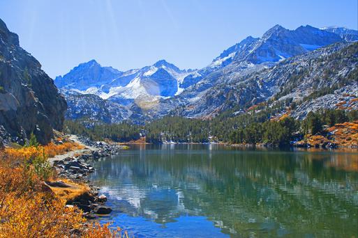
Between Echo Lake and Barker Pass, along the merged PCT and TRT, lie some of the most incredible and undisturbed forested areas in California. With 63,960 acres of alpine and subalpine forests, granite peaks, and lakes and valleys formed by glaciers long ago, the Desolation Wilderness is a sanctuary like nowhere else in the state.
The trail wanders northwest along Lower Echo Lake and up to the eastern banks of Lake Aloha, leading hikers past trickling creeks, pine forests, and floral plains. Allow yourself to camp along the shores of Lake Aloha after the beautiful six-and-a-half-mile hike to truly take in the surrounding natural wonders. Go for a dip in the lake, admire the clear waters, and prepare your body for the steep terrain ahead.
From here, the trail steadily inclines over Dicks Pass, where beautiful vistas of the Tahoe Basin can be viewed. There is about a 10-mile span between Lake Aloha and Middle Velma Lake—the landmark indicating a more forested, dry terrain than the previous section. Dense conifer lands cuddle up to small flower-filled fields while a slight undulation takes over the flat trails. Before you know it, you’ll find yourself leaving the Desolation Wilderness, so take your time to enjoy the expanse while you can.
Richardson Lake greets you on the right-hand side of the trail about eight miles after Middle Velma Lake. Only six miles lie ahead of you once you’ve reached this point. The last section features dirt roads that cross through forested areas and lead past quaint meadows and small creeks as the trail slopes up toward Barker Pass.
Reliable water sources: Water can typically be found at Lake Aloha, Heather Lake, Susie Lake, Gilmore Lake, Fontanillis Lake, and Middle Velma Lake (all in the Desolation Wilderness) as well as at a creek two miles south of Barker Pass.
Seasonal water sources: Numerous sources are located throughout the northern end of the Desolation Wilderness.
*Note: Stock up on water whenever you can; the water in this region can freeze at any time of the year, thanks to the snow that lingers even during the summer months.

Length: 16.6 miles
Rated: Moderate
Best hiked: July–October
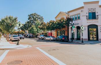
By the time you reach Barker Pass, the majority of the TRT will already be behind you, with just under 37 miles left to go. This portion of the journey will see the split of the TRT and the PCT, and hikers have the opportunity to see civilization for the first time along the trail in Tahoe City.
After conquering a difficult segment of the trail, you’ll find the following portion pleasantly gentle as the path meanders around volcanic peaks, traverses expansive rolling meadows, and steadily ascends toward Twin Peaks—where the PCT separates from the TRT. While the PCT heads west toward the Tahoe National Forest, the TRT winds its way east toward Lake Tahoe. Soon after the split, the trail takes a drastic descent into the heavily wooded Ward Canyon. While there is a stark lack of signs after you pass the bridge, don’t worry: You are on the right track. The TRT follows the fire access road until the trail crosses Ward Creek Road, where you can spot a TRT sign hiding behind one of the trees.
Pines and aspens tantalize your senses with their fragrant scents, while the soothing sounds of a small waterfall beg for your attention. Ward Creek keeps you company inside the latter end of the canyon before you make your ascent. Soon, you will come upon a three-way split in the trail, and you will need to make a left toward Page Meadow, where vividly colored wildflowers will welcome you. After passing through, take another left at the fork in the road to reenter the shaded forest areas. You’ll eventually arrive at the banks of the Truckee River and the parking lot just past the trailhead.
Reliable water sources: Ward Creek and the Truckee River (situated half a mile south of Tahoe City) offer water year-round.
Seasonal water sources: A small stream flows north of Barker Pass.

Length: 20.2 miles
Rated: Difficult
Best hiked: June–October
You’ve arrived at Tahoe City and are nearly finished with the trek. You deserve a break, so spend a day or two splashing in the waters of Lake Tahoe and enjoying the city amenities before completing the final leg.
The foliage changes a bit, featuring fir, cedar, and aspen groves next to rolling hills of manzanita as the trail consistently treds upward. Additional trails open up alongside the TRT, offering the chance to view cinder cones and ancient lava flows before you reach the 10-mile mark. At this point, the trail flattens out as it reenters the densely shaded forest before passing the Lava Cliffs Overlook, where you’ll discover brilliant views of Lake Tahoe.
Soon, you will find yourself descending into the shallow Watson Lake, which makes for a perfect camping spot. Wildflowers surround the shimmering waters, presenting a photo op and an ideal place for a picnic as you reflect on your time along the TRT. With only six more miles to go, the next morning will undoubtedly allow you to find your way to Brockway Summit, marking the end of the California segment of the trail. Enjoy the rolling hills and the merging of meadows and forests until the path takes you to State Route 267 and the Brockway Summit Trailhead.
Reliable water sources: Find ample water at Watson Lake, Watson Creek, and Burton Creek.
Seasonal water sources: Water sources are occasionally available just north of Tahoe City.

All waterfall hikes in L.A. have one thing in common—unbeatable views of terrific cascades. Here are the ones to try next.
Discover how to track and prepare for meteor showers in California for a spectacular celestial viewing experience.
Ditch the busy Spring Break crowds and check out these fantastic, underrated spring travel destinations in California.
Gaze into California's amazing sunsets with our exploration of the top sunrise spots in California.

