


Fun and Free Things to Do in San Francisco
If you're looking for something fun to do, there are plenty of fun and free things to do in San Francisco, use our guide to help make plans.

Whether you're looking for a dog-friendly trail or a family-friendly outdoor excursion, here are the best East Bay hikes.
Settled in the San Francisco Bay Area, Contra Costa County is home to some of the best panoramic views, family-friendly communities, and East Bay trails. Whether you're looking for something to do with the kids, in need of an invigorating stroll to refresh your spirits, or wanting to explore a new region, Contra Costa’s hiking trails have you covered. So throw on your hiking boots, fill up your water pack, and grab your sunglasses as you prepare to hit the trail. These are the seven best East Bay hikes you do not want to miss.
Location: Walnut Creek and Lafayette
Acres: 202
Hours: Sunrise to sunset
Getting here: Take the north Pleasant Hill Road exit from Highway 24. Turn right on Stanley Boulevard and continue on as it turns into Springbrook Road. Turn left on Bacon Way, again on Bacon Court, and once more on Peaceful Lane. At the end of the lane, you’ll find the gate to Acalanes Ridge.
Fees: None
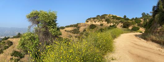
Spend the day hiking the myriad trails of Acalanes Ridge before trekking up to the 781-foot summit to see sweeping views of the surrounding area. From the top, Briones Regional Park, the Carquinez Strait, Las Trampas Regional Park, Livermore foothills, Mount Diablo, Oakland Hills, and Suisun Bay are all visible. For an extended adventure, take the Briones to Mt. Diablo Regional Trail to meet up with Briones Regional Park or Mount Diablo State Park.
Location: Lafayette and Martinez
Acres: 6,255
Hours: 8 a.m. to 5 p.m., with extended hours February through October
Getting here: Take the Orinda/Camino Pablo exit toward Richmond on Highway 24. Turn right on Bear Creek Road, and drive 5 miles until you see the Bear Creek Staging Area on the right.
Fees: Parking – $3 per vehicle (when kiosk is attended). Dogs – $2 per dog (does not apply to guide or service dogs).
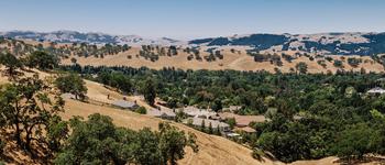
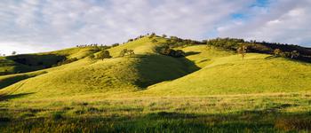
Tucked near the suburban metropolises of Concord, Lafayette, Martinez, Pleasant Hill, and Walnut Creek, Briones Regional Park is an idyllic escape. Admire the green rolling hills, shaded canyons, and unobstructed views as you traverse the landscape and make your way to Briones Peak. With clear skies, you can see Mount Diablo, the Sacramento River, Mount Tamalpais, and Las Trampas Regional Wilderness from the top of the peak. Enjoy the shade from local oak trees and watch for wildlife, including black-tailed deer, red-tailed hawks, and coyotes. Take in the beauty of the area as you trek past expansive grasslands and fields of wildflowers.
Location: Lafayette
Acres: 928
Hours: 6:30 a.m. to 5:30 p.m., with extended hours February through November
Getting here: Take exit 11 off Highway 24, and continue onto El Nido Ranch Road until it merges with Mount Diablo Boulevard. Take the first right, and continue along the road until you reach the Lafayette Reservoir parking lot.
Fees: Parking – $1.50 per hour.
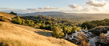
Though the Lafayette Reservoir Recreation Area offers some of the shorter trails in Contra Costa County, it’s also home to the most popular, family- and dog-friendly hikes in the East Bay. With two main trails available, visitors can choose their own adventure. Opt for the short 2.7-mile Lakeside Nature Trail, or extend your journey with the 4.7-mile Rim Trail for a perfect afternoon activity in Lafayette.
Location: San Ramon
Acres: 5,778
Hours: 8 a.m. to 5:30 p.m., with extended hours March through October.
Getting here: Take the Crow Canyon Road exit off I-680, and turn north onto Bollinger Canyon Road. Turn north once more onto Bollinger Canyon Road, driving until you come across the roadside parking spaces on the right.
Fees: None
Experience two of the Bay Area’s major fault lines as you explore the park’s fascinating geological formations. Hike throughout the thousands of acres at Las Trampas Wilderness Regional Preserve to escape the urban environment and appreciate the sunny days ahead. Pack a picnic and plenty of water to make the most of your excursion.
Location: Walnut Creek and Concord
Acres: 1,226
Hours: 5 a.m. to 10 p.m.
Getting here: Cruise along Ygnacio Valley Road to Montecito Drive, and take the first right into the parking lot.
Fees: None
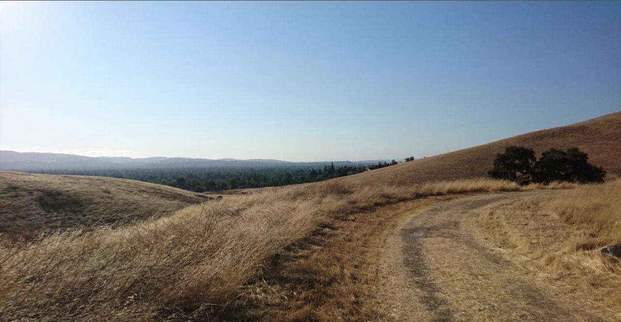
Complete with 25 miles of trails spread across 1,226 acres, Lime Ridge Open Space is one of the most unique and beautiful hiking trails in the East Bay and is home to some of Walnut Creek’s last chaparral, among other local foliage and wildlife. Named for the limestone found nearby, the ridge leads to Mount Diablo and makes for scenic hikes year-round. But in the warmer months, bring a hat and lots of water, as these trails are frequently devoid of shade.
Acres: 20,000
Hours: 8 a.m. to sunset
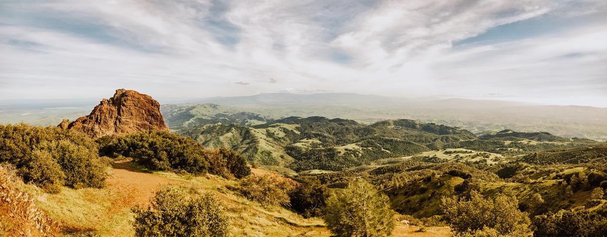
Mount Diablo State Park holds several of the most iconic East Bay hiking trails, including the Mount Diablo Summit Trail, which offers vistas of 40 California counties on a clear day. The park provides endless pathways, including the popular Falls Trail Loop and Summit Trail, where hikers can see for nearly 200 miles. You can access the park from numerous staging areas, including the following:
Macedo Ranch Staging Area
Location: 3756 Green Valley Road, Alamo (no vehicle access to the Summit)
Fees: Parking – $6
Payments accepted: Cash or check
Mitchell Canyon Staging Area
Location: 96 Mitchell Canyon Road, Clayton (no vehicle access to the Summit)
Fees: Parking – $6
Payments accepted: Cash or check
North Gate Road Entrance
Location: 1300 North Gate Road, Walnut Creek
Fees: Parking – $10
Payments accepted: Cash or check (anytime) and debit or credit card (when kiosk staffed)
South Gate Road Entrance
Location: 2675 Mt. Diablo Scenic Boulevard, Blackhawk
Fees: Parking – $10
Payment accepted: Cash or check (anytime) and debit or credit card (when kiosk staffed)
Location: Moraga
Acres: 250
Hours: Sunrise to sunset
Getting here: Head south on Moraga Way from downtown Lafayette, and turn right onto Donald Drive.
Fees: None
Located between Orinda and Moraga, this 250-acre open space is an ideal spot to take your pup. Complete with picturesque grazing cattle, off-leash areas for Fido to run free, and 3 miles of scenic views, Mulholland Ridge Open Space is the place to enjoy a laid-back hike as you work your way up to Mount Diablo.
Seeking even more adventures? Check out Antioch’s Black Diamond Mines Regional Preserve, San Ramon’s Bishop Ranch Open Space Regional Preserve, and Walnut Creek’s Shell Ridge Open Space.
Share your favorite East Bay hikes in the comments below.

If you're looking for something fun to do, there are plenty of fun and free things to do in San Francisco, use our guide to help make plans.

Finding a wall isn't the problem. The problem is figuring out which gym fits your lifestyle the best.

The leagues, the stadiums, how to watch, how to get tickets. Consider this your starting point.

What are you waiting for? Pack up your camping essentials and head over to the best campgrounds California has to offer.

