


11 Must-Try Waterfall Hikes in Los Angeles
All waterfall hikes in L.A. have one thing in common—unbeatable views of terrific cascades. Here are the ones to try next.
Here are the 5 best Bay Area hikes offering beautiful mountaintop views, unique scenery, and a great workout.
5 min read
November 23, 2022
Disclaimer: California.com is not receiving any type of compensation for reviewing any of the products or services mentioned in this article.
Often when talking about the San Francisco Bay Area, the engraved image of the bustling city pops up. While trolley cars, tech startups, and foggy skylines accurately depict the region’s vibes, the lesser-mentioned yet wide variety of Bay Area hikes are equally awe-inspiring. Though there are too many trail miles to trek in one lifetime, some of these are definitely worth visiting in this span.
Location: Hog Back Rd, Mill Valley, CA
Parking: Paid at Mount Tampalais Watershed
Difficulty: Hard
Distance: 7.4 miles
Duration: 3 hrs 45 min
Elevation: 1,568.24 ft
Route: Out and back
Dogs: Dogs allowed
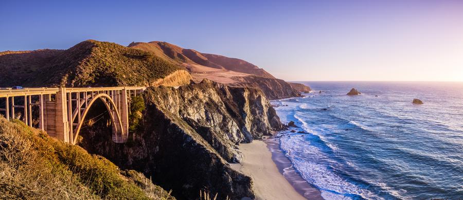
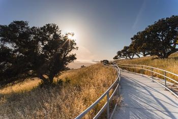
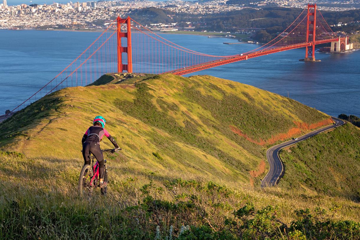
Situated north of the Golden Gate in San Francisco, Mount Tam (as the locals call it) is a Bay Area hiker’s favorite. Although there are more than a few ways to reach the top of this peak, the Matt Davis and Railroad Grade Trailheads are the most recommended. It runs for almost seven and a half miles, gaining 1,500 feet in elevation along the path. Acknowledging the fact that it's a reasonably challenging path, it is well worth the effort. Once you reach the summit, the panoramic views of the surrounding region will take your breath away. For more spectacular vistas, you can also visit the Fire Lookout perched atop the peak of Mount Tam. Before heading back down from this epic Bay Area hike, it can be especially rewarding to settle in for a picnic with gorgeous backdrops.
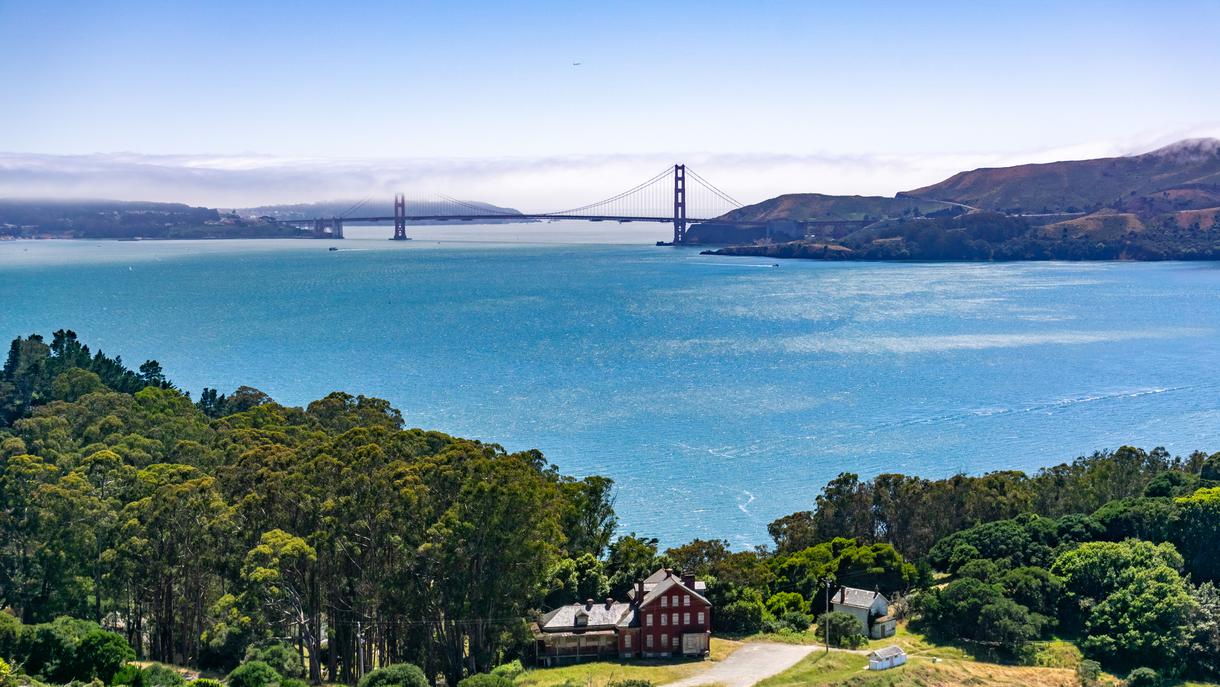
Location: Angel Island Ferry Terminal, Tiburon, CA
Difficulty: Easy
Distance: 6.2 miles
Duration: 2h 17 min
Elevation: 495.4 ft
Route: Loop
Dogs: Not Allowed
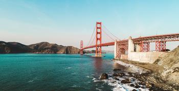
Angel Island is a San Francisco icon with a beautiful state park offering a myriad of the best Bay Area hikes. This beach hike offers the most picturesque views of the mountains and the Bay Area beaches. The loop trail is an ideal destination for urbanites seeking a relaxing day out in nature; it starts near Belvedere Tiburon and takes roughly two hours to complete. One of the more famous routes is the Perimeter Trail, a 6.2-mile loop that wraps around the entire island. So take time to appreciate stunning views of the San Francisco Bay, Golden Gate Bridge, and city skyline throughout your hike. The trail is paved and not too challenging, but it does contain several steep hills and gains around 500 feet in elevation. Enjoy this vibrant experience with fellow hikers heading to the beach, mountain bikers, or birdwatchers. You can enjoy a leisurely lunch at The Angel Island Café after trekking the most scenic of the Bay Area hikes, and then hop on the ferry when you’re ready to head back to the city.
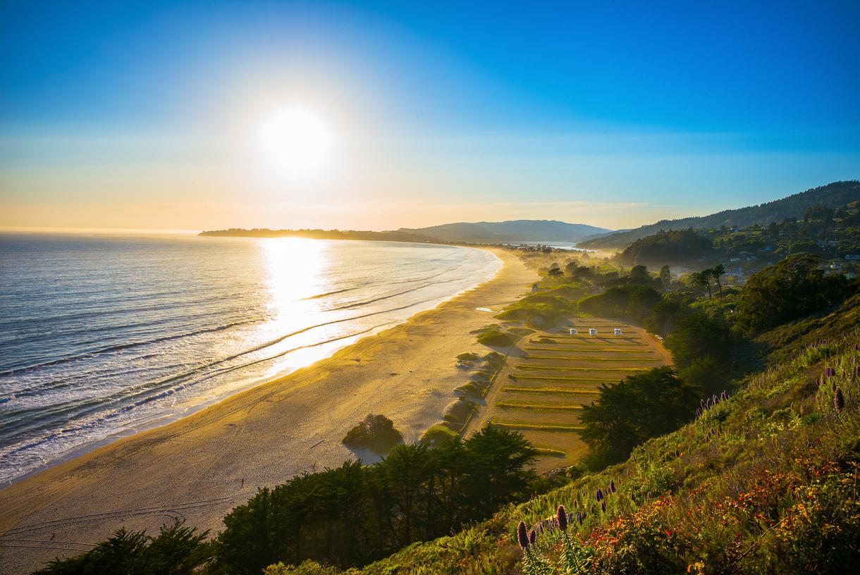
Location: Dipsea Trail & Ben Johnson Trail, California
Parking: Stinson Beach parking lot
Difficulty: Hard
Distance: 9.8 miles
Duration: 5 h 40 min
Elevation: 2,696.8 ft
Route: Loop
Dogs: Not allowed
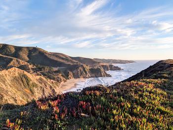
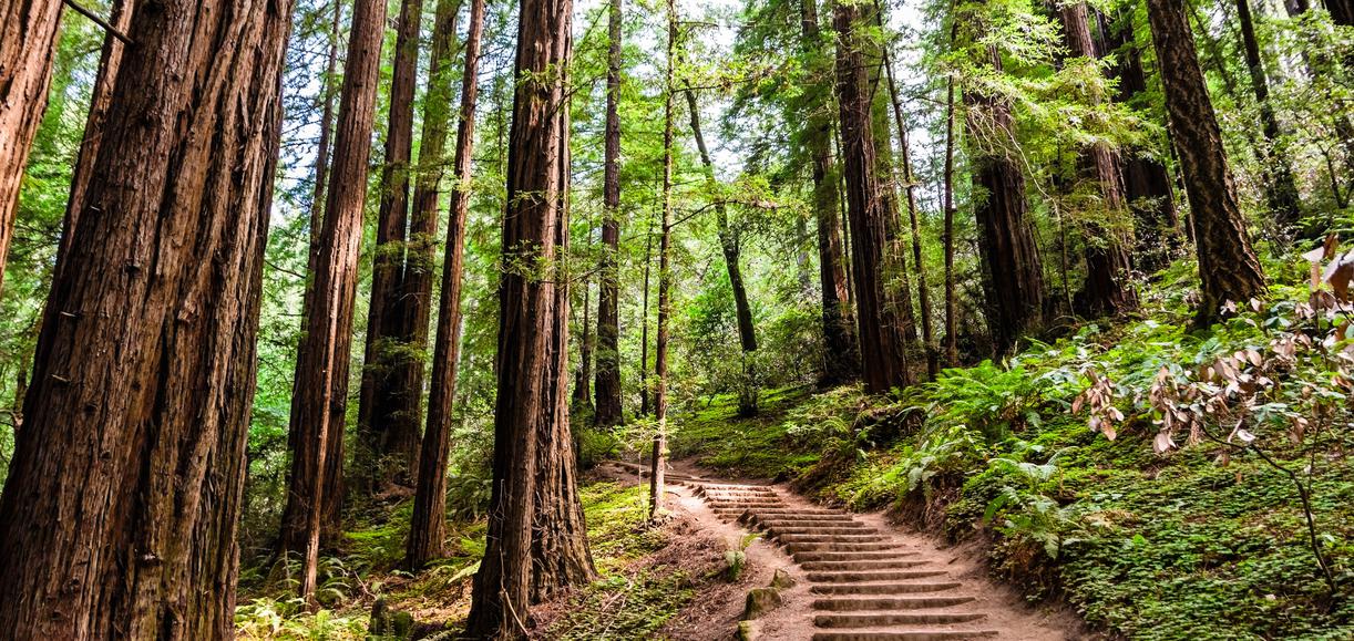
Of the many fun things to do in the Bay Area hiking can definitely make the list. For this gem, starting out at Stinson Beach, take the Dipsea Trail tucked within Muir Woods National Monument. This trail is one of the hardest, but most famous waterfall hikes in the Bay Area. The trek stretches across the Panoramic Highway before dipping into the famed Muir Woods National Monument. From there, take the Ben Johnson trail through a dense, fragrant forest rich with California wildflowers and fauna. Enjoy the loop as you eventually find yourself walking on a grassy meadow overlooking Stinson Beach. Make sure you have your camera charged and your lens in place to capture all the details of this majestic hike leading hikers past rushing waterfalls, sweeping ocean views, and the famous 10-foot-high ladder at Stinson Beach. The 10-mile route is perfect for exploring year-round. If you’re in it for the meal afterwards, then you can look forward to a lovely lunch at either The Siren Canteen or Parkside Cafe in downtown Stinson Beach.
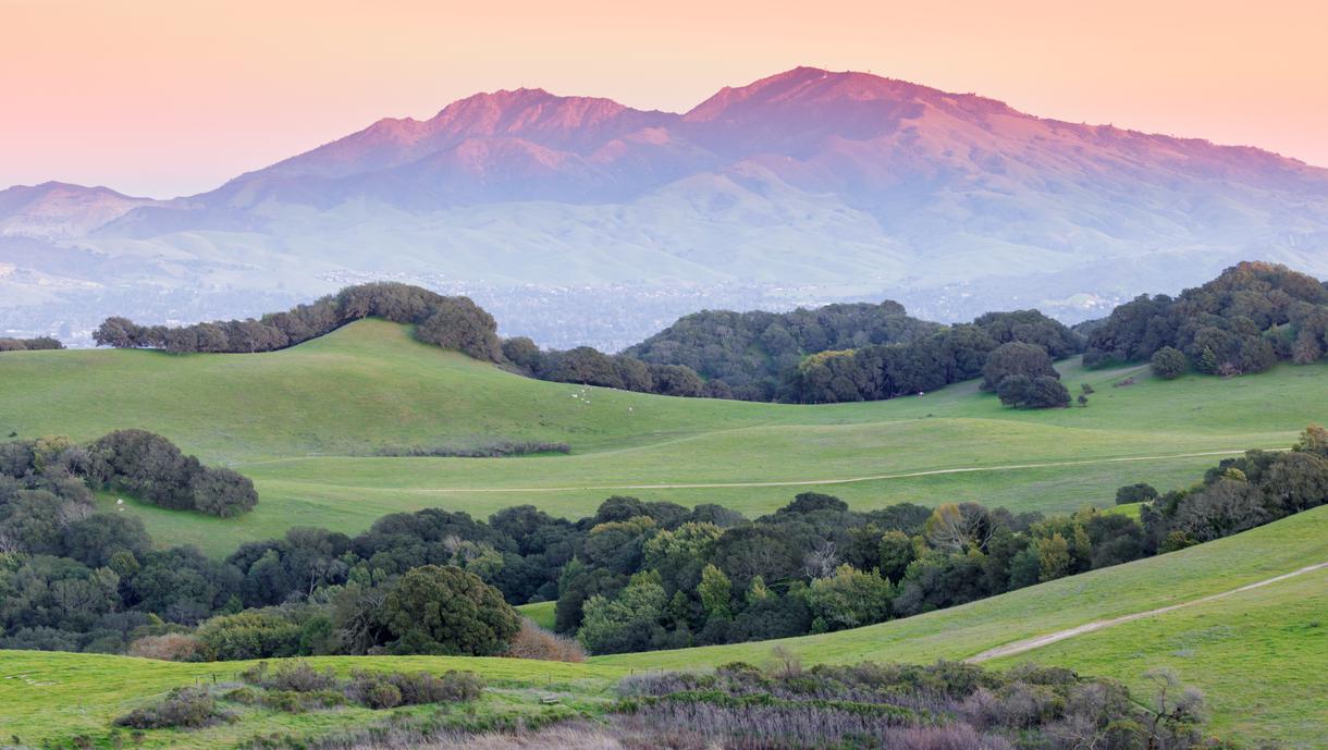
Location: Clayton, California
Difficulty: Hard
Distance: 12.9 miles
Duration: 7h 45min
Elevation: 3,822.2 ft
Route: Loop
Dogs: Not allowed
Looking for intense hikes in the Bay Area? Look no further than Mount Diablo, boasting the highest peak in the Bay Area and the best views in Contra Costa County. Start the loop clockwise, and catch nearly 200 miles in every direction from the top of the 3,822-foot-tall mountain. Catch glimpses of such famed landmarks as the Golden Gate Bridge, the Farallon Islands, Loma Prieta, and even Lassen Peak. There are multiple footpaths leading up to the summit, but one of the most popular options is the Mitchell Canyon Trail—a demanding 13-mile loop that will reward you in ways you never knew you deserved. If you feel like this route will test your athleticism and want a more relaxing hike, you should try the Mitchell Canyon Nature Trail. This 4-mile path stretches across stunning forests and features picturesque mountain views as well.

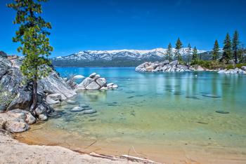
Location: Parking lot, Mt Tallac Rd A, South Lake Tahoe, CA
Parking: Mount Tallac Trail lot
Difficulty: Hard
Distance: 10.5 miles
Duration: 6h 28 min
Elevation: 3,274.3 ft
Route: Out and back
Dogs: Dogs on leash
If you’re looking to have the highest mountain in the South Lake Tahoe region under your belt, then this is the hike for you. The trek to Mount Tallac’s peak spans 10.5 miles and is one of the most difficult hikes the Bay Area has to offer. But with views of Emerald Bay, Cathedral Lake, Cascade Lake, Floating Island Lake, Fallen Leaf Lake, and Lake Tahoe awaiting at the top, it's all worth the sweat. To take on this beast, come prepared with plenty of water and a sturdy pair of shoes. Embrace this gradually shifting terrain gaining 3,274 feet in elevation throughout the trek. Take your permit beforehand (as one will be required) and head on just off Highway 89 to access the trail.
If you’re keen on exploring more Bay Area hikes, the region welcomes hikers of all levels. Check out the top coastal hikes in the Bay Area and enjoy the cool weather as check off more summits on your list.

All waterfall hikes in L.A. have one thing in common—unbeatable views of terrific cascades. Here are the ones to try next.

Discover how to track and prepare for meteor showers in California for a spectacular celestial viewing experience.
Ditch the busy Spring Break crowds and check out these fantastic, underrated spring travel destinations in California.
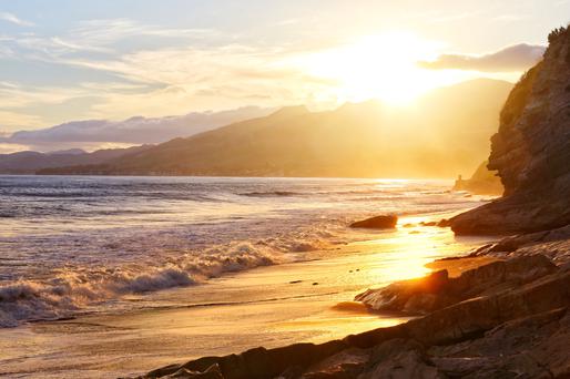
Gaze into California's amazing sunsets with our exploration of the top sunrise spots in California.

