


Fun and Free Things to Do in San Francisco
If you're looking for something fun to do, there are plenty of fun and free things to do in San Francisco, use our guide to help make plans.
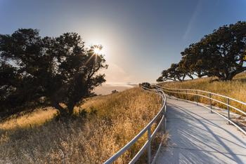
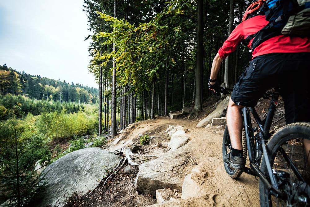
Indulge your wild side and get amped to go on an intense, thrilling bike ride through the gorgeous hills and mountains of the Bay Area.

7 min read
July 10, 2020
Enjoy living la vida loca? Indulge your wild side and get amped to go on an intense, thrilling bike ride through the gorgeous hills and mountains of the Bay Area. If you’re having trouble selecting which mountain bike trail to explore next, worry not—we’ve found the best mountain biking spots in the Bay Area.
Considering that cycling is one of the best outdoor workout activities in the Bay, you’ll be able to tone your muscles while also feeling that summer sunshine on your face. Whether you crave challenging pathways, stellar views, or just a weekend adventure, you're bound to find the trail for you.

Location: Mill Valley
Parking: The suggested parking is at the Tennessee Valley parking lot, located on Tennessee Valley Road.
Difficulty: Moderate
Distance: 9.5 miles
Time: 2 hours
Route: Loop
Several scenic biking trails await just north of San Francisco. Marin County boasts some of the most spectacular trails and landscapes in the Bay Area. There are enjoyment and excitement for all cyclists, regardless of your skill level.
Relatively accessible, the Marincello, Bobcat, and Miwok Trails have magnificent views—sans the struggle. These easy, short pathways provide a smooth ride. As you bike onward, marvel at the jaw-dropping views and headlands encompassing bare hillsides. The entire route consists of only two elevated climbs, which makes it a great option for beginners.
The journey begins on the Marincello Trail. This path was originally designed to be the main thoroughfare for a residential development, but when the project ultimately failed, the wide, rocky road was left partially unfinished. Once you’ve biked the section of the Marincello Trail, you’ll reach the Bobcat Trail, which is known for its vibrant wildflowers and vista points. The route skirts around Gerbode Valley, providing one of the smoothest mountain biking trails in the Bay Area, and eventually connects to the Miwok and Old Springs Trails. The latter offers a bike-legal singletrack that will bring you to the lush and well-shaded forests of Marin.
Location: Mill Valley
Parking: Parking at the watershed is prohibited (only people with disabilities and the required placards/license plates for their vehicle can park here). However, you can park in the street off of Deer Park Road.
Difficulty: Moderate
Distance: 11.5 miles
Time: 2.5 hours
Route: Loop
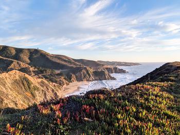
Mount Tamalpais offers another fun and rewarding bike trail that follows the Deer Park Fire Road and the Coast View Trail. This route features an exciting loop with partially paved roads, fire routes, and singletracks leading up to Mount Tamalpais. The first challenge is the steep climb up Deer Park Fire Road, which has an average elevation grade of 12 percent, making it a great whole-body workout. As you descend along the Coast View Trail, slow down to enjoy the most scenic part of the ride. This singletrack offers observation points on a mesmerizing coastal hillside overlooking the calm ocean.
If you’re craving a quick dip in the ocean after cycling for several miles, you’re in luck. This amazing trail takes you to Muir Beach (via Highway 1, one of the best cycling routes in California). Slow down (or just make a pit stop) to admire the clear blue waters, watch the waves, and feel the breeze. If you take this trail in the fall, you might be able to spot thousands of monarch butterflies as they migrate to the California coast. But no matter when you explore the trail, we know that you’ll be pretty hungry after a ride like this, so make sure to stop by the nearby Pelican Inn for a delicious meal.
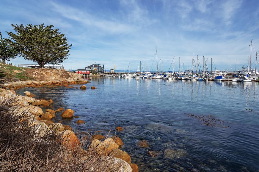
Location: Tiburon
Parking: Park in one of the Point Tiburon parking lots (for a fee), then board the ferry to Angel Island.
Difficulty: Moderate
Distance: 4.6 miles
Time: 3 hours
Route: Loop
Angel Island is pure bliss for tourists, hikers, and bikers alike. Enjoy the tranquility of the quiet island, which features sweeping views of the San Francisco skyline. Due to the fame and splendid vistas found on Angel Island, this loop is pretty heavily trafficked. To not feel rushed on your joyride, you may need a minimum of three hours to complete the journey (for a smoother ride, you can take Perimeter Road—it’s paved and borders the island along the coast).
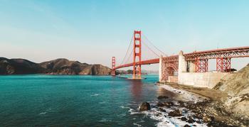
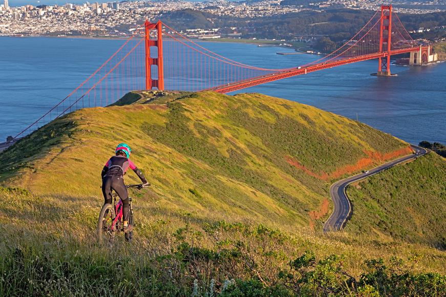
Rich in ethereal nature, this charming island is lush with oak, hazelnut, gooseberry, and pine—especially on the route to the peak of Mount Livermore—and is dotted with vibrant wildflowers. As you bike down the south slope, picturesque views of Point Blunt will appear. You’ll also take in vistas of the Tiburon Peninsula, the Golden Gate Bridge, Alcatraz, the Bay Bridge, and the Berkeley Hills. (You might even spot the Richmond–San Rafael Bridge.)
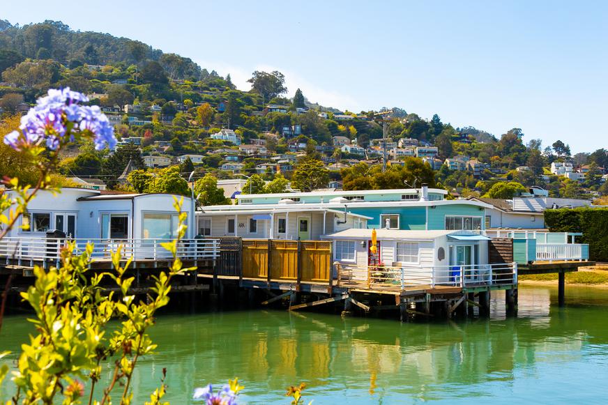
Location: Sausalito
Parking: The suggested parking lot is Blackie's Meadow, near the intersection of Tiburon Boulevard (Route 131) with Trestle Glen Boulevard. You can also park near San Francisco’s Chrissy Field and bike across the Golden Gate Bridge into the town of Sausalito.
Difficulty: Moderate
Distance: 38 miles
Time: 3–4 hours
Route: Loop
One of the best mountain biking routes in San Francisco is Paradise Loop. Cyclists just love “doing Paradise” to savor the splendor of the city. There aren’t any difficult climbing areas, just several mild ups and downs. The quiet route offers spectacular views of iconic S.F. landmarks such as the Golden Gate Bridge. Not to mention, you'll be starstruck by the dizzying array of multi-million dollar homes situated along the Tiburon Peninsula.
The route starts on the Tiburon Historical Trail, following the old railroad tracks along the shore. As you pedal on, you’ll discover gorgeous views of Sausalito, looming Mount Tam, and Richardson Bay.
Location: San Rafael
Parking: The parking fee is $5 at China Camp State Park. You can park at the campground area or at Buckeye Point.
Difficulty: Easy to moderate
Distance: 11 miles
Time: 3 hours
Route: Loop
The China Camp mountain biking loop is an excellent option if you’re not an advanced cyclist or haven’t hit the tracks in a while; it features singletrack for beginners or family rides. At the start of the ride, you’ll climb upward at a moderate range. Don’t let that steep hill scare you though—the rest of the route is a flat ride along the hillside. The loop consists mostly of singletrack with just a few fire roads.
You’ll be rewarded with stunning vistas showcasing the northern part of Marin County. Along the way, visit the renowned China Camp Village, which preserved the last remnants of several Chinese fishing villages scattered around the Bay Area. If it’s your first time here, check out the small village museum to discover the region’s rich culture and history.
Although this loop trail is shared with hikers and may be heavily trafficked, it’s definitely worth the ride (especially if you enjoy a post-workout treat at the popular Sol Food in downtown San Rafael).
Location: Blackhawk
Parking: Parking at the South Gate entrance to Mount Diablo State Park is $10. There’s also an upper parking lot near the Summit Trail.
Difficulty: Challenging
Distance: 7 miles
Time: 4 hours
Route: Out and back
If you’ve got your heart set on an intense and challenging mountain biking experience and you appreciate stunning scenic vistas, then biking up Mount Diablo via the Summit Trail is just for you. You may have to make several pit stops on this ride, but we promise it’s worth it—there’ll be plenty of opportunities to stop and marvel at the gorgeous views. (Tip: Given the number of hikers, drivers, and other cyclists heading up the mountain, it’s better to reach the summit first and then stop at vista points on your descent.)
Start off from South Gate Road to hit the Summit Trail. It is usually heavily trafficked and features a singletrack and dirt road. As you continue to bike upward, the elevation will increase and the track will become steeper—a great challenge for the advanced cyclist.
Once you reach the Mount Diablo summit, take a breather and admire the remarkable views of rolling hills and flat valleys. You’ll be able to see almost 200 miles away; on a clear day, you can spot the Golden Gate Bridge and Farallon Islands to the west. This vista point offers an exceptional panorama that encompasses over 40 counties in the Golden State.
While you’re up on the summit, check out the Summit Visitor Center and Observation Deck, which is open daily from 10 a.m. to 4 p.m. You can admire the exhibits and learn more about the park’s cultural and natural history. Then, you can simply sit back and relax as you take in the phenomenal scenery.
Location: Los Gatos
Parking: You can park at Almaden Quicksilver County Park.
Difficulty: Moderate
Distance: 14.5 miles
Time: 3.5 hours
Route: Loop
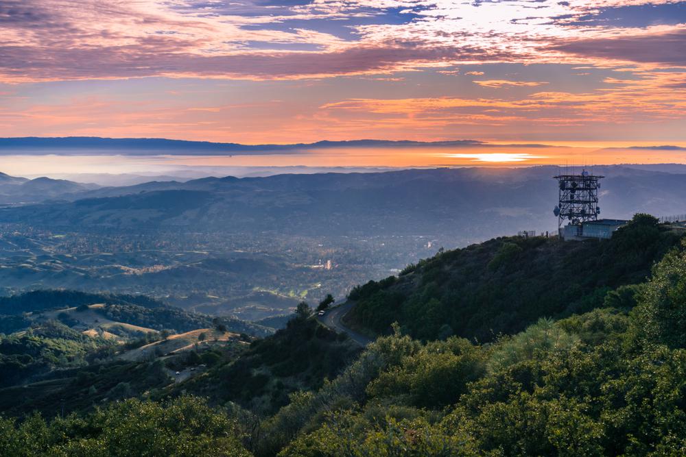
Leading from the blissful Sierra Azul forest to the summit of Mount Umunhum, this loop will be a highlight of your active weekend. As the Mount Umunhum summit once served as a radar base for the U.S. Air Force, it was long considered forbidden fruit for mountain bikers; for years, it was closed off to the public but finally became publicly accessible in 2017. At the summit, you can still see the eight-story concrete tower (we can only wonder what crazy things happened up here in the past).
Since opening to the general public, the trail underwent changes to restore the natural ecosystem—honoring the meaning of umunhum, which means “hummingbird” in the Ohlone language. This historically significant trail is also home to fun twists and turns, making the ride enjoyable for cyclists. The views from the summit are breathtaking, too. Silicon Valley stretches below you, and (on a clear day), you can see the city of San Francisco, the Monterey Bay, and the Pacific Ocean.
These amazing mountain bike trails are a great way to see the Bay Area, but there are numerous other biking trails in the region as well as various bike paths in California waiting to be explored. With so many trails and so little time, pull out the bike and go for a ride.

If you're looking for something fun to do, there are plenty of fun and free things to do in San Francisco, use our guide to help make plans.

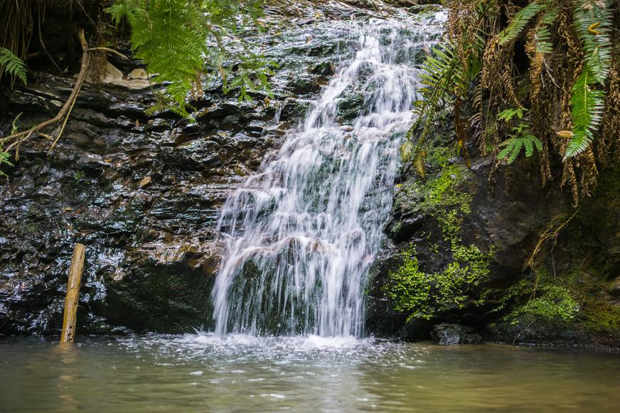
All waterfall hikes in L.A. have one thing in common—unbeatable views of terrific cascades. Here are the ones to try next.

From undulating mountains, to coastal expanses, to verdant forests, here are some of the top spots for backpacking in California.
Settled off the California coast, the Channel Islands offer endless adventures. Here are the best things to do and how to get there.

