


Fun and Free Things to Do in San Francisco
If you're looking for something fun to do, there are plenty of fun and free things to do in San Francisco, use our guide to help make plans.
Roaring waterfalls, secluded beaches, striking desertscapes—you can find it all on these cool Southern California hiking trails.

5 min read
November 06, 2020
Southern California is a treasure trove of natural wonders, featuring dramatic mountain ranges, thunderous waterfalls, hidden beaches, and vast desert terrains. Stretching from the northern borders of Los Angeles County down to the tip of San Diego County, the region's stunning landscapes are accessible and ready for exploration throughout the year. Although the Pacific Crest Trail might appear daunting, there are plenty of shorter hikes in California that promise equally breathtaking vistas. So, lace up your hiking boots and grab your water bottles, as we're about to dive into some of the most serene and less-traveled trails in Southern California.
Whether you're searching for hikes through the rolling hills, along the shimmering coastline, or through the striking deserts, SoCal cities have it all. Here are the top Southern California hiking trails to explore now.
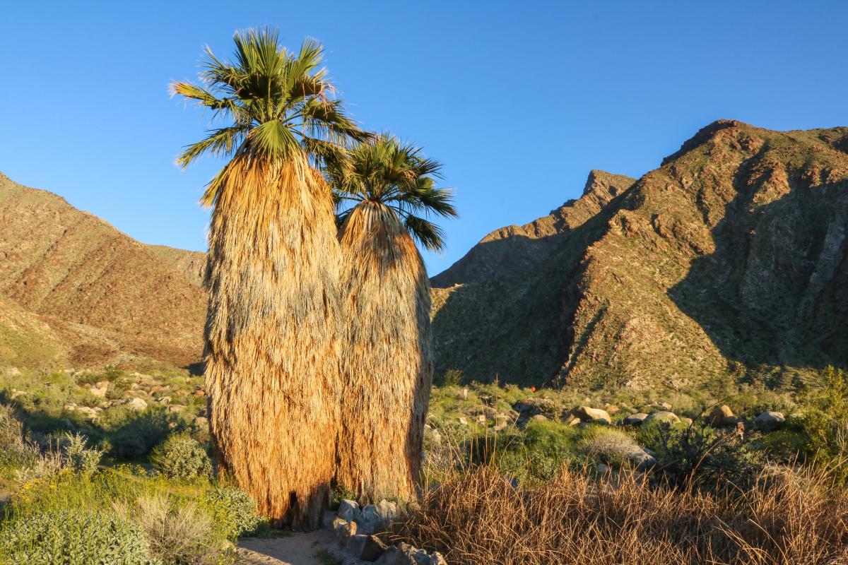
Location: Anza-Borrego Desert State Park, Borrego Springs
Length: 3 miles
Type: Loop
Frequently overlooked, Anza-Borrego Desert State Park is one of the most beautiful yet low-key places for hiking in SoCal. The park is conveniently situated in the Colorado Desert, only a couple of hours away from San Diego. Anza-Borregos's otherworldly rugged terrain is worth hiking multiple times—it's not the kind of place where visiting once is enough.
This state park is also home to one of the best San Diego hiking trails. The Borrego Palm Canyon Trail is an easy and short hike that'll take you through the San Ysidro Mountains, past various types of cacti and desert greens, and into an oasis in the heart of the canyon. The trail is definitely an intense workout rather than a brisk walk—some parts of the path require you to show off your bouldering skills.
For gorgeous views post-hike, head to the Panoramic Overlook Trail accessed via the trailhead. This quick, one-mile hike is all about the great vistas of Borrego Palm Canyon.
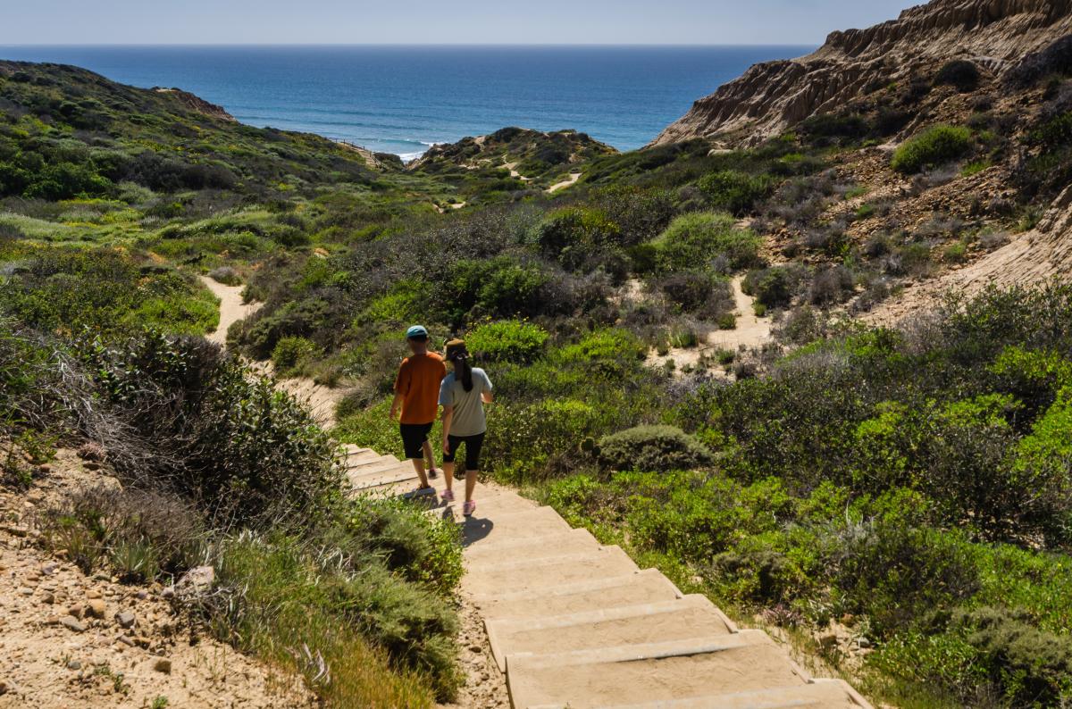
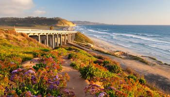
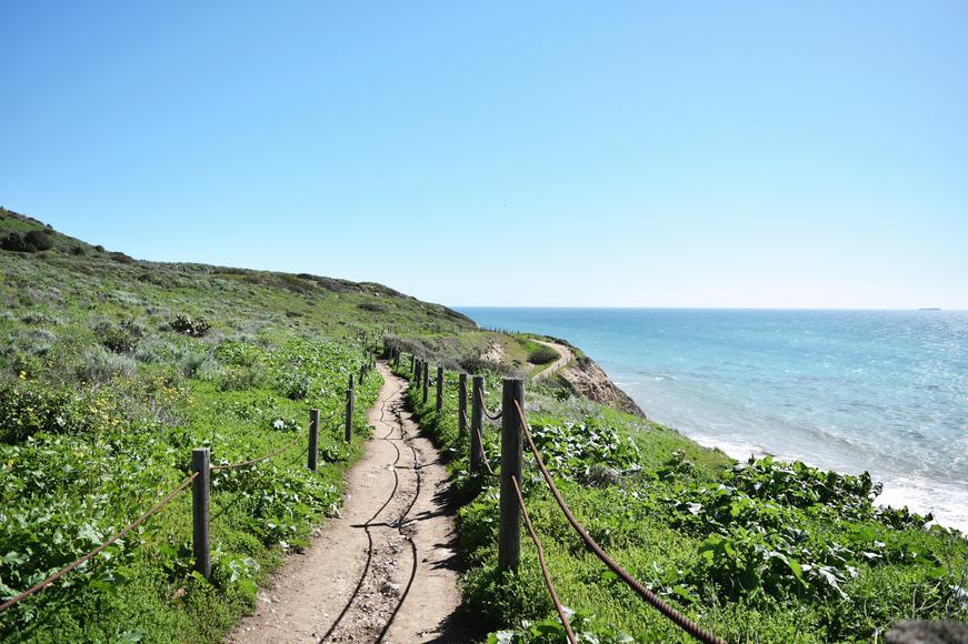
Where: Torrey Pines State Reserve, La Jolla
Length: 1.25 miles
Type: Loop
Is there any place more scenic in San Diego than Torrey Pines State Reserve? We think not, and Yucca Point Trail surely exceeds the standards of beauty. This easygoing SoCal beach trail will take hikers along the cliffs of the coastal state park and down to the beach (where you should relax come sunset). You'll enjoy stunning scenery on your stroll. Torrey Pines boasts 2,000 acres of coastal scenery, desert wildflowers, and of course, the rare Torrey Pine trees.
There are plenty of trails at Torrey Pines State Reserve, but the Yucca Point Trail is the only one that will take you directly to the beach. For longer hikes in the park, consider combining the Guy Fleming Trail or the Razor Point Trail with the Yucca Point Trail before heading down to the sandy beaches and crystal-clear waters.

Where: Mission Trails Regional Park, San Diego
Length: 3 miles
Type: Out and back
The Cowles Mountain Trail is one of the best hikes in Southern California. Although it's a short trail, the nearly 1,593-foot climb up to the summit isn't for the faint of heart. You'll feel the burn as you trek up to the top of the mountain, but upon reaching it, you won't regret the workout. From the peak, you'll enjoy sweeping views of Lake Murray and Mexico.
Just make sure you're prepared: Similar to many hiking trails in Southern California, the Cowles Mountain Trail has little to no shade, so pack plenty of water and don your best hat.

Where: Lake Poway, Poway
Length: 6.4 miles
Type: Out and back
One of the more popular trails in Southern California, especially in the summer, is the Mount Woodson Trail. Often referred to as the Potato Chip Rock Hike, the trek’s highlight is Potato Chip Rock—a rock naturally shaped like a thin potato chip. Thrill-seekers will love taking the small leap to reach the rock; once you're up there, show off your best scorpion handstand or one-handed tree yoga pose for your Instagram post.
Aside from leading you to the famed rock just waiting to be photographed, the Mount Woodson Trail also takes you through shrubland and granite fieldstones on the route to the tallest peak in the region. Once you reach the top, you'll be rewarded with gorgeous views of Palomar Mountain, Lake Poway, and the Pacific Ocean.

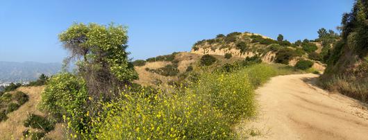
Where: Griffith Park, Los Angeles
Length: 6.5 miles
Type: Out and back
One of the best options for hiking near Los Angeles and one of the best Hollywood hikes is the Brush Canyon Trail, which leads to the peak of Mount Lee, situated just behind the iconic Hollywood Sign. The moderate trail is suitable for all skill levels and offers breathtaking views of Los Angeles. Once you reach the top of the 1,700-foot mountain, gorgeous views of the Griffith Observatory, Lake Hollywood Reservoir, Dodger Stadium, and the Santa Monica Mountains await you—could you ask for more? There's a perfect Instagrammable shot at every twist and turn, so be sure to smile during your stellar photo-op sesh in Los Angeles.

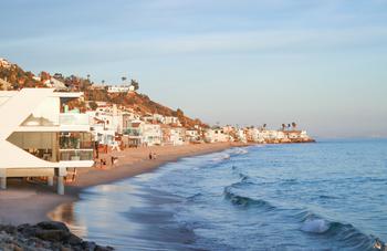
Where: Santa Monica Mountains National Recreation Area
Length: 3.2 miles
Type: Loop
Although Malibu is all about the beaches, don't neglect the city when it comes to hiking. One of the greatest hiking routes in California is the Solstice Canyon Trail—a shaded canyon and, most importantly, a small waterfall await you. The trail offers an almost tropical feel, which is quite a welcoming change from the dry SoCal heat. The path is flat and the elevation is minimal, so it's doable no matter your skill level.
When you reach the trailhead, follow the service road and veer right at the dirt road. Once you pass by the Santa Monica Mountains Conservancy, turn right after the second building; this will take you to the Rising Sun Trail, to the top of the ocean-view ridge, and down into the ruins of the Tropical Terrace. Here, you may be able to see the 30-foot waterfall if it has rained recently. Regardless, the Solstice Canyon Trail is worth exploring when spending a weekend in Malibu.
Looking for more? Here are the best off-the-beaten-path hiking trails in California to add to your list.

If you're looking for something fun to do, there are plenty of fun and free things to do in San Francisco, use our guide to help make plans.

Finding a wall isn't the problem. The problem is figuring out which gym fits your lifestyle the best.

The leagues, the stadiums, how to watch, how to get tickets. Consider this your starting point.

What are you waiting for? Pack up your camping essentials and head over to the best campgrounds California has to offer.

