


Fun and Free Things to Do in San Francisco
If you're looking for something fun to do, there are plenty of fun and free things to do in San Francisco, use our guide to help make plans.
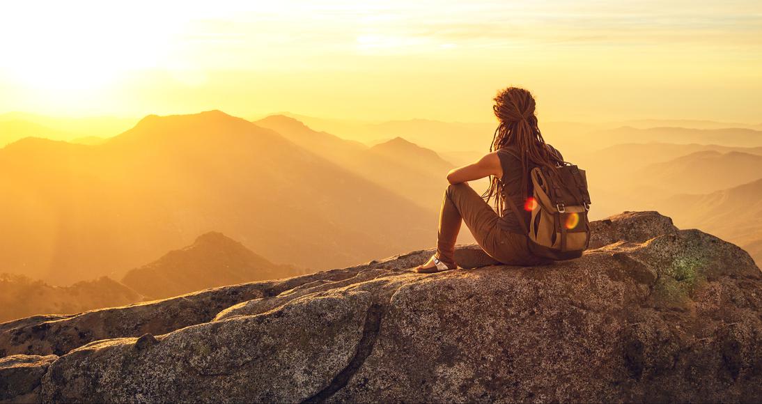
With everything from lush forests to sandy beaches, to rugged peaks, there's no better way to see the state than hiking in California.
Hiking in California is the best way to see the diverse state where there’s everything from lush forests, to sandy beaches, to rugged mountain peaks. Thousands of pathways await, from easy trails like the Bay Area’s best mountain hikes and treks through the Hollywood Hills to extensive expeditions like the Pacific Crest, Tahoe Rim, Lost Coast, or Muir Woods National Monument trails. Though these popular trails might be the first ones that come to mind when you think about hiking in Northern California or hiking near Los Angeles, there is so much to explore off the beaten path.
Whether you’re searching for an exciting picnic date, seeking a belated Galentine’s Day activity, looking for your favorite national park, or trying to keep your New Year’s fitness resolution, your ideal hike lies in the California wilderness, just waiting to be found.
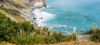
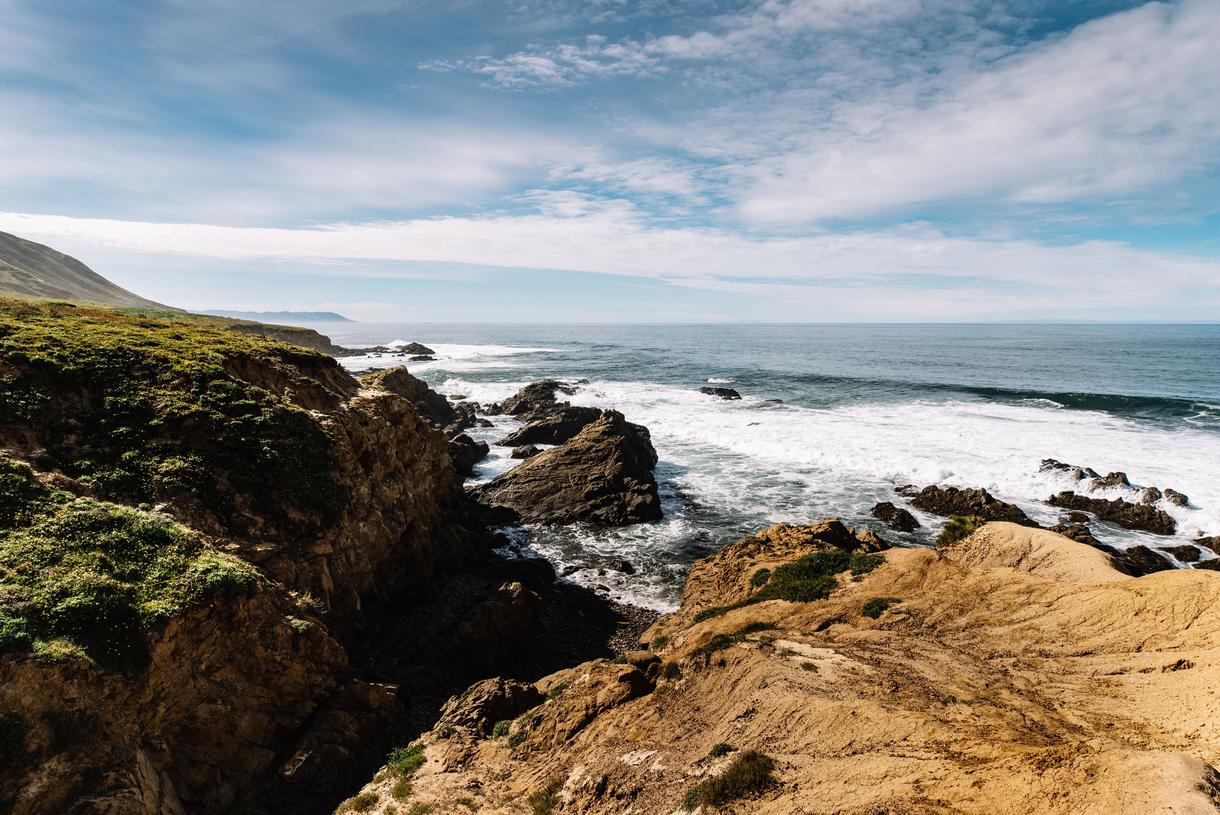
Where: Big Sur
Distance: 5.3 miles
Route Type: Out and back
Though one could argue that every trail should be considered one of the best hikes in Big Sur, the Boronda Trail (a.k.a. Timber Top) is an exquisite path made for incredibly seasoned hikers. If you’re looking for a challenge, this is a great place to start—just make sure to wear a hat and sunscreen, and pack tons of water.
Complete with an ultra-steep uphill climb, overgrown patches, and wildlife encounters, this region is sure to up your adrenaline and get your heart pounding. You will be rewarded with beautiful seasonal wildflowers, narrow roads that wind up the mountain, scenic coastal vistas, and a much-needed resting point at Timber Top Camp.
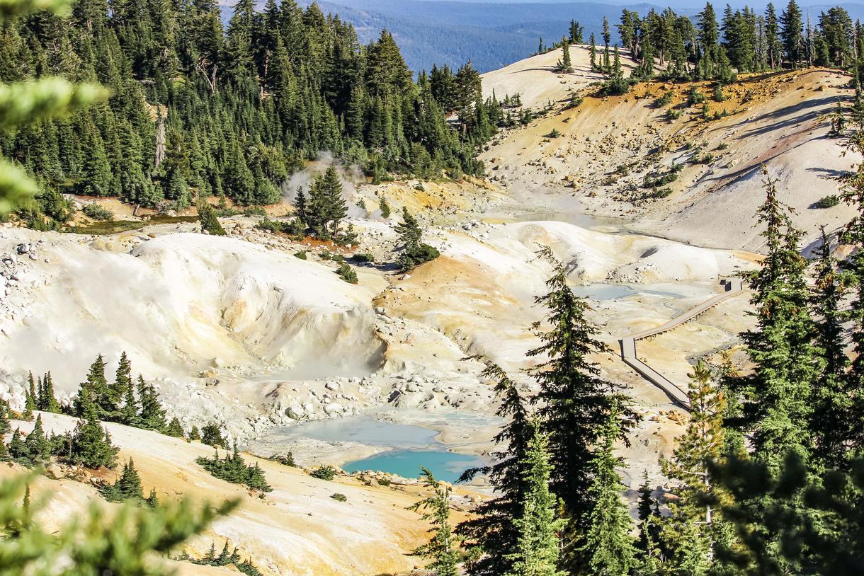
Where: Lassen National Park
Distance: 6.3 miles
Route Type: Out and back
Of California’s hiking trails, the paths in Lassen National Park are arguably the most unique. Bumpass Hell Trail is particularly distinct, trading out typical ocean or mountain views for active volcanoes, mud vats, geysers, and hydrothermal pools. Though this trail leads to the largest hydrothermal area in the park, its inherent danger keeps some of the tourists away—and regardless of how many people join you, this magical region is well worth the trip. Make sure to stay on designated trails throughout the entire journey, as thin crust covers much of the park’s boiling water.
This trail is best visited between mid-July and October, so pack plenty of water and sunscreen for a safe trip.
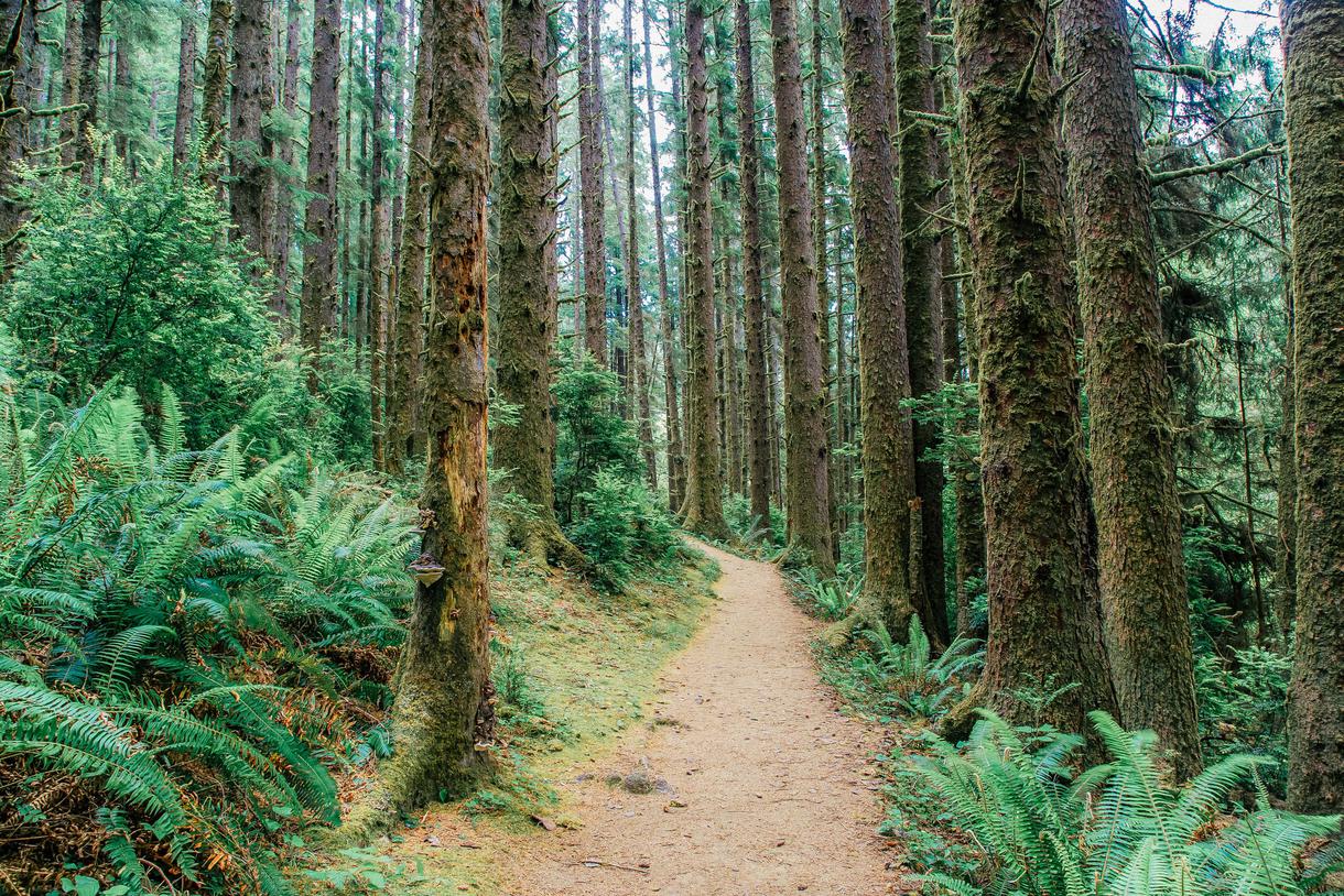
Where: Prairie Creek Redwoods State Park
Distance: 1.1 miles
Route Type: Loop
Hiking in Northern California is an experience like no other. Foggy mist and the smell of chlorine surround you, as luscious foliage peaks out of every crack and a sense of adventure overwhelms the senses. But Fern Canyon Loop Trail is undoubtedly one of the best hikes in California.
Filled with old-growth coastal redwoods, Douglas firs, and hemlock, the park is famous for its dense ground cover and brilliant hues. Meander through the creek bed, surrounded by 50-foot-high, plant-filled canyon walls; climb over fallen tree trunks; walk across gravel; and make your way through shallow waters to emerge anew. If the striking beauty and remote location aren’t enough to entice you, this trail is a well-known movie set, featured in hit films such as The Lost World: Jurassic Park.
Though the trail is suitable for new hikers, the drive in can prove to be quite challenging. The road is mostly unpaved and narrow, with many blind curves—so take it slow and enjoy the journey.
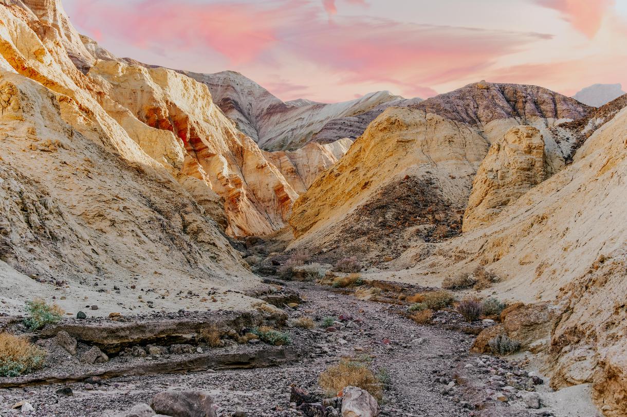
Where: Death Valley National Park
Distance: 3 miles
Route Type: Out and back
Get your desert fix by hiking from Golden Canyon to Red Cathedral in Death Valley National Park. This moderate trail typically takes about two hours to traverse, taking hikers gradually uphill from Golden Canyon, through a rocky aisle of yellow walls, over a pile of loose rocks, and under low ridges.
Though this trail is fairly short, the lack of shade, intense heat, and various terrain lead to greater physical exertion than traditional hikes. Pack ample water and sun protection, and wear shoes with good traction to stay safe on this route.
Where: Harmony Headlands State Park
Distance: 4.3 miles
Route Type: Out and back
Tucked along the Pacific Coast Highway, between Morro Bay and San Simeon, Headlands Trail is an easy hike that leads to spectacular views. The entire path is relatively flat, making it a great option for the entire family. Follow the dirt pathway over a small hill, past a pond, through a beautiful ravine, and onto a bluff overlooking the ocean. Though the trail itself doesn’t feature diverse scenery, the adventure is worth experiencing. Keep an eye out for hawks, ticks, and wildflowers along the way, as well as whales and other sea creatures at the precipice.

Where: Mojave National Preserve
Distance: 2.7 miles
Route Type: Out and back
Admire some of the tallest sand dunes on the continent at Kelso Dunes, and get an incredible workout as you move through the sand. The short Kelso Dunes Trail provides an intimate look at the magic of the Mojave Desert and is best seen between October and May. Plan your trip at sunrise or sunset to enjoy cooler temperatures and unbelievable beauty as the light casts shadows and golden hues along the dunes.
For an even more sensory experience, run down the dunes to trigger a booming noise as the sand moves.
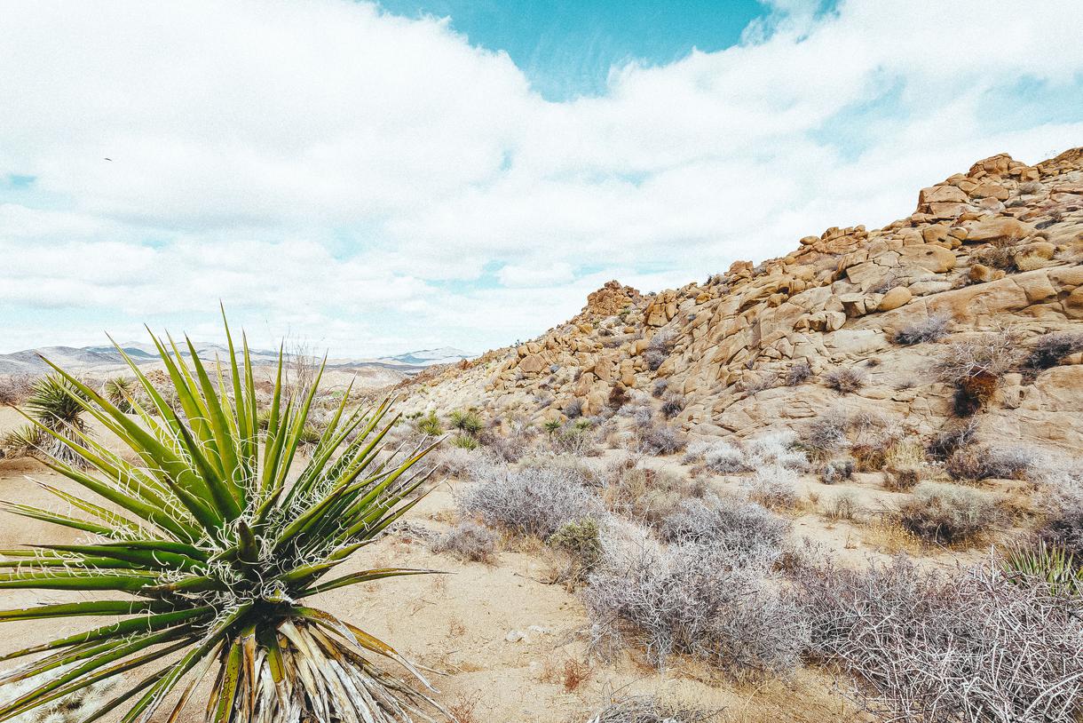
Where: Joshua Tree National Park
Distance: 7.2 miles
Route Type: Loop
Choose your adventure along one of the best hikes in Southern California: The Lost Palms Oasis Trail. Walk along the quick, one-mile loop, or trek the entire seven-mile path to see all this slice of paradise has to offer. Expect to spot lots of wildlife, be surrounded by arid weather, and witness a desert oasis—don’t worry, it’s not a mirage. Since the trail is located in the desert, it’s best visited (with plenty of water) between October and March.
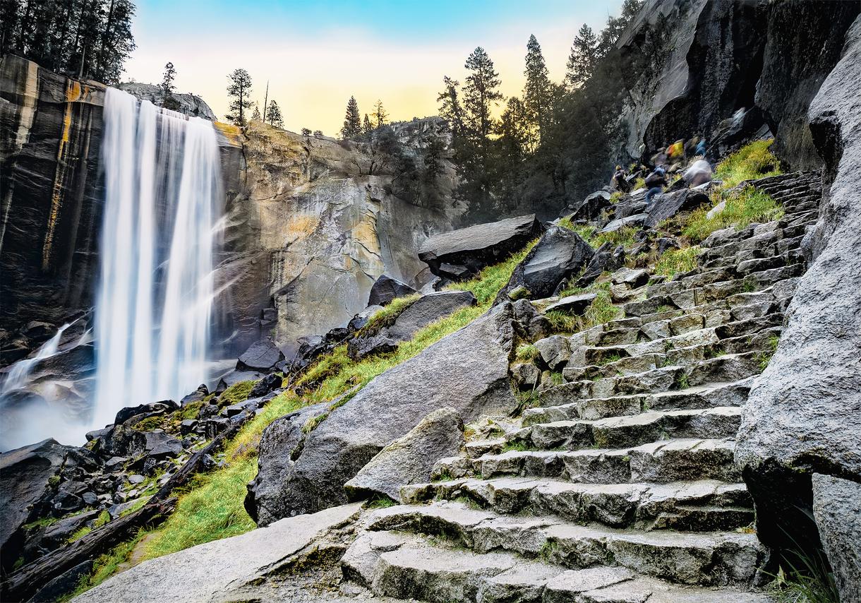
Where: Yosemite Valley
Distance: 10.3 miles
Route Type: Loop
If you’ve been searching for a difficult hike in the Yosemite Valley, look no further than the Mist Trail. Passing by Vernal and Nevada Falls, the scenic pathway offers a refreshing look at this popular national park. Though the trail is heavily trafficked, it’s a lesser-known gem in the valley and ideal for true adventurers who are ready to tackle slippery sections, loose rocks, and steep steps.
Begin the hike at the Happy Isles trailhead near shuttle stop 16, right by Curry Village. The path will wind along the river banks before steeply ascending to a footbridge. From here, you’ll get your first glimpse of Vernal Fall and follow the trail until you come face-to-face with the rushing water as it cascades down the rockface. Continue on past Emerald Pool, and you’ll encounter intimate views of Nevada Fall, too. This will lead you to the highest point in the hike and present the opportunity to take the John Muir Trail for additional vistas of Nevada Fall and Liberty Cap. This detour adds an additional mile and a half to the Mist Trail, but it’s a worthwhile detour. Before you know it, you’ll meet back up with the Mist Trail by the footbridge and continue back toward the trailhead.
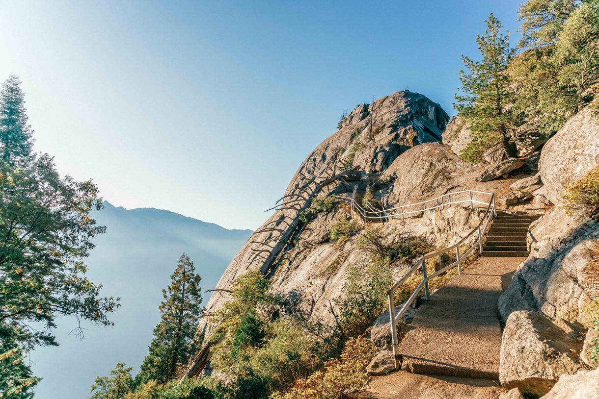
Where: Sequoia and Kings Canyon National Parks
Distance: 0.4 miles
Route Type: Out and back
Sequoia and Kings Canyon National Parks is one of the most underrated national parks in California; with Yosemite to the north and Death Valley to the east, this incredible destination often falls to the bottom of our to-do lists. But not any more. Moro Rock Trail is the perfect excuse to head over to Sequoia and Kings Canyon National Parks for an afternoon.
The incredibly short trail leads you up a steep granite dome staircase, which results in awe-inspiring vistas of the western region of the park. Enjoy the walk between February and November, but note that the road to the trailhead is closed during snow season and becomes part of a ski slope, rather than a hiking trail.
What’s your favorite little-known trail in California? Let us know where to hike next in the comments below.

If you're looking for something fun to do, there are plenty of fun and free things to do in San Francisco, use our guide to help make plans.

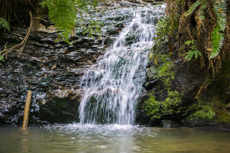
All waterfall hikes in L.A. have one thing in common—unbeatable views of terrific cascades. Here are the ones to try next.

From undulating mountains, to coastal expanses, to verdant forests, here are some of the top spots for backpacking in California.
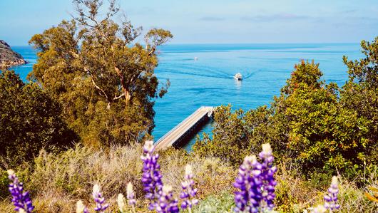
Settled off the California coast, the Channel Islands offer endless adventures. Here are the best things to do and how to get there.

