


Fun and Free Things to Do in San Francisco
If you're looking for something fun to do, there are plenty of fun and free things to do in San Francisco, use our guide to help make plans.
Explore the 13 best waterfall trails in California with detailed information – prepared for campers and nature lovers like you.

7 min read
July 31, 2022
Hiking in California is an exhilarating experience by its very nature, let alone hiking waterfall trails in California. South or north, a big part of California’s wealth lies in its brilliant nature. Lush landscapes, redwood forests, magnetic panoramas, interesting historic sites, and an explorer's passion all draw backpackers in from across the globe. If you’re a hiker trekking California, there are certainly some beloved waterfall hikes you shouldn’t miss out on.
Location: McArthur-Burney Falls Memorial State Park, 24898 CA-89, Burney, C.A. 96013.
Difficulty: Easy.
Duration: 28 minutes.
Distance: 0.9 miles.
Elevation: 167 feet.
Route type: Loop.
Pets: Not allowed.
Enjoy the one-mile, clockwise loop of the park’s flora and fauna until the magical scenery of the divine cascades unveils itself, leaving you awestruck. Lodged by the Cascade Mountains, these Cascades are open year-round and ready to steal the hearts of the visitors. Fair warning: be prepared to leave your heart at this quintessential waterfall hike.
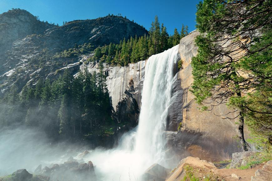
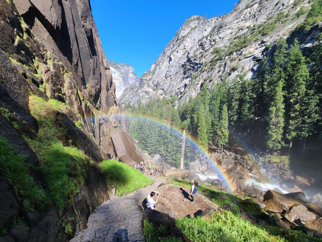
Location: Happy Isle Loop Rd, Yosemite Valley, C.A. 95389.
Difficulty: Hard.
Duration: 2 hours 30 minutes.
Distance: 3.9 miles.
Elevation: 1280 feet.
Route type: Out and back.
Pets: Not allowed.
Although the lyrics suggest otherwise, some waterfalls are worth the chase. A popular destination for those seeking hiking with waterfalls, a short but steep paved trail will lead you to cross a bridge where views overlooking the Verna Falls await you. Enjoy the lush greens and soak up the cool air, as you make your way through the stretch of the wide dirt trail to the steep rock stairway leading up to the falls. Watch your step on the stairs, as they’re usually slippery from the mist of the falls.
Location: Temescal Canyon Trailhead, Temescal Canyon Trail, Pacific Palisades, C.A. 90272.
Difficulty: Moderate.
Duration: 2 hours 4 minutes.
Distance: 3.7 miles.
Elevation: 935 feet.
Route type: Loop.
Pets: Not allowed.
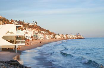
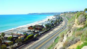
Hiking waterfall trails are definitely exhilarating experiences, especially if you’re hiking routes that portray vistas of canyons and oceans. With its proximity to L.A. city, be ready to encounter fellow hikers on this popular road, while you bask in the endless sceneries of Malibu, and the Santa Monica Mountains. Enjoy the fragrant smell emitted from the wildflowers, the arched trees, and wood-paved bridges year-round.
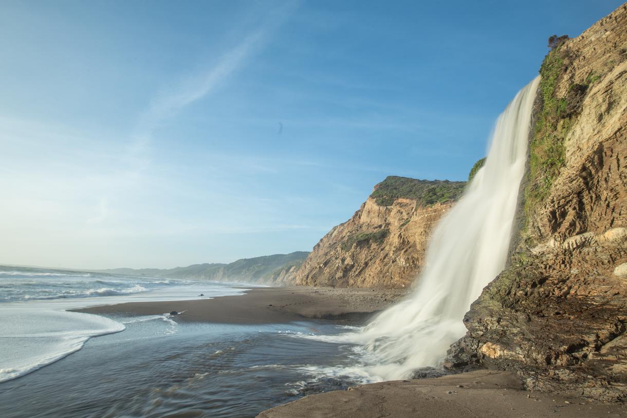
Location: Bolinas, California 94924.
Difficulty: Moderate.
Duration: 5 hours 46 minutes.
Distance: 13.6 miles.
Elevation: 1811 feet.
Route type: Out and back.
Pets: Not allowed.
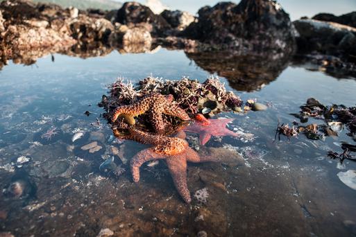
Get started on his waterfall hike from the Coast Trail of Palomarin Trailhead. Situated in San Francisco’s Point Reyes National Seashore, the stunning Alamere Falls is a tidefall pouring into the pacific. If you’re hiking on a clear day, get your cameras ready to welcome the compelling views of the ocean, the Farallon Islands, Bass Lake, and Pelican Lake. Be sure to pack some long sleeves to dodge the poison oak, and avoid going down to the falls during high tide.
Location: Solstice Canyon Education Shelter, TRW Loop Trail, Malibu, C.A. 90265.
Difficulty: Moderate.
Duration: 1 hour 34 minutes.
Distance: 2.9 miles.
Elevation: 669 feet.
Route type: Loop.
Pets: Allowed on leash.
Hiking trails with waterfalls are easy to come by when you’re searching in the right places. The Solstice Canyon route is a mostly shaded, spectacular canyon climb in the Santa Monica Mountains — and it’s popular amongst hikers. Enjoy an hour and a half of a moderately challenging hike, all the while exploring historic sites, rivers, waterfalls, and wildlife. Make sure you stop to check out the oldest stone house in Malibu and a series of ruins.
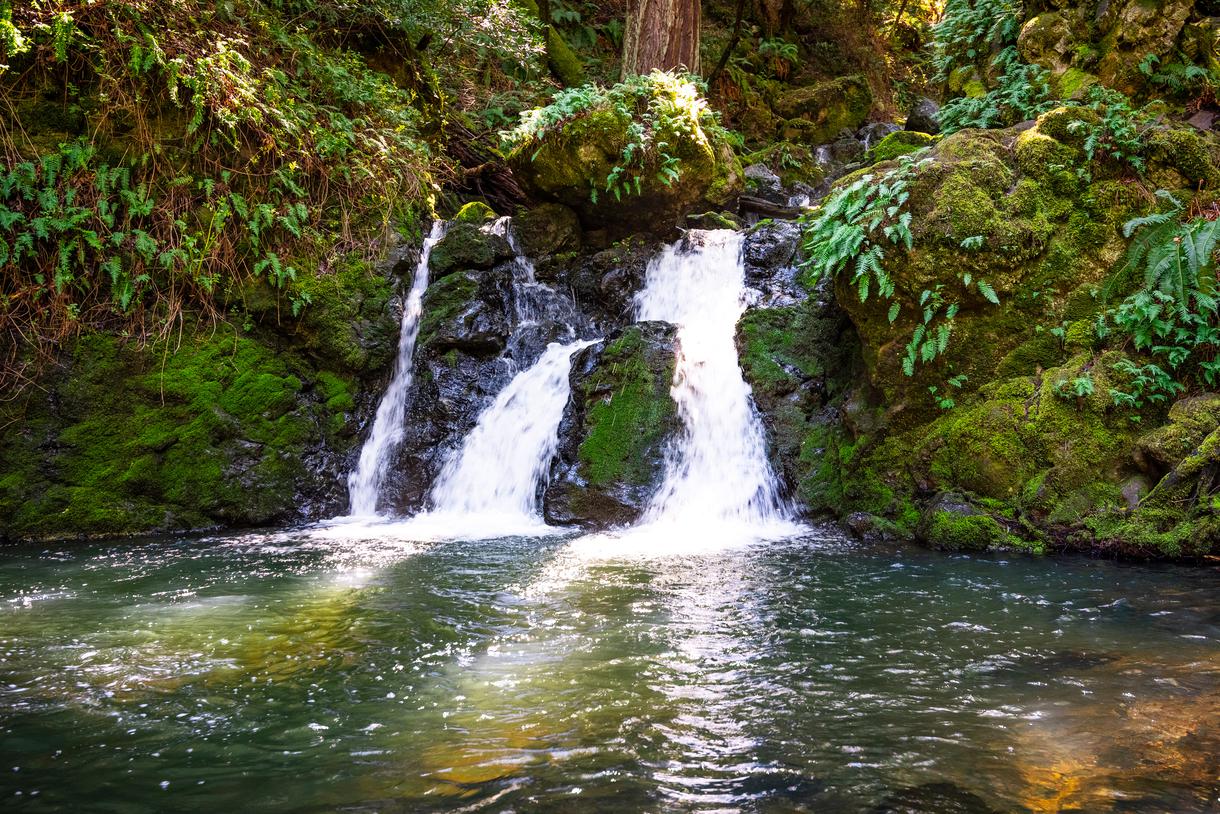
Location: Dipsea Trail Head Parking, Dipsea Trail, Stinson Beach, C.A. 94970.
Difficulty: Moderate.
Duration: 3 hours 56 minutes.
Distance: 7.5 miles.
Elevation: 1689 feet.
Route type: Loop.
Pets: Not allowed.
Lounge in the liberating feeling of this waterfall hiking experience in Mount Tamalpais State Park. Starting off from the Dipsea Trail, you’ll be accompanied by crazy ocean views all the way to Steep Ravine Trail. Bask in mesmerizing views of the exceptionally steep and lush towering redwood forests — a creation of the Webb Creek waters.
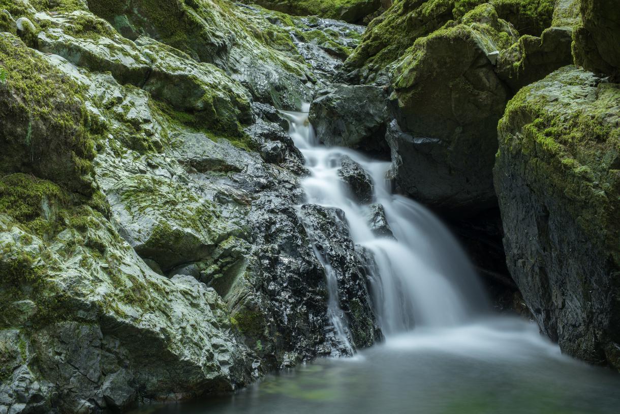
Location: Cataract Trailhead, Bolinas - Fairfax Rd, Bolinas, C.A. 94924.
Difficulty: Moderate.
Duration: 1 hour 56 minutes.
Distance: 2.7 miles.
Elevation: 1056 feet.
Route type: Out and back.
Pets: Allowed on leash.
Explore one of the most stunning Northern California waterfalls located in the San Francisco Bay Area. Sulk in the magnificence of the cascading waterfalls throughout the entirety of the trail, as you make your way uphill through the greenest forests and finally reach the picnic area. Making your way past the picnic spot, you’ll find a refreshing pool at the junction of Helen Markt and Cataract Trail. Bath in the bliss of this waterfall hike, all the while embracing the serenity and the fuzziness of the wildflowers.
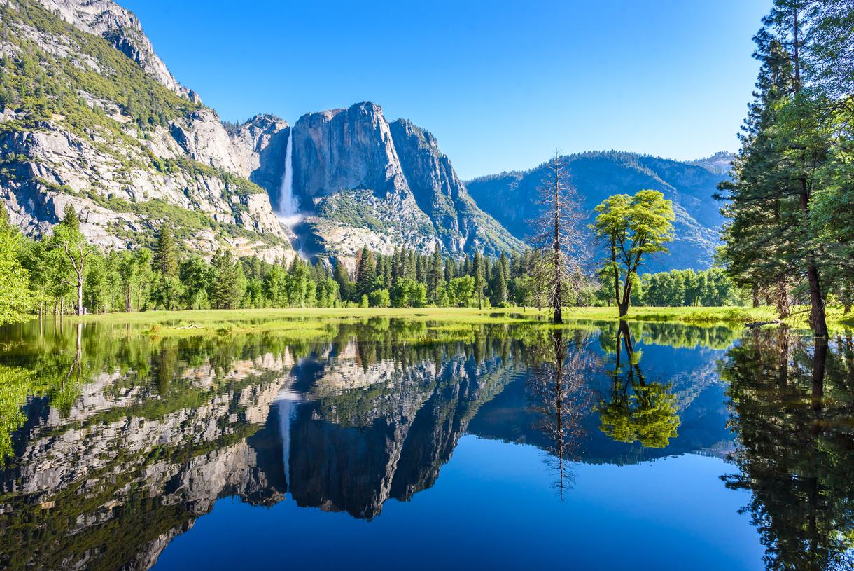
Location: Mirror Lake Trailhead, Mirror Lake Trail, C.A.
Difficulty: Moderate.
Duration: 1 hour 34 minutes.
Distance: 4.4 miles.
Elevation: 301 feet.
Route type: Loop.
Pets: Not allowed.
Consider this remarkable trail if you enjoy hiking to waterfalls. Envision a well-marked trail with lesser crowds — mirroring reflections of Half Dome — while you enter this enchanted region. Located in the Yosemite National Park, this trail is enjoyable year-round with the marvelous activities that it offers to adventurous daredevils. Make sure to keep in mind to reserve your entrance and ask about the charge beforehand.
Location: Trail Canyon Trail Parking, Big Tujunga Canyon Rd, Shadow Hills, C.A. 91040.
Difficulty: Moderate.
Duration: 2 hours 19 minutes.
Distance: 4.47 miles.
Elevation: 990 feet.
Route type: Out and back.
Pets: Allowed on leash.
A short drive from downtown Burbank, you’ll find one of the best waterfalls in California trekking this extraordinary Canyon Falls trail. Embrace the seasonal changes as the stream becomes smoother in the Summer, and enjoy a rich palette of wildflowers spread like knitted covers on the trail. Get ready for a few water crossings as you start the trail and steeper ground as you approach the waterfall. Be sure to put on proper footwear for this hike, and grab on to the ropes for extra stability.
Location: Stevens Trail Parking, Dwight D. Eisenhower Hwy, Colfax, C.A. 95713.
Difficulty: Hard.
Duration: 3 hours 52 minutes.
Distance: 7.7 miles.
Elevation: 1584 feet.
Route type: Out and back.
Pets: Allowed on leash.
Forgotten and rediscovered by a boy scout Eric Keil, this waterfall hike is under the maintenance of the Bureau of Land Management. Initially used as a toll road for miners to get to the railroad town of Colfax, history, looming sceneries, wildlife, and waterfalls will find the mountaineers venturing this route. If you’re pondering on trekking this route in the summer months, we highly recommend making your hydration a priority.
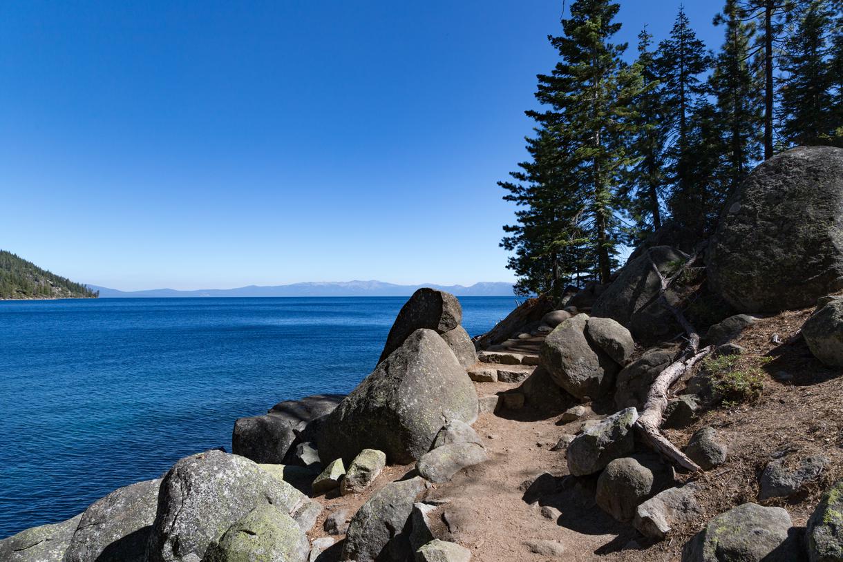
Location: D. L. Bliss State Park, 9881 CA-89, South Lake Tahoe, C.A. 96150.
Difficulty: Moderate.
Duration: 7 hours 6 minutes.
Distance: 16.4 miles.
Elevation: 2306 feet.
Route type: Out and back.
Pets: Not allowed.
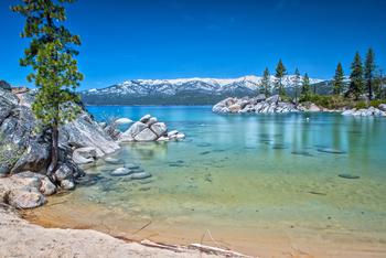
Undulating roads, sugar pine forests, and campgrounds at the front and end of the trail await the hikers of the Rubicon Trail. This waterfall hike located on the southwest shore of southern Lake Tahoe is a hidden gem. Connecting the Emerald Bay State Park with D.L. Bliss State Park in the Sierra Nevada Mountains, the trail is a seasonal glory. It is conveniently accessible and features the nicest vistas of Lake Tahoe which are sure to keep you coming back for more.
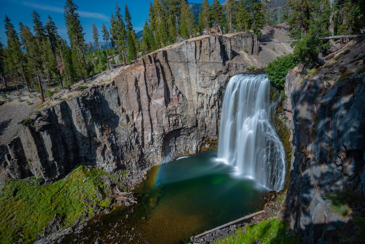
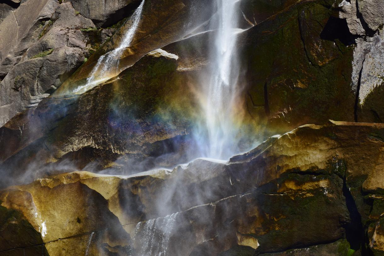
Location: Devils Postpile, California.
Difficulty: Easy.
Duration: 1 hour 56 minutes.
Distance: 4.9 miles.
Elevation: 515 feet.
Route type: Out and back.
Pets: Allowed on leash.
After dropping 101 feet, numerous rainbows emerge in the misty waters on sunny summer days, giving the falls its name. Get to know the highest and simply most majestic waterfalls in California on the Devil’s Postpile Trail. With the Middle Fork of the San Joaquin River, the refreshing Rainbow Falls is within a 2.5-mile hike from the Devils Postpile Ranger Station, offering the best of California hiking trails.
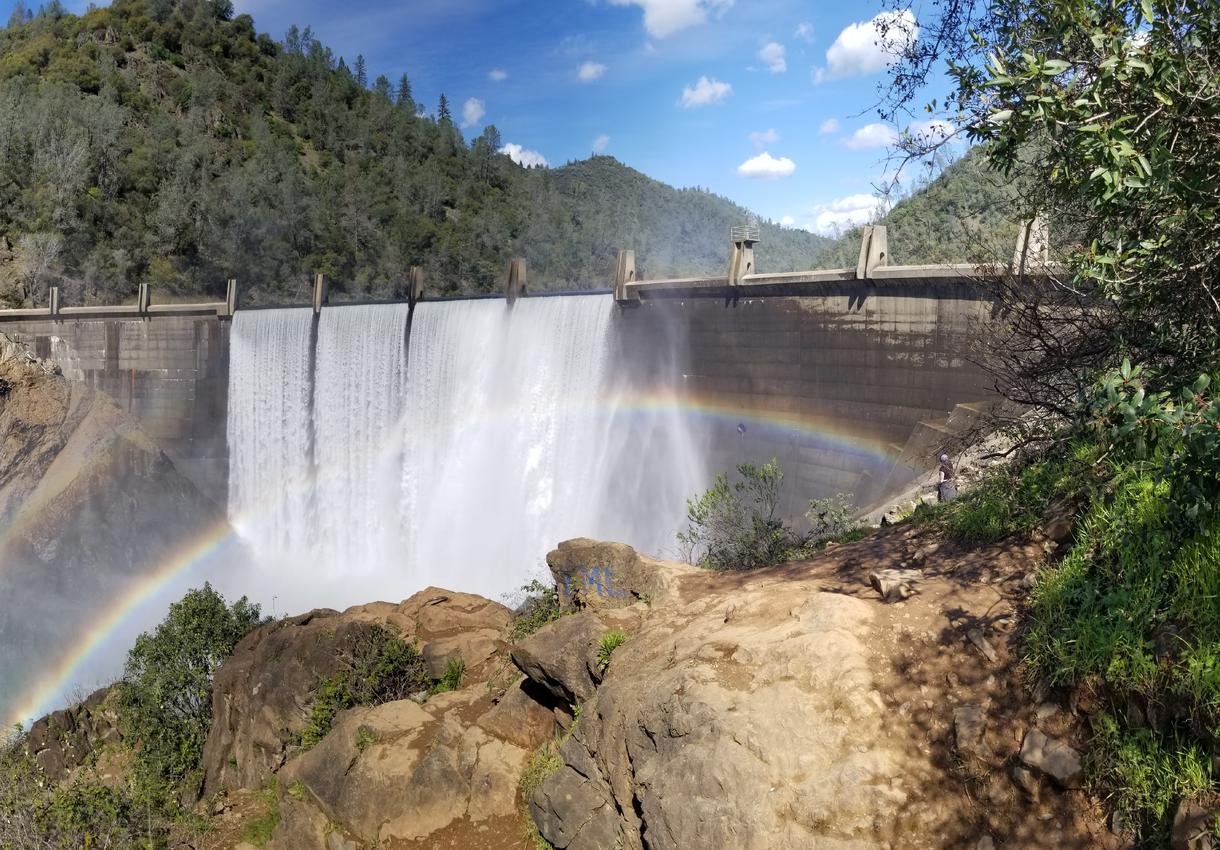
Location: Foresthill Union Elementary, California.
Difficulty: Moderate.
Duration: 2 hours 2 minutes.
Distance: 4.47 miles.
Elevation: 698 feet.
Route type: Out and back.
Pets: Allowed on leash.
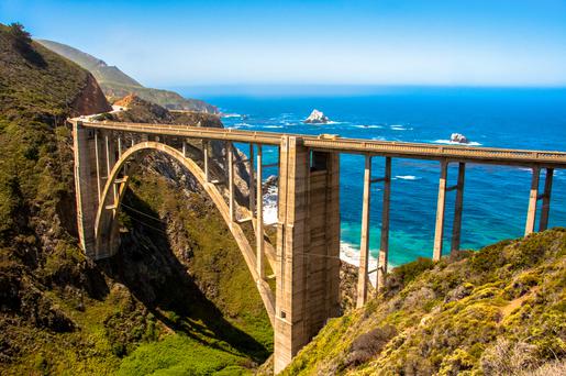
Leading to a vantage point where the North Fork of the American River meets the cliffs, get to know this waterfall hike with looming sceneries of the cascading water. This breathtaking waterfall trail runs beneath California’s tallest bridge — Foresthill bridge. With people rarely attending to the base of the falls, sulk in the serenity of the sound of cascades; but stay on the lookout for poison oak.

If you're looking for something fun to do, there are plenty of fun and free things to do in San Francisco, use our guide to help make plans.

Finding a wall isn't the problem. The problem is figuring out which gym fits your lifestyle the best.

All waterfall hikes in L.A. have one thing in common—unbeatable views of terrific cascades. Here are the ones to try next.

From undulating mountains, to coastal expanses, to verdant forests, here are some of the top spots for backpacking in California.

