


Fun and Free Things to Do in San Francisco
If you're looking for something fun to do, there are plenty of fun and free things to do in San Francisco, use our guide to help make plans.
From easygoing, scenic coastal bike paths to challenging mountain routes, these are the best cycling trails in L.A. for every interest.
7 min read
January 05, 2024
Going for a scenic bike ride in California is an awesome way to enjoy nature, lower your carbon footprint, and squeeze in an outdoor workout. There’s nothing better than biking away work-related stress and laughing with your friends, especially when you have L.A.’s gorgeous beaches, undulating mountains, and lush parks serving as a backdrop.
So, the next time you’re itching to get outside, hop on your bike to bond with your friends and admire your surroundings. Whether you’re seeking an easygoing, 2-mile ride or a more challenging, 38-mile excursion, these Los Angeles bike trails will keep your legs pumping, your heart beating, and your mind clear.
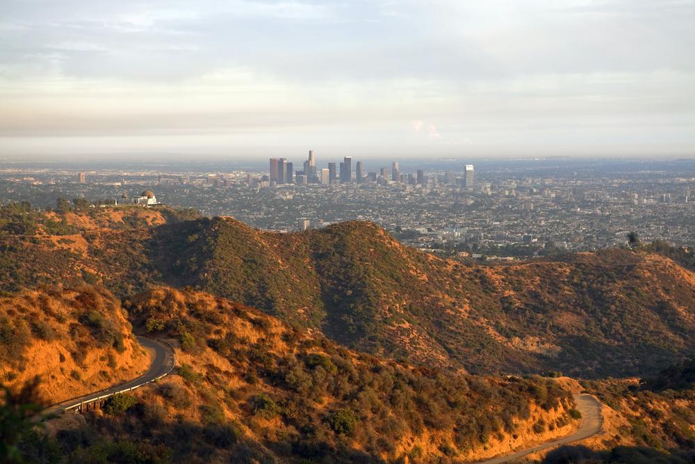
Location: Griffith Park, 4730 Crystal Springs Drive, Los Angeles
Hours: 5:00 a.m.–10:30 p.m. Trails close at sunset.
Parking: There is parking in and around Griffith Park. You can also park on the side of the road, if permissible.
Difficulty: Moderate
Distance: 8 miles
Time: 45 minutes
Route: Loop
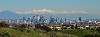
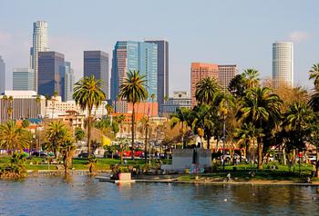
Griffith Park is one of the best urban parks in the greater Los Angeles area and is home to some of the best free things to do in L.A. There are different types of biking trails in the park, but for a good workout and a nice climb with beautiful views, try the Mount Hollywood Loop. This trail takes you around Griffith Park, leading up Commonwealth Canyon Drive to the Griffith Helipad and then back down to Vermont Canyon. On this route, you’ll bike over Mount Hollywood and take in sweeping views of the city. You’ll also pass by the Griffith Observatory—among the most iconic buildings in California—so if you’re down for a stellar experience, take a break and become one with the universe.
Location: The base of Angeles Crest Highway (along Foothill Boulevard in La Cañada-Flintridge), Los Angeles
Hours: Dawn to dusk
Parking: There is plenty of unrestricted residential parking close to the beginning of the route.
Difficulty: Challenging
Distance: About 19 miles
Time: 2–3 hours
Route: One-way
Mount Wilson, located in the gorgeous greenery of Angeles National Forest, is about a 5,710-foot climb. Start from the base of the Angeles Crest Highway, and bike uphill until you reach the top of Mount Wilson. (We suggest that you avoid biking during rush hour on the Angeles Crest Highway.) There’s a ranger station at Clear Creek Junction (the first junction) and also at the turnoff to Mount Wilson Road (the second junction) if you need a break. Once you reach the summit, a stunning view of the greater L.A. area awaits you. After this grueling journey, satisfy your hunger at the Cosmic Cafe, which is situated inside the Mount Wilson Observatory, and explore the astronomical museum, exhibits, tours, and telescopes.
Location: Will Rogers State Beach, 17000 CA-1, Pacific Palisades
Hours: Dawn to dusk
Parking: Avoid the exorbitant waterfront lot fees by parking your car in a nearby residential area and biking to the path.
Difficulty: Moderate
Distance: 22 miles
Time: 1.5–2 hours
Route: One-way
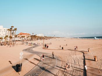
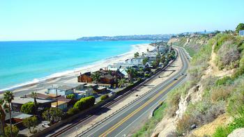
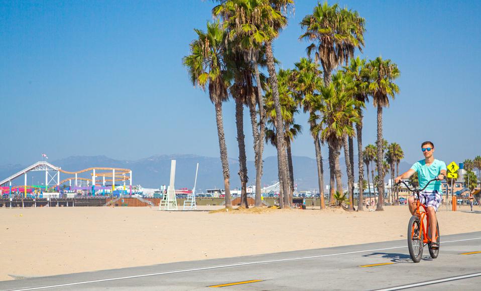
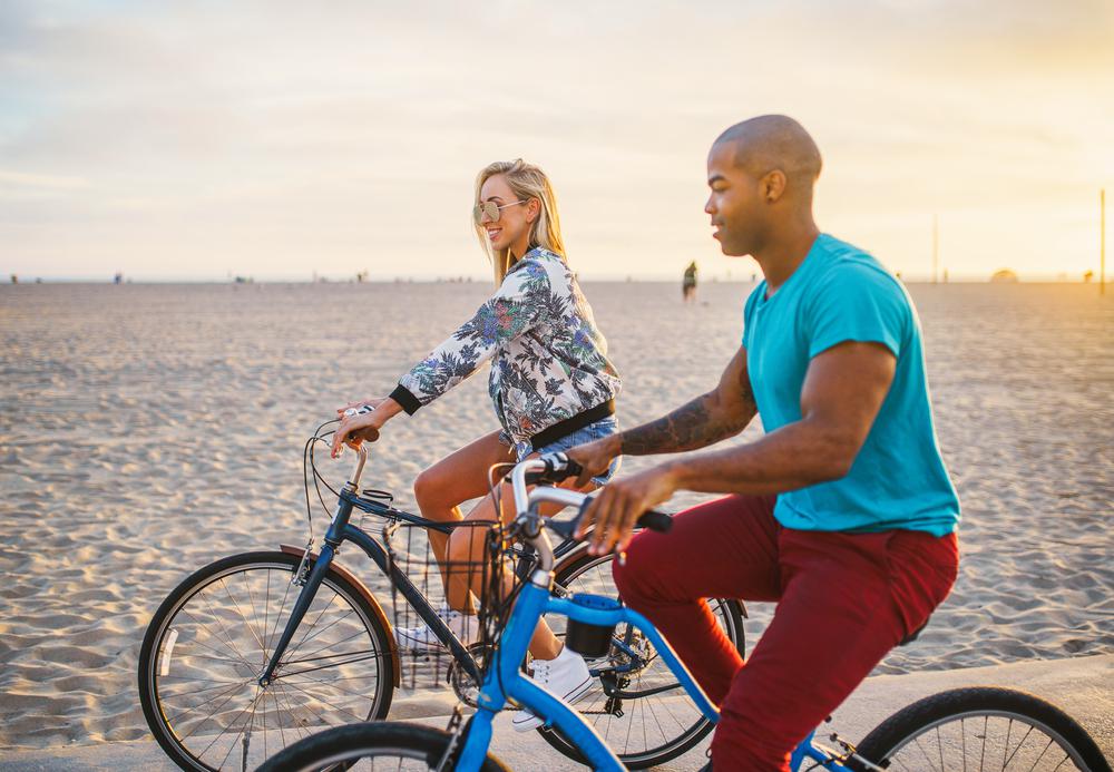
This blissful journey along the Pacific Coast will have you in seventh heaven. The 22-mile trail stretches from Will Rogers State Beach in Pacific Palisades to Miramar Park in Torrance (where dedicated cyclists can jump on the Ballona Creek Bike Path, which continues into Culver City).
The Marvin Braude Trail is a longer journey, but it is a pretty easy one, complete with facilities along the way. So, you’ll have no excuse not to put the pedal to the metal on this bike path. The trail can get crowded on weekends, especially as you’re going through Santa Monica and Venice Beach, so take some time to visit the Santa Monica Pier and to explore the Italian-inspired canals and boho scene of Venice Beach. Once you reach Marina del Rey, the path will turn into a bike lane along Washington Boulevard. The Marvin Braude Trail will also split on Hermosa Beach, where you can choose to ride along The Strand (which is usually bustling on weekends) or on Hermosa Avenue (which is pretty relaxed).
Location: Syd Kronenthal Park, 3459 McManus Avenue, Culver City
Hours: Dawn to dusk
Parking: Park for free in the Syd Kronenthal lot or along the street at the bike trail’s other entrances.
Difficulty: Easy
Distance: 7 miles
Time: 30 minutes
Route: One-way
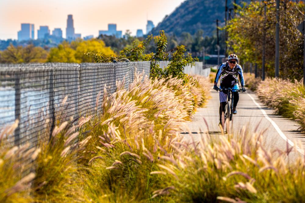
Dreaming of carefree cruisin’ straight to the beach? If so, then this is the bike path for you. Hop on the path at Culver City’s Syd Kronenthal Park, and follow the route down Duquesne Avenue for an enjoyable ride on a newly paved road. You’ll pass by public art installations and several parks, where you can stop for a breather and enjoy a sip of cold water before continuing on. Follow the trail until you reach the Ballona Wetlands; linger here to enjoy the vistas and watch for wildlife. When you reach the Pacific Ocean, the trail connects with the Marvin Braude Bike Trail, so you can continue your journey if you’re up to a long ride.
Location: San Gabriel Canyon Road, Azusa
Hours: Dawn to dusk
Parking: Parking is available off of San Gabriel Canyon Road (State Route 39). There’s also nearby parking off of East Foothill Boulevard and at two trailheads in Azusa (Azusa River Wilderness Park and Azusa Trail Rest Area).
Difficulty: Moderate
Distance: 38 miles
Time: 3.5–4 hours
Route: One-way
Extending from the base of the San Gabriel Mountains to the Pacific Ocean, the San Gabriel River Trail will take you through an exceptionally diverse landscape—from residential and industrial areas in the south to scenic parks and mountain vistas in the north—so you’ll always have an interesting view. The tree-lined trail parallels the San Gabriel River through El Dorado Park. You’ll be greeted by gorgeous ocean views when you end your 38-mile journey in Seal Beach, where you can watch the sunset on the sand with some California kombucha in hand.
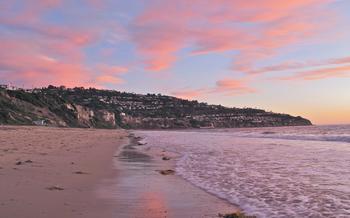
Location: Abalone Cove Shoreline Park, 5970 Palos Verdes Drive South, Palos Verdes
Hours: Dawn to dusk
Parking: Abalone Cove Shoreline Park is a good place to park. You can park there until dusk.
Difficulty: Challenging
Distance: 24 miles
Time: 2 hours
Route: Loop
Tackle this challenging, 24-mile circuit loop for a fierce workout and a stunning coastal view. Since it’s a loop, you can begin your bike ride anywhere on the route and in either direction, but we recommend starting at Abalone Cove Shoreline Park. (If you’re going counter-clockwise, you’ll be on the side of the gorgeous Pacific Coast vistas). Of course, the best panoramas are seen from the toughest part of the ride (no pain, no gain), so get ready to feel the burn.
You’ll take in the Palos Verdes Peninsula’s ruggedly beautiful topography and maritime structures such as the Point Vicente Lighthouse (if you’re in luck, you can spot whales from here) and the Point Fermin Lighthouse. At certain points throughout the Palos Verdes Donut Loop, you may have to share the route with cars, but it won’t be for too long.
Location: 429 Shoreline Village Drive, Long Beach
Hours: Dawn to dusk
Parking: Parking is available (for a fee) in lots off of Shoreline Drive and East Ocean Boulevard.
Difficulty: Easy
Distance: 3.1 miles
Time: 30 minutes
Route: One-way
Relax with a lovely ride along the pristine white sands of Long Beach. With two wide lanes dedicated to bikers, you won’t have to worry about cars or pedestrians as you soak up the sun and admire the dazzling views of the ocean, Palos Verdes, and the mouth of the San Gabriel River. Begin your relaxed ride in Shoreline Village, in view of both the Queen Mary and the Aquarium of the Pacific, and follow the gradual twists and turns of the trail until you reach Alamitos Bay. Linger awhile to savor the views of swaying palm trees, crashing waves, and sandy beaches before heading back.
Location: Elysian Park, 929 Academy Road, Los Angeles
Hours: Dawn to dusk
Parking: There is plenty of parking at Elysian Park and on the nearby streets. (Just make sure there isn’t a Dodgers game scheduled at the same time you want to ride, because traffic will be very heavy.)
Difficulty: Moderate
Distance: 7.4 miles
Time: 30 minutes
Route: One-way
Elysian Park, the oldest park in L.A., is the kind of park that’s frequented by locals in-the-know. Head to this verdant expanse with your bike, and jump on the Elysian Valley Bicycle Path. As you ride on the smooth asphalt roads, you’ll pass looming trees and spot gorgeous views of downtown L.A. While there are several hills, they aren’t particularly steep and don’t take too long to climb. So, don’t let a few hills deter you from taking this path—you’ll be rewarded with fun, speedy downhills. If you need to recharge, you’ll find bathrooms and water fountains along the route.

If you're looking for something fun to do, there are plenty of fun and free things to do in San Francisco, use our guide to help make plans.
Finding a wall isn't the problem. The problem is figuring out which gym fits your lifestyle the best.

The leagues, the stadiums, how to watch, how to get tickets. Consider this your starting point.
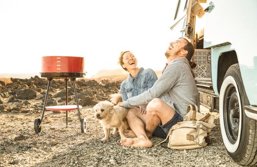
What are you waiting for? Pack up your camping essentials and head over to the best campgrounds California has to offer.

