


Fun and Free Things to Do in San Francisco
If you're looking for something fun to do, there are plenty of fun and free things to do in San Francisco, use our guide to help make plans.
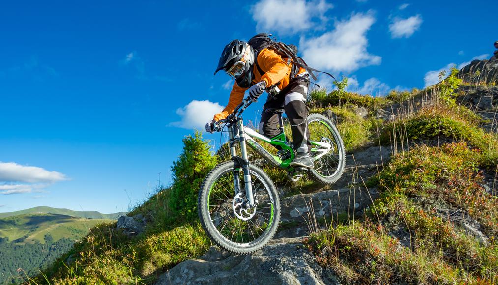
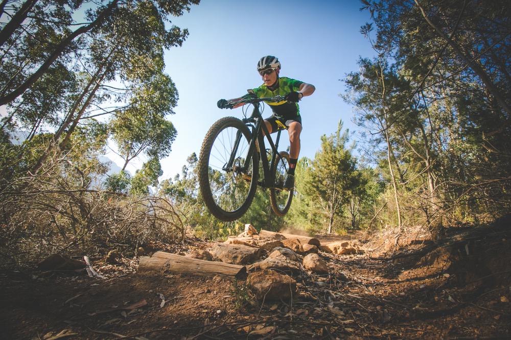
Put off reality and put on your helmet as you embark on these fun mountain biking trails in the Golden State.

8 min read
July 31, 2020
Ready to bike your way through California’s scenic spots? We’ve got you covered. We know it can be difficult to choose from the innumerable mountain bike trails throughout the Golden State, so we’ve rounded up our favorite bike routes. All you have to do is pick a place, pack your bags, and hit the road.
Whether you decide to cycle in the Bay Area or pedal along the bike paths of Los Angeles, you’ll feel an intimate connection to California’s spectacular landscapes. So, put off reality and put on your helmet as you embark on these fun mountain biking trails in the Golden State.
Location: Marin County
Hours: Sunrise–sunset
Parking: Limited pull-out parking is available near Blithedale Park, and there is street parking on Blithedale Avenue all the way back to town.
Difficulty: Intermediate
Distance: 16.3 miles
Time: About 2 hours
Route: Loop
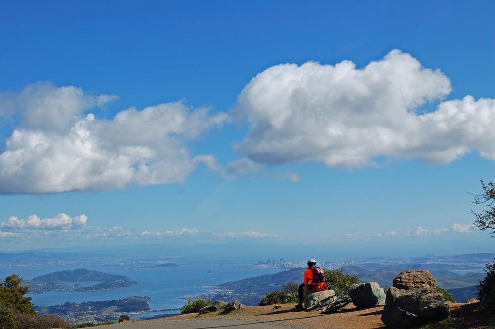
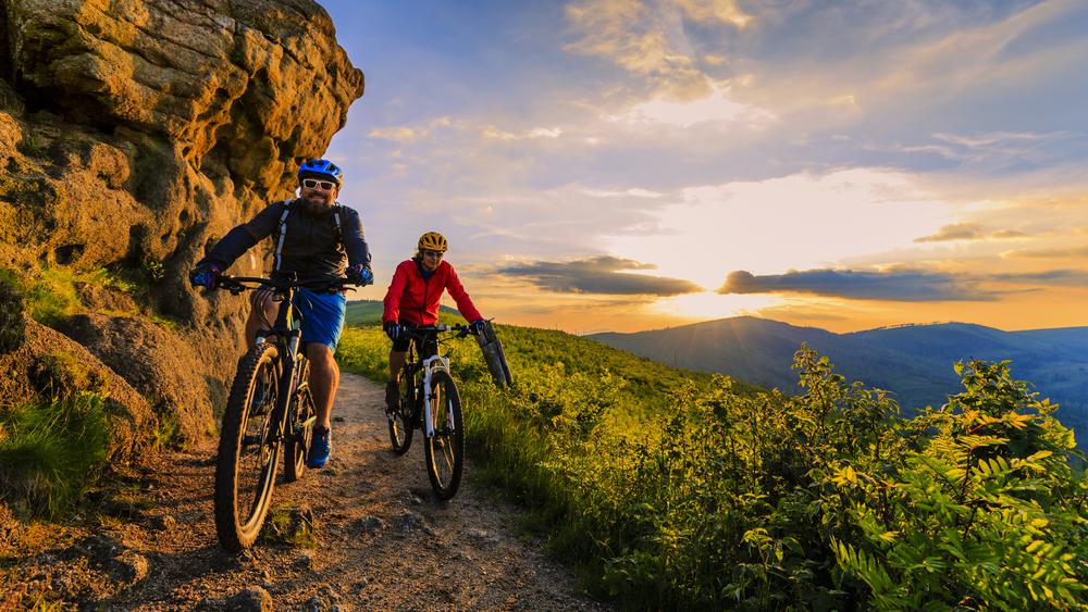
Ride away into the sunset and indulge in magnificent views of the San Francisco Bay and Pacific Ocean on the Mount Tamalpais Summit Loop. Mount Tamalpais has been a popular summer and weekend destination ever since the famous Muir Woods National Monument and Mount Tamalpais State Park were formed in the early 1900s. In the late 1970s, a group of local bikers known as the Marin Repack Road Clunker Clan ventured off-road on local trails and fire roads, helping to popularize the epic sport of mountain biking in the Bay Area and beyond.
During your gradual yet steady climb to the summit of Mount Tam, you’ll pass by a redwood-lined creek, dense forest, and scenic overlooks. Make sure to stop for a while at the top and fully take in the view before heading back down the steep mountain.
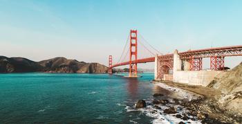
Location: San Francisco Bay
Hours: Sunrise–sunset
Parking: There’s no parking on the island. To get there, park by Pier 41 in San Francisco and take the Blue and Gold Fleet Ferry.
Difficulty: Intermediate
Distance: 9 miles
Time: About 1 hour
Route: Loop
Ride your way through Angel Island State Park for panoramic views of the Bay, the S.F. skyline, and Marin Headlands. The largest natural island in the San Francisco Bay, this local gem offers many recreational and wildlife watching opportunities. You can pedal along the paved six-mile loop that takes you around the perimeter of the island, and then hop on the three-mile upper loop on a fire road for the full experience.
While on your ride, traverse the island’s coastal grasslands and rich ecology, and take a breather by the pristine Ayala Cove or Quarry Point beaches. Refuel yourself at the Angel Island Café with a plate of nachos, and cool down with a cone of California ice cream before hitting the road.
Location: Marin County
Hours: Samuel P. Taylor State Park is open from 8 a.m.–7 p.m.
Parking: Parking is available on Platform Bridge Road in Tocaloma and at Samuel P. Taylor State Park in Lagunitas.
Difficulty: Intermediate
Distance: 12.8 miles
Time: About 1–1.5 hours
Route: Point to point
You’ll feel fast and furious as you speed your way on this mostly downhill trail. Running along the crest of Bolinas Ridge, this section of the Bay Ridge Trail leads you through damp forests, past tall chaparral on rocky sandstone, and across cattle-grazed grasslands. From the highest points, you’ll be blessed with views of the Pacific Ocean, Tomales Bay, Point Reyes Peninsula, distant mountain peaks, canyons, and tree-covered ridges. After descending to Lagunitas Creek, pedal on the paved Cross Marin Trail through Samuel P. Taylor State Park. Although the ride can be a bit bumpy, the invigorating breeze and magnificent vistas make it worthwhile.
Location: Truckee
Hours: 7 a.m.–8 p.m.
Parking: Parking is available near the trailhead at Donner State Memorial Park.
Difficulty: Advanced
Distance: 7 miles
Time: About 1 hour
Route: Loop
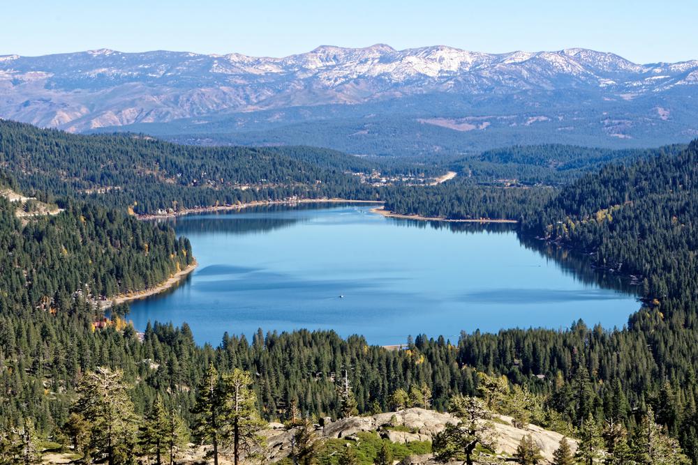
Nestled in the mountains near the charming town of Truckee—one of the best small towns in the Lake Tahoe area—this moderately trafficked lakeside loop is accessible year-round. With stunning views of an alpine lake and facilities available at the north shore, the Donner Lake Bike Loop is hard to pass up. The historic trail leads you through Donner Lake Memorial Park, which has over eight miles of hiking trails and plenty of fishing opportunities, so catch your post-workout meal and take a break by diving into the clear, blue waters of Donner Lake.
Once you complete the beautiful ride, why rush your home when you can set up camp in one of the park’s 154 camping sites? Enjoy a leisurely afternoon by the beach after your solid morning bike ride, then start a bonfire and savor an easy summer dessert.
Location: Sierra County
Hours: Sunrise–sunset
Parking: Park near the start of the trail. If you visit during the summer, Coyote Adventures offers shuttle rides (otherwise you end up riding a 35-mile advanced loop trail).
Difficulty: Advanced
Distance: 16 miles
Time: About 2 hours
Route: Loop
This challenging loop trail is a popular choice for adrenaline junkies. With 16 miles downhill and a 5,000-foot vertical drop, you’ll love every second of this ride. The Downieville Downhill is a singletrack for 85 percent of the ride, featuring steep uphills, creek crossings, waterfalls, swimming holes, and rocky terrain; it’s definitely one for the win. Though it can be a difficult journey, the scenery is priceless and the ride is legendary. So, what are you waiting for? It’s time to put on your helmet and embark on your next adventure near Lake Tahoe.
Location: Santa Monica Mountains National Recreation Area
Hours: Sunrise–sunset
Parking: Park in the lot for the Cheeseboro Trail System.
Difficulty: Intermediate to advanced
Distance: 13 miles
Time: About 1.5 hours
Route: Loop
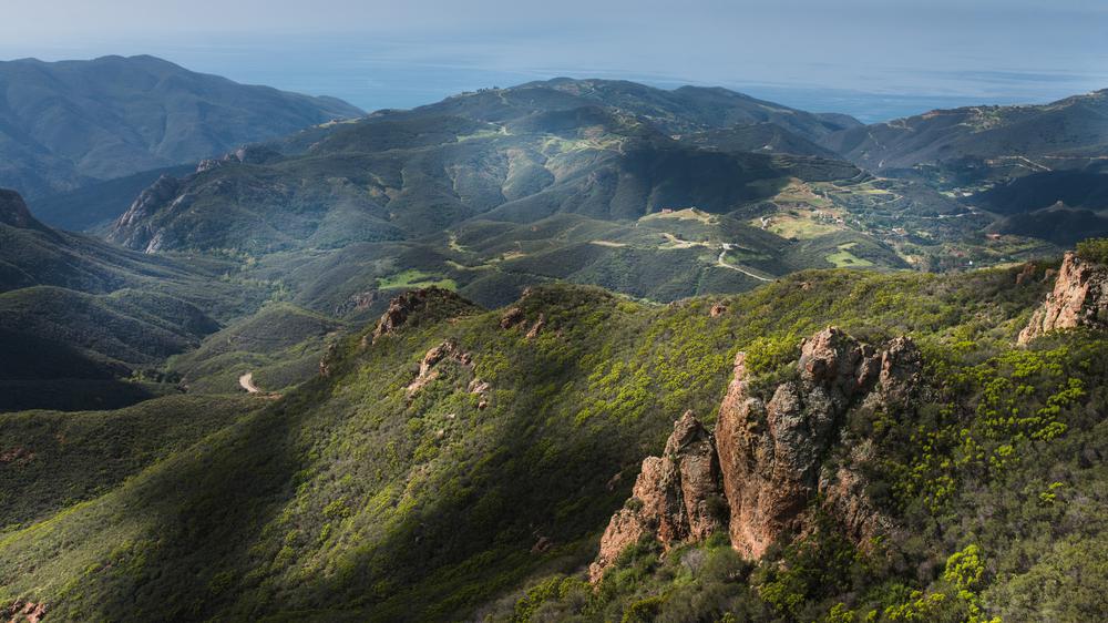
Establish a physical connection with the Santa Monica Mountains National Recreation Area while cycling the Cheeseboro Loop. The climbs are mostly on fire roads, and cell service will probably drop, but that’s a part of the fun and adventure. Use this time to disconnect and recharge your batteries (so to speak) as you make your way through the mountains. You’ll start by heading up the Palo Comado Canyon Trail before jumping on the Sheep Corral Trail and then linking up with the Las Virgenes Canyon fire road. You’ll then meet the Upper Las Virgenes Canyon Trail before retracing your steps at the Cheeseboro Canyon Trail, which will take you back to your car.
Location: Santa Monica Mountains National Recreation Area
Hours: Sunrise–sunset
Parking: Park at the Yerba Buena Parking Lot to access the trailhead.
Difficulty: Intermediate to difficult
Distance: 14 miles
Time: About 1.5 hours
Route: Out and back
Bike your way through Santa Monica’s mountain terrain on this classic ride. Complete with crumbling rock, shale chips, and coastal and desert plant life, the Backbone Trail makes for one enjoyable experience. The views of the crashing ocean waves and (on clear days) downtown L.A. and Hollywood make the tough climb worthwhile. Approximately 1.5 miles up the trail, there’s a left-hand bend and a large oak tree near a drop-off. A commanding view of the valley and the perfect spot to take a break await you.
The trail then becomes more difficult, with about a mile-plus of loose-pebble, sun-exposed slope that eventually gives way to short, steep downhill bends. The trail ends once you reach the Backbone Trail sign; take the Temescal Ridge Trail fire road to make your way back to civilization. If you’re in the mood for an extra challenge, just hop on one of the other connected roads in the area.
Location: North Tustin
Hours: Sunrise–sunset
Parking: Free parking is available at Santiago Hills Park.
Difficulty: Intermediate to difficult
Distance: 10 miles
Time: 15 minutes
Route: Out and back
This awesome ride may be the most (free) fun you’ll have in the O.C. With jumps, berms, chunk, speed, and technicality, the Santiago Oaks 10-Mile Enduro has it all. Start with a short ride to the trailhead from Santiago Hills Park before hopping on the fire road. As you make your way from the Roadrunner Loop singletrack to the Chutes climb, you’ll feel your glutes and your heart beating faster. After conquering the fairly steep Barham Ridge fire road, you won’t be too far from the top (yay!); once you reach the summit, soak up the sun and the view as you take a much-deserved breather. The exhilarating ride downhill will also make all the uphill struggle worth it. You’ll be in seventh heaven, counting down until your next ride.
Location: Trabuco Canyon
Hours: Sunrise–sunset
Parking: Park at or by Cook’s Corner restaurant.
Difficulty: Difficult
Distance: About 7 miles
Time: About 1 hour
Route: Loop
The rocky doubletrack might be double the trouble, but it’s totally worth it. With rad views of the O.C. and majestic sunsets waiting along the Luge Loop Mountain Bike Trail, you won’t mind pounding out the miles of a steep uphill climb. You’ll know the trail has come to an end when you reach Live Canyon Oak Road; turn right to enjoy the intensely sensational rush as you fly downhill at speeds of up to 40 miles per hour. Before you hop back in your car though, stop by Cook’s Corner for a well-earned bacon cheeseburger and fries.
Location: Aliso and Wood Canyons Wilderness Park
Hours: 7 a.m.–9 p.m.
Parking: Parking is available in the park.
Difficulty: Intermediate
Distance: 10.5 miles
Time: About 1 hour
Route: Loop
A heavily trafficked trail near Laguna Niguel, the Aliso Creek and Wood Canyon Loop features a flowing river and is accessible year-round. Enjoy the lovely SoCal scenery as you bike your way to the top, where you’ll be rewarded with a great view of Laguna Beach. Aliso and Wood Canyons Wilderness Park is one of the most popular outdoor destinations in Orange County, offering both flat and hilly terrain that’s perfect for beginner and skilled bikers alike.
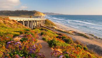
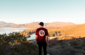
Location: Escondido
Hours: 6 a.m.–6 p.m. (October 1–March 31) and 6 a.m.–7:30p.m. (April 1–September 30)
Parking: Street parking is available at the Sunset Drive Staging Area or the Sikes Adobe Staging Area.
Difficulty: Moderate
Distance: 7.4 miles
Time: 2 hours
Route: Out and back
The Bernardo Mountain Summit is a prominent yet easily accessible peak towering over the blue waters of Lake Hodges. When you reach the summit, you’ll also enjoy views of the eastern half of San Diego County and the Del Dios Gorge. Along your route, smell the wildflowers and enjoy the killer vistas. Ride over the crest to the coast or follow the loop to the overlook and back. The Bernardo Mountain Summit Trail is perfect for a workout-worthy ride, making it one of best bike trails in San Diego.

If you're looking for something fun to do, there are plenty of fun and free things to do in San Francisco, use our guide to help make plans.

All waterfall hikes in L.A. have one thing in common—unbeatable views of terrific cascades. Here are the ones to try next.

From undulating mountains, to coastal expanses, to verdant forests, here are some of the top spots for backpacking in California.
Settled off the California coast, the Channel Islands offer endless adventures. Here are the best things to do and how to get there.

